


 Français
 Deutsch
 Italiano
ACCOMMODATION IN VAL D’AOSTA
Discover the best Hotels, B&Bs and Apartments in the Mountains based on thousands of verified reviews.
Height4,805.59 m (2023 survey; rock 4,792 m)
WhereFrance–Italy border: Haute-Savoie and Aosta Valley
DistancesGeneva 88 km to Chamonix · Courmayeur 20 km via the tunnel
Cable carsAiguille du Midi 3,842 m · Skyway 3,466 m
Skyway return€59–63 until 1 Nov 2026
Seasonshiking late June–mid-September · Vallée Blanche January–April
Updated October 2026 · Sources: Haute-Savoie surveyors, Skyway Monte Bianco, Compagnie du Mont-Blanc, FFCAM, Haute-Savoie prefecture, Chamonix tourist office, Wikipedia
Find a place to stay near Mont Blanc
Mont Blanc is the highest mountain in the Alps: at the last published survey, in September 2023, the summit stood at 4,805.59 metres. It sits on the border between France and Italy. The north side rises above Chamonix in Haute-Savoie; the south side above Courmayeur in Italy’s Aosta Valley. The massif is about 40 km long and also reaches into Switzerland. In Italian it is Monte Bianco.
The two towns at its foot are only about 20 km apart, linked by the Mont Blanc Tunnel (11.6 km). Chamonix is 88 km from Geneva airport; Courmayeur is about 150 km from Turin and 220 km from Milan. In summer you can even cross from one side to the other high up, on three lifts in a row: Skyway, Panoramic Mont-Blanc and Aiguille du Midi.
You don’t need to be a climber to see Mont Blanc up close: cable cars take you above 3,400 metres in minutes. The summit itself is a serious high-mountain climb, with strict rules on the French side. This page helps you choose the side, the lifts and the season; for the towns themselves, see our guides to Chamonix and Courmayeur.
How high is Mont Blanc?

Depending on the source you’ll read 4,805, 4,807 or 4,810 metres. They are all correct, just for different years. The summit is a cap of snow and ice that grows and shrinks with snowfall and wind, so surveyors from Haute-Savoie have measured it every two years since 2001.
- 2023: 4,805.59 m, the latest published survey we could verify (2.22 m lower than in 2021).
- 2021: 4,807.81 m.
- 2007: 4,810.90 m, the highest value ever measured.
- Rock: under the snow, the rocky summit is at 4,792 m, about 40 metres further west.
The “4,807 m” (15,771 ft) you see in many books comes from the 1863 survey and was used for more than a century.
The border on the summit
Even the summit comes in two versions. French maps put it entirely in France; Italian maps run the border right across the top, as the 1861 treaty says. The difference goes back to a French military map of 1865 and has never been settled. In practice, almost everyone climbs it from the French side.
What to see on Mont Blanc
Mont Blanc is mostly enjoyed from the cable cars and the valleys around it. These are the places to know, on both sides.
Skyway Monte Bianco and Punta Helbronner
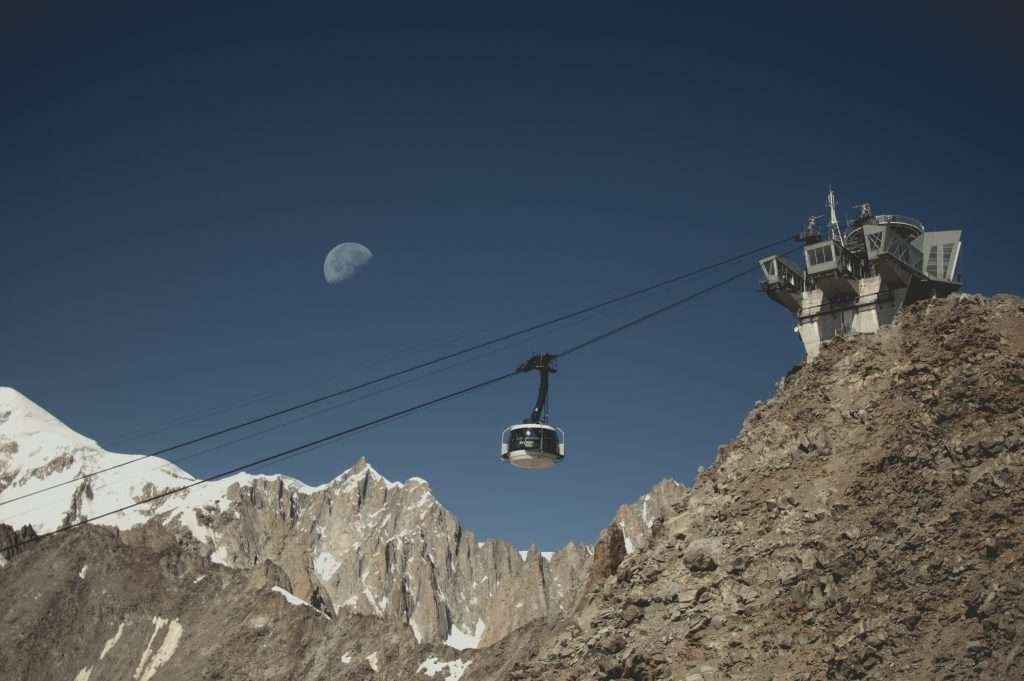
The Skyway is the cable car on the Italian side. It leaves from Pontal d’Entrèves in Courmayeur (1,300 m), stops at the Pavillon du Mont Fréty (2,173 m) and ends at Punta Helbronner (3,466 m), on the border. It opened in 2015 and the cabins rotate 360 degrees on the way up. From the top terrace you see Mont Blanc, the Dent du Géant and the Grandes Jorasses.
On the fares valid until 1 November 2026, a return ticket to Punta Helbronner costs €59 in low season and €63 in high season. Go only on a clear day. Opening times, maintenance closures and winter fares are on the Skyway website; more in our Courmayeur guide.
Pavillon du Mont Fréty
The Skyway’s middle station at 2,173 metres is worth a stop on its own: the ticket is cheaper, the altitude easier on the body and, in summer, the Saussurea alpine garden has more than 900 mountain plant species.
Panoramic Mont-Blanc: Italy to France by gondola
From Punta Helbronner, in summer only, the Panoramic Mont-Blanc gondola flies over the glaciers of the massif to the Aiguille du Midi above Chamonix. It’s the only way to switch sides without going back down to the valley. It isn’t included in the Compagnie du Mont-Blanc MultiPass: check dates and tickets before you go.
Aiguille du Midi
On the French side, the Aiguille du Midi cable car climbs from the centre of Chamonix (1,035 m) to 3,842 metres. At the top there are viewing terraces, the Pas dans le Vide (a glass box over the drop) and the start of the Vallée Blanche. Booking is compulsory, with a boarding number; extra places are released mostly the day before. Details in our Chamonix guide.
Mer de Glace and Montenvers

The Mer de Glace is the great glacier of the French side. The Montenvers rack railway climbs from Chamonix to 1,913 metres in about 20 minutes. Since 2024 a gondola takes you down towards the ice; then it’s about 170 steps to the ice cave at 1,760 metres. The train is closed from 2 November to 4 December 2026.
Val Veny and the Italian glaciers

Val Veny starts at Courmayeur and runs below the south face. Here you see the Brenva glacier and the Miage glacier, covered in dark rubble, at close range. An easy walk leads to Lake Miage at about 2,020 metres: around 1 hour 15 minutes from La Visaille, with 303 metres of ascent. It’s also where the Italian normal route to the summit begins.
Val Ferret
On the other side of Courmayeur, Val Ferret faces the Grandes Jorasses and climbs to the Swiss border. In summer it’s the valley of the Bertone and Bonatti huts on the Tour du Mont Blanc; in winter the valley floor has cross-country ski loops.
Tramway du Mont-Blanc
From Le Fayet, near Saint-Gervais, the Tramway du Mont-Blanc climbs towards the Nid d’Aigle at about 2,400 metres, the starting point of the French normal route. Extension works are under way and the terminus has been moved temporarily: check the website before you go. The tram is closed until 11 December 2026.
Chamonix and Courmayeur
The two towns are the easiest way to experience Mont Blanc. Chamonix (1,035 m) is a proper small town with trains, lots of lifts and the story of the first ascent, on 8 August 1786, by Jacques Balmat and Michel-Gabriel Paccard. Courmayeur (1,224 m) is smaller, with a pedestrian main street and the mountain guides’ house.
Vallée Blanche
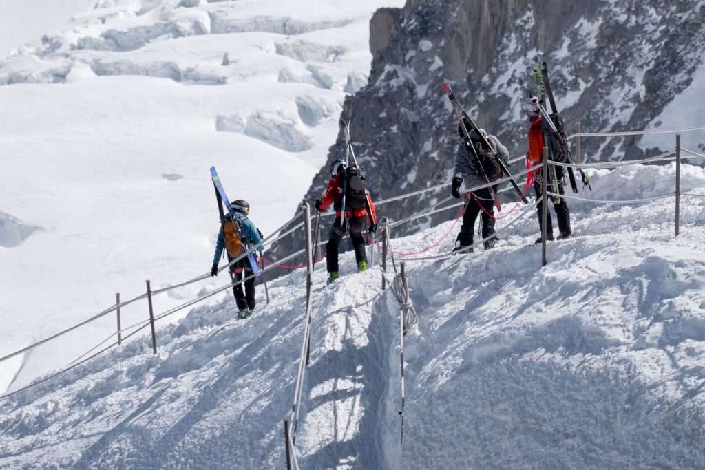
The Vallée Blanche is the most famous ski descent in the massif. It starts at the Aiguille du Midi (3,842 m) and runs down the glaciers to the Mer de Glace. According to the Chamonix tourist office it’s more than 20 km long with 2,800 metres of descent. It is not a piste: it is neither groomed nor patrolled, and there are crevasses and seracs.
The first part is on foot, down the Aiguille du Midi ridge with fixed ropes: the most exposed moment. A mountain guide is strongly recommended, and you need to ski black runs comfortably. The season usually runs from January to April; you return on the Montenvers train or, with lots of snow, ski down to the valley. From the Italian side you can also reach the Vallée Blanche via the Skyway, again with a guide.
Climbing Mont Blanc
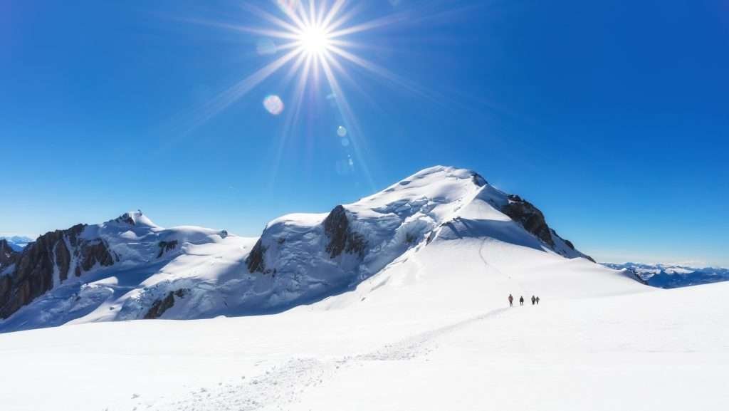
Mont Blanc is not a hike. Even the easiest route needs glacier experience, crampons and an ice axe, good acclimatisation and usually two days. If you’ve never done high-altitude mountaineering, hire a guide in Chamonix, Saint-Gervais or Courmayeur.
The French normal route and the rules
The busiest route is the Goûter route, on the Saint-Gervais side. You start at the Nid d’Aigle (2,372 m), climb to the Tête Rousse hut (3,165 m) and the Goûter hut (3,815 m), then reach the summit via the Dôme du Goûter, above 4,300 metres. The most dangerous section is the Grand Couloir below the Goûter, swept by rockfall.
Since 2019 a Haute-Savoie prefecture order controls access:
- to climb the normal route you need a booking in one of the huts on the route, with the names of everyone in the party;
- you must carry the confirmation (on paper or on your phone) and a valid ID, to show at checks and at the hut;
- camping and bivouacking are banned along the route, except at the Tête Rousse base camp and in emergencies.
In 2026 the Goûter hut was staffed from 30 May to 4 October. From 11 to 26 August 2026 the mayor of Saint-Gervais closed the Goûter and Tête Rousse huts because of rockfall risk in the Grand Couloir, after weeks of heat and drought; many guides had also suspended ascents. Bookings go through the official hut booking site.
The Italian normal route
On the Italian side the normal route starts in Val Veny and climbs over the Miage glacier to the Gonella hut, at about 3,000 metres. It’s longer, more remote and far less busy than the French route, on glaciers that change a lot in hot weather. For experienced mountaineers or guided parties only.
Tour du Mont Blanc
The Tour du Mont Blanc is the trek around the massif: about 170 km through France, Italy and Switzerland, usually in 7–11 days, with roughly 10,000 metres of combined ascent and descent. In Italy it passes through Courmayeur, Val Veny and Val Ferret.
The rules change from 2027. In September 2026 the mayors of the French towns on the route agreed on a joint charter: in summer, accommodation along the trail will have to be booked in advance and wild camping will be banned, replaced by paid designated sites. It’s due to apply from spring 2027, with the final text expected by the end of 2026. If you’re planning the trek for next summer, book huts and gîtes early.
Italian side or French side?
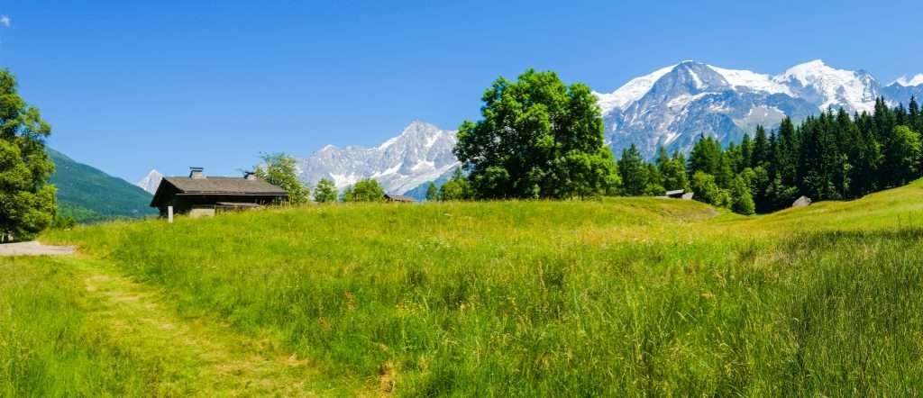
It depends on what you want:
- An easy trip to altitude: the Skyway from Courmayeur, the most convenient if you’re coming from Italy.
- A glacier up close: Montenvers and the Mer de Glace in Chamonix.
- The crossing: in summer, Skyway, Panoramic and Aiguille du Midi in one day; plan your return by bus or through the tunnel.
- The summit: almost always via the French route, with a hut booking.
- Skiing: Courmayeur has one compact ski area, Chamonix several areas along the valley. The Mont Blanc Unlimited pass covers both.
The Italian side has the spa at Pré-Saint-Didier and Aosta Valley food; the French side has trains and Geneva airport close by.
When to go to Mont Blanc
Summer (late June to mid-September): the season for high trails, the Panoramic Mont-Blanc and the Tour du Mont Blanc. Start early: in the afternoon clouds often hide the summit.
Climbing: the huts on the French route are staffed from late May to early October. In the heat of July and August rockfall increases, as in 2026: always check conditions.
Winter: skiing in Courmayeur and Chamonix; the Vallée Blanche usually from January to April.
Autumn and early spring: quiet times, but many lifts close for a few weeks for maintenance. Check opening dates for the Skyway, Aiguille du Midi and Montenvers before you travel.
Where to stay near Mont Blanc
There’s no town “on” Mont Blanc: you stay in the valleys below. Pick your side based on your plans.
- Courmayeur centre: the easiest base on the Italian side, walking distance to restaurants, shops and lifts.
- Entrèves and La Palud: the hamlets closest to the Skyway, for early rides up or for Val Ferret.
- Dolonne: at the gondola to the slopes, good for skiers and families.
- Pré-Saint-Didier and La Thuile: a few kilometres down the valley, often cheaper, if you have a car.
- Chamonix and its valley: if you arrive by train or via Geneva, for the Aiguille du Midi, the Mer de Glace or the French normal route.
You’ll mostly find hotels, apartments and chalets; for the climb and the Tour du Mont Blanc you sleep in huts, booked separately.
How to get to Mont Blanc
By car
From Italy, take the A5 motorway Turin–Aosta to Courmayeur. From France, the A40 leads to Chamonix, and the Mont Blanc Tunnel (11.6 km, opened in 1965) takes you through to Courmayeur. In autumn 2026 the tunnel only has overnight closures, usually 10 pm to 6 am, until December; long closures for works are announced for 2027 and 2028. Check dates on the tunnel website.
By train
On the French side, TGV trains reach Saint-Gervais-Le Fayet; from there the Mont-Blanc Express runs to Chamonix and on to Martigny in Switzerland. On the Italian side the nearest station is Aosta; until 13 December 2026 the Ivrea–Aosta line is replaced by buses for works.
By bus
Buses link Chamonix and Courmayeur through the tunnel. From Courmayeur, Arriva buses run to Aosta (about an hour), Turin and Milan. Check winter timetables before you travel.
By plane
The nearest airport is Geneva: 88 km from Chamonix, 115 km from Courmayeur through the tunnel. In Italy, Turin Caselle is about 150 km and Milan Malpensa 212 km from Courmayeur. From any of them you can continue by bus, rental car or private transfer.
Parking
In Chamonix it’s best to leave the car and use the valley’s buses and trains. In Courmayeur there are paid car parks P1 (Piazzale Monte Bianco) and P2 (Viale Monte Bianco), and a large car park at the Skyway base station in Pontal d’Entrèves.
Frequently asked questions about Mont Blanc
How high is Mont Blanc?
At the last published survey, in 2023: 4,805.59 metres. The height changes by a few metres with the snow, which is why you also see 4,807 or 4,810 metres. The rock under the snow is at 4,792 metres.
Where is Mont Blanc?
On the border between France (Haute-Savoie, above Chamonix) and Italy (Aosta Valley, above Courmayeur). The massif also reaches into Switzerland.
Is the summit of Mont Blanc in France or Italy?
It depends on the map: France puts the summit entirely in France, Italy runs the border across the top. The question has never been settled.
How can I see Mont Blanc up close without climbing?
Take the Aiguille du Midi cable car (3,842 m) from Chamonix or the Skyway (3,466 m) from Courmayeur. For the glacier, take the Montenvers train.
How much is the Skyway Monte Bianco?
Until 1 November 2026 a return to Punta Helbronner costs €59 in low season and €63 in high season. Winter fares are on the Skyway website.
Can you cross from Italy to France by cable car?
Yes, but only in summer: Skyway to Punta Helbronner, Panoramic Mont-Blanc to the Aiguille du Midi, then the cable car down to Chamonix.
Can you climb Mont Blanc without experience?
No. It’s a glacier climb with rockfall and an altitude above 4,800 metres. Without experience, go with a mountain guide after proper acclimatisation.
Do you need a permit to climb Mont Blanc?
Not a permit as such, but on the French normal route you need a booking in one of the huts, shown with ID at checks. Camping and bivouacking are banned.
Chamonix or Courmayeur?
Chamonix if you arrive by train or via Geneva and want the Aiguille du Midi and the Mer de Glace; Courmayeur for the Skyway, a smaller village and an Italian feel.
Is the Mont Blanc Tunnel open?
In autumn 2026 yes, with overnight closures until December. Long closures are announced for 2027 and 2028: check dates on the tunnel website.
Weather: Monte Bianco
Photos: Monte Bianco


