


 Français
 Deutsch
 Italiano
ACCOMMODATION IN SAN PELLEGRINO PASS
Discover the best Hotels, BBs and Apartments in the Mountains based on thousands of verified reviews.
Altitude1,918 m (Col Margherita 2,514 m)
WhereDolomites, between Val di Fassa (Trentino) and the Biois valley (Veneto)
From Moenaabout 11 km on the SS346 · Falcade about 11 km
SlopesSan Pellegrino–Falcade: 59 km, 15 lifts
Ski passDolomiti Superski €80–89 per day (2026/27)
Ski season4 Dec 2026 – 4 Apr 2027
Updated October 2026 · Sources: ApT Val di Fassa, Ski Area San Pellegrino, Visit Trentino, Trentino Trasporti, Dolomiti Superski
Find a place to stay near the San Pellegrino Pass
The San Pellegrino Pass (Passo San Pellegrino) is a Dolomite pass at 1,918 metres, between the Val di Fassa and the Biois valley. On one side the road drops to Moena in Trentino, about 11 km away; on the other to Falcade in the province of Belluno (Veneto), also about 11 km. The road is the SS346. The pass lies within the municipality of Moena; the border with Veneto is about 4 km further east.
It is not a village but a wide plateau of meadows with a few hotels, car parks and the bottom stations of the lifts. To the north rise the Costabella ridges and Cima Uomo, to the south the Col Margherita, where a cable car climbs to 2,514 metres. From the pass you can set off on the area’s most popular walk, to the Fuciade basin, and on the loop around the small San Pellegrino lake.
It works all year. In summer for hiking, the cable car and a road climb the Giro d’Italia has used more than ten times. In winter for skiing in the San Pellegrino–Falcade area, 59 km of slopes in the Dolomiti Superski, and for cross-country skiing at Alochet. In January 2027 the LaVolatA run hosts the women’s World Cup.
In questa guida
What to see at the San Pellegrino Pass
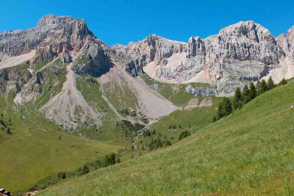
Almost everything is less than an hour’s walk from the pass, or a cable car ride away.
The pass and its history
The pass is a watershed: on the Moena side water flows to the Adige, on the Falcade side to the Piave. For centuries it was a route between northern Europe and Venice, used by merchants, pilgrims and soldiers. The name comes from a travellers’ hospice: on 14 June 1358 the community of Moena allowed the friars of San Pellegrino to build it. The friars were poor, and from 1453 the hospice was run by the Regola of Moena, which appointed a lay prior.
The chapel of Sant’Antonio

On the pass stands the small chapel of Sant’Antonio. Across the road stood the old hospice, destroyed by shelling in 1915, at the start of the First World War.
San Pellegrino lake and the Pozze lake
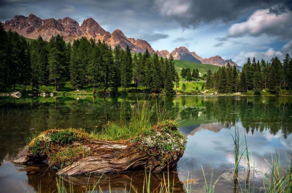
San Pellegrino lake is a small lake at about 1,900 metres, among larches and Swiss stone pines. The loop around it is just over a kilometre, on wooden boardwalks and footbridges, with a few wooden sculptures along the way. The water reflects the Costabella, Col Margherita, Cima Juribrutto and Cima Uomo. It is the best walk with small children, and in winter you can do it on snowshoes.
A few minutes from the pass there is also the small Pozze lake, set in the meadows. You can combine both lakes and the walk to Fuciade in a morning.
The Fuciade basin
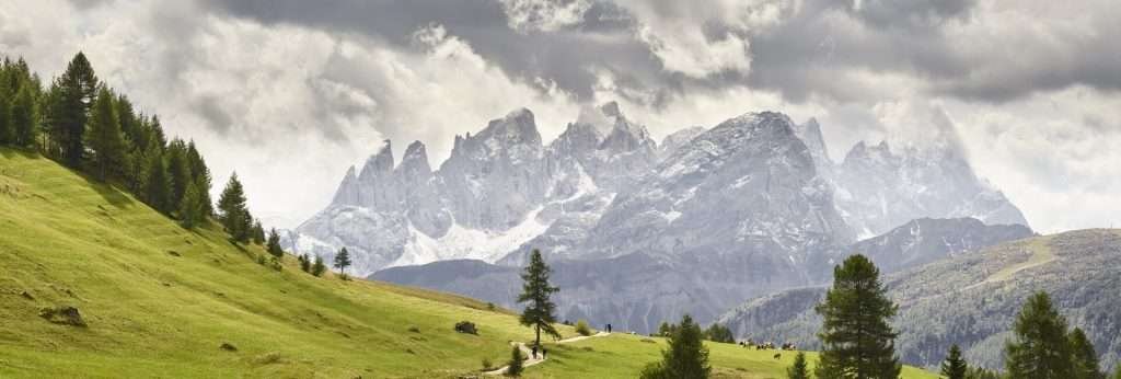
Fuciade is a meadow basin at almost 2,000 metres below the Costabella, dotted with old wooden hay barns and small huts. One of these barns, restored, is the Rifugio Fuciade, which belongs to the municipality of Soraga di Fassa. From here you see the Pale di San Martino and Col Margherita. In summer the meadows are in flower; in winter it is one of the most popular snow walks in the valley. How to get there is explained below.
Col Margherita
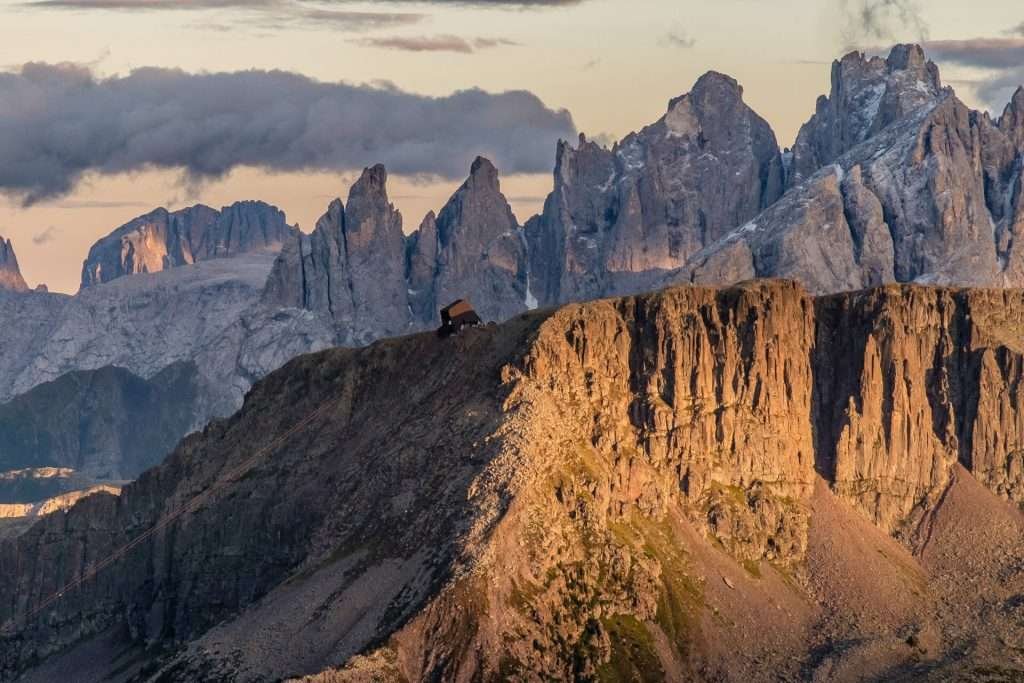
Col Margherita is a porphyry plateau at 2,514 metres above the pass. At the top station the view is very wide: the Costabella, Cima Uomo and the Marmolada; to the right Civetta, Pelmo, Sorapiss, Moiazza, Focobon and Mulaz; behind you the Pale di San Martino; to the south-west the Lagorai range. The north face is steep, the south side slopes gently down to the Passo Valles.
On the path towards Cima Juribrutto there are two viewing balconies with panels that name the peaks.
The Geo Walk
On top of Col Margherita starts the Geo Walk, a short, easy loop designed for families. Panels and installations tell how the Dolomites were formed: volcanoes, ancient seas, islands and fossils.
The Costabella ridges and the First World War

In the First World War the front line ran through here. Austro-Hungarian troops held Cima Uomo and the Costabella ridges, the Italians held Col Margherita. Between the Costabella, Cima Bocche and the Alta Via Mariotta you can still see trenches, tunnels and positions, partly restored and signposted.
Along the Costabella ridges runs the Alta Via Bepi Zac via ferrata, through caves, tunnels and trenches. It is not a stroll: you need a harness, via ferrata lanyards, a helmet and a head for heights. If you have no experience, hire a mountain guide.
Rifugio Fuciade: how to get there on foot
This is the most common question about the pass. The short answer: from the San Pellegrino Pass it is about 45 minutes of easy walking on a gravel track, with about 140 metres of climbing.
The route from the pass
From the pass, go a short way down towards Falcade and take the small road on the left to the car park where the track begins. Then follow the track, closed to private traffic, to the basin. It is wide and even, with little up and down: fine for pushchairs and dogs. The Val di Fassa tourist board says about 45 minutes, Visit Trentino just under an hour. You return the same way.
Parking for Fuciade
The nearest car park is at the start of the track, just past the pass towards Falcade. On sunny summer days it fills up early: arrive before 9am or leave the car at the pass and add a few minutes on foot. Fees change, so check on site.
Fuciade in winter
In winter the track is groomed and you walk up with good boots or snowshoes. The rifugio also runs a snowmobile or snowcat service on request. For the 2026/27 season it reopens on 4 December 2026. Book if you want to eat there, especially for dinner and at weekends.
Col Margherita cable car: times and prices
The cable car leaves from the pass, near the “Col Margherita” bus stop, and climbs to 2,514 metres. It has been running since 1980; its cabins, for about 100 people, were designed by Pininfarina. In winter it is the main lift of the ski area; in summer it carries hikers and families up the mountain.
In summer 2026 it ran from 20 June to 20 September, 9:00–13:20 and 14:00–17:30, with a lunch break. A return ticket cost 22 euros for adults and 17 euros for juniors. The Costabella chairlift was open over the same period. In winter the cable car runs from the start of the ski season on 4 December 2026. Summer 2027 dates and prices are not out yet: check the Ski Area San Pellegrino website.
You can only walk up Col Margherita in summer, and the tourist board recommends it for fit hikers.
Hikes from the San Pellegrino Pass
The best season runs from late June to late September. Always check the weather and trail conditions before you set off. The two easy walks, the lake loop and the track to Fuciade, are described above. Here are the others.
Fuciade – Forca Rossa – Val Fredda – Malga Boer loop (demanding)
From the Fuciade basin take trail 670 towards Forca Rossa, on the Le Saline ridge. At the junction switch to trail 694 and descend into Val Fredda, steep in places, along the stream and past old huts. A short signposted detour leads to Rifugio Flora Alpina. From Malga Boer a path takes you back to the Fuciade track and the pass. Allow a full day: it is a loop for fit hikers in proper boots.
Col Margherita and the Geo Walk (easy, by cable car)
Ride the cable car up, do the Geo Walk and follow the path to the viewing balconies towards Cima Juribrutto. Big views, little effort.
Alta Via Bepi Zac (difficult, via ferrata)
A historic via ferrata on the Costabella ridges, among First World War positions. Full via ferrata kit is essential. The pass is also on Dolomites High Route No. 2, from Bressanone to Feltre.
Skiing at the San Pellegrino Pass
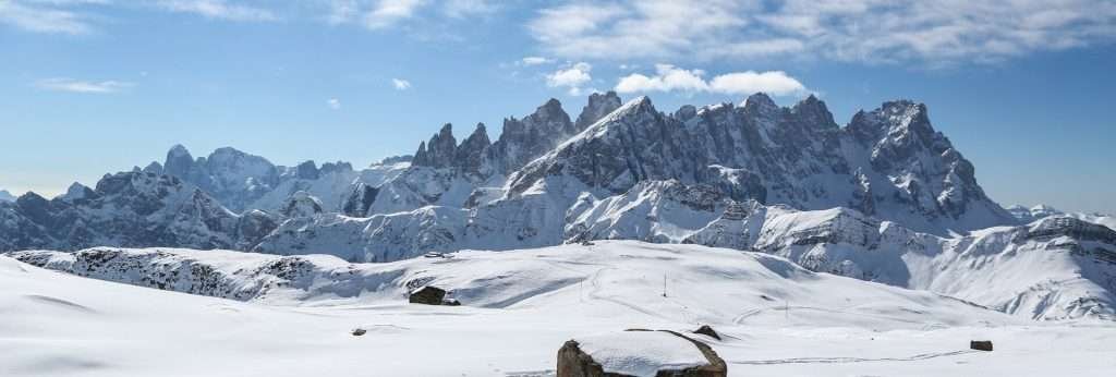
The pass is the hub of the Passo San Pellegrino – Falcade ski area: 59 km, 40 runs and 15 lifts between Col Margherita, Cima Uomo and Falcade in Veneto. In the 2026/27 season it is open from 4 December 2026 to 4 April 2027, snow permitting; lifts usually run from 8:30 to 16:00. From Falcade you get back to the pass with the Molino–Le Buse gondola and the chairlifts towards Laresei.
Runs and levels
There is something for everyone: three nursery areas for beginners, plenty of long red runs towards Falcade and three blacks: Col Margherita, Nuova Cima Uomo and LaVolatA. There is also a snowpark, a boardercross course and children’s areas. The longest descents start from Col Margherita.
LaVolatA and the World Cup
LaVolatA is the women’s World Cup run. Opened in 2017, it is about 2.5 km long with gradients of up to 47%. A downhill and a super-G are scheduled for Saturday 9 and Sunday 10 January 2027. During races and training the run is closed to the public.
Ski passes
The Alpe Lusia/San Pellegrino pass covers this area and Moena–Alpe Lusia: about 85 km in total. A ski bus links the pass with Ronchi, where the Alpe Lusia gondola starts, and with Moena. The Valle Silver and Dolomiti Superski passes are also valid. With the Dolomiti Superski, in 2026/27 an adult day pass costs 80 euros in low season and 89 in high season; buy online at least two days ahead and you save 5%. The 2026/27 prices for the local pass had not been clearly published when we wrote this: check before you travel.
Cross-country skiing and snowshoeing
The Alochet cross-country centre is on the meadows between the pass and Moena: about 18 km of trails between 1,700 and 1,900 metres, classic and skating, with a practice area. The trails reach San Pellegrino lake. On snowshoes, the classic routes are the lake, Fuciade and Val Fredda.
The San Pellegrino Pass by bike and motorbike
Both climbs are about 11 km long. From Moena (1,184 m) you gain about 730 metres, from Falcade (1,137 m) about 780. Both sides have ramps of up to 18%; the Falcade side is the harder one, with long stretches at 15%.
The Giro d’Italia has crossed the pass many times: first in 1963, most recently in 2008, 2014 and 2022. In 2006 the pass was a stage finish. Mountain bikers have the San Pellegrino Bike Trail, a loop at the foot of the Costabella shared with walkers: slow down when you meet them.
On a motorbike, combine the San Pellegrino with the Passo Valles and Passo Rolle towards San Martino di Castrozza, or with the Val di Fassa towards Canazei and the Pordoi.
When to visit the San Pellegrino Pass
The road is open all year. The Falcade side has steep hairpins: take care in winter. In Trentino, from 15 November to 15 April you must have winter tyres or carry snow chains.
For hiking and the cable car, the best time is late June to mid-September. July and August are the busiest months, especially at Fuciade; in September there are fewer people and clearer air. Skiing runs from December to early April. In October, November and spring, the lifts and many huts are closed.
Day trips from the San Pellegrino Pass
- Moena: about 11 km, the nearest town, with its old centre, the Alpe Lusia and Puzzone cheese.
- Falcade: about 11 km on the Veneto side, in the Biois valley, also linked to the pass on skis.
- Val di Fassa: up the valley from Moena you reach Soraga, Vigo, Pozza and Canazei. Full overview in the Val di Fassa guide.
- Pordoi Pass: beyond Canazei, with the Sass Pordoi cable car facing the Marmolada. See Pordoi Pass.
- Predazzo and Val di Fiemme: down the valley from Moena, below the Latemar. See Predazzo.
- San Martino di Castrozza: from the Falcade side over the Passo Valles and Passo Rolle, below the Pale. See San Martino di Castrozza.
- Lake Carezza: from Moena towards the Costalunga Pass, below the Latemar. See Lake Carezza.
Where to stay at the San Pellegrino Pass
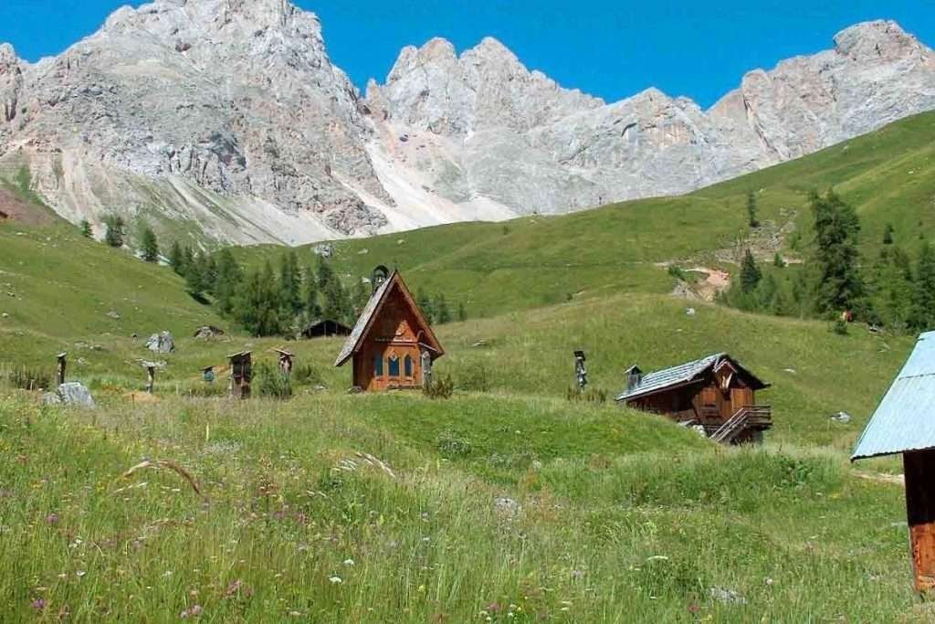
On the pass there are a few hotels and mountain huts with rooms. Everything else is in the valley towns. Choose by what you want to do.
- On the pass: ski-in/ski-out in winter, trails from the door in summer, quiet evenings. Few services: you need a car for shops and restaurants. Best for skiers and keen hikers.
- Moena: the most complete base, 11 km away, with hotels of every category, apartments, shops and a ski bus to the pass. Best for families and anyone who wants village life.
- Falcade: on the Veneto side, with a gondola into the ski area. Usually quieter and a little cheaper in high season.
- Soraga and the rest of Val di Fassa: if you want to combine San Pellegrino with the rest of the valley, the Sellaronda and the passes.
How to get to the San Pellegrino Pass
By car
From the Brenner and Bolzano, leave the A22 at Bolzano Nord and drive over the Costalunga Pass into the Val di Fassa, then down to Moena. From the south, exit at Egna-Ora and drive up the Val di Fiemme to Moena. From Moena take the SS346: about 11 km. From Venice, take the A27 to Belluno, then Agordo, Cencenighe and Falcade: from there it is about 11 km uphill.
By train
There is no railway at the pass. On the Trentino side the stations are Trento, Ora and Bolzano, on the Brenner line; on the Veneto side Belluno and Feltre. From there, continue by bus.
By bus
In summer Trentino Trasporti line B123 links Moena and the pass, with stops at the Costabella chairlift and the Col Margherita cable car. In 2026 it ran from 27 June to 20 September, hourly from 8:20 to 11:20 and from 14:20 to 17:20, taking about 25 minutes. Between the pass and Falcade, Dolomitibus line 2 runs a few times a day. These buses are not included in the Val di Fassa and Trentino guest cards.
From September 2026 to June 2027 the B123 runs just once each way on weekdays, for commuters and students. In winter, skiers use the ski bus from Moena and Ronchi. Timetables at Trentino Trasporti.
By plane
The nearest airport is Bolzano, about 40 km from the Val di Fassa. Next come Treviso (160 km), Venice (175 km) and Verona (180 km), with more international flights; Innsbruck and Munich are options via the Brenner. Add about 11 km from Moena to the pass. Without a car, the simplest plan is a transfer to Moena and the summer bus or winter ski bus from there.
Parking
There are several car parks near the lifts on the pass. The one at the Costabella chairlift is free. For Fuciade, use the car park at the start of the track, just past the pass towards Falcade.
Frequently asked questions about the San Pellegrino Pass
How high is the San Pellegrino Pass?
The pass is at 1,918 metres (some sources say 1,919). Col Margherita, reached by cable car, is at 2,514 metres.
Where is the San Pellegrino Pass?
In the Dolomites, between the Val di Fassa (Moena, Trentino) and the Biois valley (Falcade, province of Belluno). The pass is in the municipality of Moena.
How far is the San Pellegrino Pass from Moena?
About 11 km on the SS346. In summer the bus takes about 25 minutes. Falcade is also about 11 km away.
How do you get to Rifugio Fuciade from the pass?
On foot along an easy gravel track, in about 45 minutes, with about 140 metres of climbing. Start from the car park just past the pass towards Falcade.
Can you take a pushchair to Fuciade?
Yes. The track is wide and even. In winter it is groomed, but a pushchair with big wheels or a sledge works better.
How high is Rifugio Fuciade?
Almost 2,000 metres, a little higher than the pass, in the Fuciade basin below the Costabella.
Where is San Pellegrino lake?
Right next to the pass, at about 1,900 metres. The loop is just over a kilometre on wooden boardwalks, ideal with children.
How much is the Col Margherita cable car?
In summer 2026 a return ticket cost 22 euros for adults and 17 for juniors, from 20 June to 20 September. Check current prices before you go.
Is the San Pellegrino Pass open in winter?
Yes, the road is open all year. From 15 November to 15 April you need winter tyres or snow chains on board.
Weather: Passo San Pellegrino
Photos: Passo San Pellegrino


