


 Français
 Deutsch
 Italiano
ALLOGGI A Chamois
Scopri i migliori Hotel, B&B e Appartamenti in Montagna in base a migliaia di recensioni verificate.
Altitude1,815 m
WhereValtournenche, Aosta Valley, Italy
From Châtillon (A5)12 km to Buisson + 6-min cable car
Slopes14–16 km · 3 chairlifts · 1,815–2,500 m
Day ski passfrom €25.50 (2026/27)
Ski season28 Nov 2026 – 29 Mar 2027
Updated October 2026 · Sources: Comune di Chamois, Chamois Servizi (cable car), Cervino SpA, Aosta Valley Region (lovevda.it), ISTAT
Find a place to stay in Chamois
Chamois is a small municipality in the Valtournenche valley, in Italy’s Aosta Valley, on the sunny slope above Buisson, a hamlet of Antey-Saint-André. Its main village, Corgnolaz, sits at 1,815 metres, making Chamois one of the highest municipalities in the region. Just over a hundred people live here, spread across seven hamlets of meadows, larch woods and stone roofs, with the Matterhorn at the head of the valley.
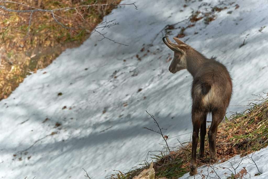
What makes it unique is simple: Chamois is the only municipality on mainland Italy that you cannot reach by car. You ride the cable car up from Buisson, six minutes for 700 metres of climb, or you walk. There are no private cars in the village. The name is French (it means the alpine goat-antelope), but the village is called Chamois in every language.
Buisson is about 12 km from the Châtillon–Saint-Vincent exit of the A5 Turin–Aosta motorway. The nearest airports are Turin Caselle (108 km) and Milan Malpensa (170 km). In winter there is a small, quiet ski area between 1,815 and 2,500 metres, part of the Cervino Ski Paradise. In summer it is a hiking base: Lake Lod half an hour above the village, balcony trails facing the Matterhorn and an almost flat path to La Magdeleine.
What to see in Chamois

Chamois has no historic centre in the usual sense: it is a cluster of small hamlets linked by lanes and footpaths. The main ones are Corgnolaz (the main village), La Ville, Suis, Crépin, Lieussel and Caillà; higher up is Lake Lod. You can see it all on foot in half a day.
Corgnolaz, the main village
This is where the cable car drops you. It has the town hall, the tourist office and the bottom station of the chairlift to Lake Lod. Houses are built of stone and wood, roofed with “lose”, the stone slabs typical of the valley. Near the cable car arrival there is a playground with a view.
La Ville
The oldest hamlet, in the lower part of the village just below the cable car station. It keeps its rascards, old wooden barns on stone bases, plus stables and haylofts converted into homes. The old mule track from Buisson ends here: before the cable car it was the only link with the valley floor.
Church of San Pantaleone
The parish church of San Pantaleone was built in 1681 and took its present form when it was rebuilt in 1838: façade and bell tower to the east, a vaulted chancel with an octagonal dome to the west. It is a few minutes’ walk from the cable car.
Suis and the altiport
Towards La Magdeleine is Suis, with Aosta Valley stone houses, slate roofs and the 17th-century chapel of Notre-Dame de la Pitié. Just above it is the altiport: a grass runway under 300 metres long with an 18% slope, built in 1967. It was Italy’s first altiport and is still used by light aircraft and by pilots training for mountain flying. The strip is fenced off, so you watch from outside.
Hamlet chapels
Every hamlet has its chapel. Crépin has the 18th-century chapel of the Transfiguration. On the path to La Magdeleine you pass a Trinity chapel and an old water mill. They are small and often closed, but they say a lot about life in these isolated communities.
Lake Lod

Lake Lod (Lago di Lod) is a glacial lake at 2,020 metres above Corgnolaz, at the foot of Mont Charvaz. You can walk up in 30 to 40 minutes on a mule track through the woods, or take the Corgnolaz–Lago Lod chairlift. There is a picnic area on the shore and fishing in summer. On clear days the Matterhorn is reflected in the water: the classic Chamois photo.
Ru des Novalles
A “ru” is a medieval irrigation channel dug to water the meadows. The Ru des Novalles runs along the hillside above the village: following it is a quiet alternative to the chairlift, with a view down over every hamlet.
Le Point Sublime
From Lake Lod two chairlifts climb to 2,470 metres, the highest point of the ski area. The viewpoint called Le Point Sublime looks straight at the Matterhorn and the surrounding peaks. A few minutes away, the chapel of San Domenico Savio at Col Clavalité, at about 2,500 metres, hosts a festival in the first week of August.
La Magdeleine
The neighbouring municipality to the south, at about 1,650 metres, is reachable by car. From Chamois you walk there in an hour on an almost flat path. It is worth a visit for its eight mills lined up along a stream between Brengon and Le Clou, and for the communal bread ovens still used in three hamlets.
Skiing in Chamois

The Chamois Ski area is small and quiet. Runs go from 1,815 to 2,500 metres and add up to about 15 km (official sources give 14 to 16 km). Three chairlifts run one after the other, Corgnolaz–Lago Lod, Lago Lod–Teppa and Teppa–Falinère, plus two magic carpets for beginners. Most runs are easy or intermediate and queues are rare: it suits families, beginners and anyone who wants to ski with a Matterhorn view away from the crowds.
Chamois is part of the Cervino Ski Paradise, run by Cervino SpA together with Breuil-Cervinia, Valtournenche and Torgnon, but it is not linked to the other areas on skis. The upside: you ski from the village, as the first chairlift starts right there.
2026/27 season
The Chamois lifts open on the weekends of 28–29 November, 5–8 December and 12–13 December 2026, then every day from 19 December 2026 to 29 March 2027, snow permitting.
Ski pass prices 2026/27
An adult day pass for the Chamois area alone costs €25.50 on low-season weekdays and €30.50 at weekends, on holidays and in high season (Christmas to Epiphany and 30 January to 7 March 2027). A half-day pass costs €20.50 or €24.50. There are reduced rates for juniors (born after 31 October 2010), young skiers and seniors; children born after 31 October 2018 ski free with a paying adult. Note: no ski pass, not even the Cervino Ski Paradise passes, includes the Buisson–Chamois cable car, which you pay for separately. Full price list on the Cervino Ski Paradise website.
Off-piste, ski touring and snowshoeing
Off-piste routes lead towards Cheneil, and ski-touring routes climb to the Becca di Nana and the Becca Trecare (3,033 m), the highest peak in the municipality: for experienced skiers or with a guide. Marked snowshoe trails cross the larch woods, and when there is snow the path to La Magdeleine is groomed. There is a ski school in the village.
Summer in Chamois
From June to September Chamois is a handy base: you start at 1,800 metres and the trails begin at the houses. In 2026 the Lake Lod chairlift ran from 20 June to 6 September (and on some earlier weekends), 9:00 to 17:15; the two chairlifts up to Teppa and Falinère only from mid-July to late August, with a lunch break. Dogs are not allowed on the upper chairlifts. Current times at cervinia.it.
La Magdeleine to Chamois on trail 107
The easiest walk: 4.5 km, about an hour one way, only around 100 metres of climbing. Trail 107 crosses woodland and pasture, follows a ru, passes through Suis and ends in Corgnolaz. It is part of the Gran Balconata del Cervino, and includes the “Energie in gioco” family trail with play stations and panels about energy sources. Good for mountain bikes too.
The mule track from Buisson
Before the cable car, villagers climbed the mule track with 93 hairpins (trail 2). It starts at Nuarsaz, next to Buisson, and reaches La Ville after about 700 metres of ascent. It is steep, with a few exposed sections. A fine loop (grade E, standard mountain path) climbs from Buisson on the mule track, crosses Chamois and descends towards Maen: 11.8 km, 849 metres of ascent, about 4 hours 50 minutes in total.
Towards Cheneil and the Matterhorn

From Lake Lod a path climbs to the Colle di Cheneil (2,280 m) and drops to Cheneil (2,105 m), a hamlet of Valtournenche right below the Matterhorn. Allow about two and a half hours one way, standard hiking grade. This is another section of the Gran Balconata del Cervino, a loop of more than 50 km (trail 107) linking Antey-Saint-André, La Magdeleine, Chamois, Cheneil, Breuil-Cervinia, Cignana and Torgnon.
Becca Trecare
For experienced hikers, the Becca Trecare (3,033 m) is the local summit: the last part follows faint tracks with no marked trail. It takes a full day and needs settled weather.
Bikes and kids
Bikes ride the cable car for a small supplement. The tracks to La Magdeleine and Lake Lod suit mountain bikes and e-bikes. With children, Lake Lod by chairlift and the “Energie in gioco” trail are the easiest options.
Day trips from Chamois
To explore the area you first ride the cable car down to Buisson, then continue by car or bus.
- La Magdeleine: an hour on foot on trail 107; mills and communal bread ovens.
- Cheneil: on foot from Lake Lod, or drive to Valtournenche and walk up.
- Breuil-Cervinia (about 16 km from Buisson): the big Matterhorn ski area, linked with Zermatt.
- The Matterhorn: the valley’s signature peak, best seen up close from Breuil-Cervinia.
- Valtournenche and Torgnon: the other two areas of the Cervino Ski Paradise, a few kilometres away.
- Champoluc: in the neighbouring Ayas valley, on the other side of the Chamois mountains.
- Courmayeur: at the foot of Mont Blanc, at the top of the Aosta Valley.
Where to stay in Chamois
Chamois has only a handful of places to stay: small hotels, B&Bs, apartments and holiday homes. Book early, especially for Christmas, February and August. Pick the area that fits how you travel.
- In the village (Corgnolaz, La Ville, Suis): for a car-free holiday, families with small children and skiers using the Chamois area. Corgnolaz is the most convenient for the cable car and chairlift. Ask your host how luggage gets up: there is a transport service from the cable car.
- Buisson and Antey-Saint-André: for travellers with a car who want to move around the valley between Chamois, Torgnon, Valtournenche and Cervinia. Often cheaper.
- La Magdeleine: as quiet as Chamois but reachable by car, an hour’s walk away.
- Valtournenche and Breuil-Cervinia: for skiers who mainly want the big area and will visit Chamois for a day.
How to get to Chamois
By car
You cannot drive to Chamois: you drive to Buisson and leave the car there. From Turin or Milan take the A5 towards Aosta and exit at Châtillon–Saint-Vincent; from Switzerland come through the Great St Bernard tunnel to Aosta, then the A5 towards Turin. From Châtillon follow the SR46 up the Valtournenche towards Breuil-Cervinia. Past Antey-Saint-André, about 12 km from Châtillon, the cable car car park is on the right at Buisson. The only road to Chamois is a farm track from La Magdeleine, closed to private traffic: only a few authorised service vehicles use it.
By cable car
The regional Buisson–Chamois cable car is the normal way into the village. It is run by Chamois Servizi, a company owned by the municipality, and operates every day of the year, apart from short maintenance breaks, from 7:00 to 22:30, every 30 minutes (every 15 when busy). In summer it runs later at weekends. The ride takes about six minutes. The operator’s published fares are €3.50 one way and €5.50 return, rising to €4.50 and €7 in July, August and the first week of September; bikes and animals pay a supplement. Dogs must be on a lead and muzzled. Notices and fares on the cable car website.
By train
The nearest station is Châtillon–Saint-Vincent, on the Turin–Aosta line. Because of electrification works, the Ivrea–Aosta section is served by replacement buses until December 2026: check Trenitalia before you travel to see whether trains are back. From Châtillon continue by bus or taxi to Buisson.
By bus
The Arriva Châtillon–Breuil-Cervinia line stops at Buisson, right by the cable car. Timetables and tickets at Arriva Valle d’Aosta; check them in advance, as frequencies change with the season. In winter and summer a shuttle also links the neighbouring villages; times on the Chamois tourist office website.
On foot
You can climb the 93-hairpin mule track from Buisson (about 700 metres of ascent) or walk in almost on the level from La Magdeleine on trail 107 (4.5 km, one hour). From Valtournenche, trails come via Cheneil and via Cretaz.
By plane
The nearest airports are Turin Caselle (108 km from Buisson) and Milan Malpensa (170 km). From either, hire a car or book a transfer or bus to Châtillon. Light-aircraft pilots can land at the Chamois altiport, but only after contacting the operator.
Parking
At the cable car car park in Buisson the first two hours are free; after that a daily rate applies (€3 in 2026, valid until midnight). This is where the car stays for your whole trip; ask your host about options for longer stays.
Frequently asked questions about Chamois
Where is Chamois?
In the Aosta Valley, northwest Italy, in the Valtournenche valley, on the slope above Buisson (Antey-Saint-André), about 12 km from the Châtillon–Saint-Vincent exit of the A5.
What is the altitude of Chamois?
The main village, Corgnolaz, is at 1,815 metres. Lake Lod is at 2,020 metres and the highest peak in the municipality, the Becca Trecare, at 3,033 metres.
Can you drive to Chamois?
No. It is the only municipality on mainland Italy with no road access for cars: park at Buisson and take the cable car or walk.
How do you get to Chamois on foot?
From Buisson on the 93-hairpin mule track (about 700 metres of ascent), or from La Magdeleine on trail 107: 4.5 km, almost flat, about an hour.
How much is the Chamois cable car and when does it run?
It runs daily from 7:00 to 22:30, every half hour. The operator lists €3.50 one way and €5.50 return (€4.50 and €7 in high summer).
Where do you park for Chamois?
At the cable car car park in Buisson: two hours free, then a daily rate of a few euros.
How many km of slopes does Chamois have?
About 15 km between 1,815 and 2,500 metres, served by three chairlifts. An adult day pass for 2026/27 costs €25.50 on weekdays and €30.50 on holidays; the cable car is not included.
How do you get to Lake Lod?
On foot from Corgnolaz in 30 to 40 minutes, or on the Corgnolaz–Lago Lod chairlift, which runs in winter and summer.
What is there to do in Chamois in summer?
Lake Lod, the Point Sublime at 2,470 metres, the walk to La Magdeleine, the trail to Cheneil facing the Matterhorn and, for experienced hikers, the Becca Trecare.
How many people live in Chamois?
Just over a hundred: 113 according to ISTAT figures from May 2026.
Weather in Chamois
Photos of Chamois


