


 Français
 Deutsch
 Italiano
ACCOMMODATIONS IN THE DOLOMITES
Discover the best Hotels, B&Bs and Apartments in the Mountains based on thousands of verified reviews.
Altitude1,754 m
WhereMisurina, Auronzo di Cadore (Belluno), Veneto, Italy
From Cortinaabout 14 km · 20–25 min by car
Lake walkabout 2.5 km · 30–45 min, flat
Tre Cime by caronline booking · €40 (2026)
Maximum depth5 m · about 2.6 km around
Updated October 2026 · Sources: Municipality of Auronzo di Cadore (auronzo.info), Dolomiti Bus, Tre Cime Dolomiti tourist consortium, Wikipedia
Find a place to stay near Lake Misurina
Lake Misurina (Lago di Misurina) is a natural lake at 1,754 m in the eastern Dolomites, in the Veneto region of Italy. It sits in the hamlet of Misurina, part of the municipality of Auronzo di Cadore in the province of Belluno – not in South Tyrol, as many people assume. It is about 14 km from Cortina d’Ampezzo (20–25 minutes by car over the Passo Tre Croci), 20 km from Dobbiaco (Toblach) and 24 km from the centre of Auronzo. Venice airport is about 160 km away.
It is the largest natural lake in the Cadore area, but it is still small: about 2.6 km around and no more than 5 m deep. Around it rise the Sorapiss, Monte Cristallo and the Cadini di Misurina. Misurina is not a village as such: it is a cluster of hotels, cafés and a few houses on the shore, with the long façade of the former Grand Hotel on the south side.
Most people come through on their way to the Tre Cime di Lavaredo: the toll road to Rifugio Auronzo starts just above the lake. But Misurina also makes a good base for the Cadini, Monte Piana and Lake Sorapis. In summer you hike; in winter the lake freezes and there is a small ski area on the shore, part of the Dolomiti Superski pass.
What to see at Lake Misurina
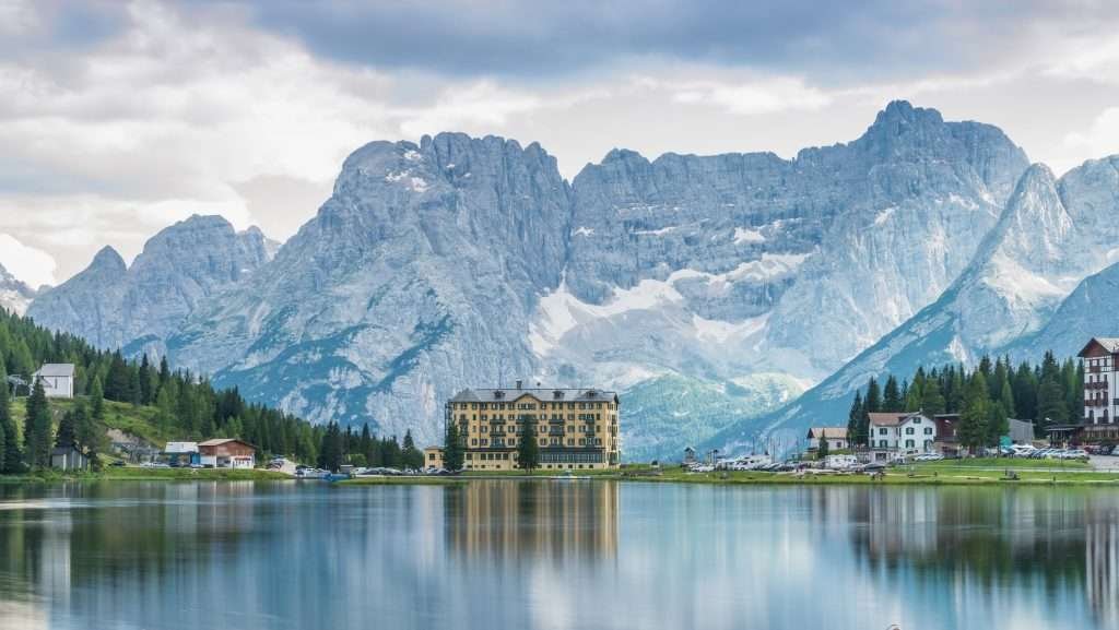
You can walk around the lake in under an hour, but plan at least half a day: the area’s best-known hikes start a few minutes away.
The walk around the lake
The path around the lake is about 2.5 km and almost flat: allow 30–45 minutes at an easy pace. It works for children and pushchairs. The best reflections come early in the morning when there is no wind: from the north shore you see the Sorapiss mirrored in the water.
Worth knowing: since 2022 a breach in the retaining wall on the south shore has been lowering the water level. The municipality of Auronzo has tied the repair to a planned Misurina–Carbonin cycle path, with no date yet. In summer 2026 the lake was much lower than usual and boat hire was restricted. If you are coming for the classic postcard shot, expect wider shores and less water.
The former Grand Hotel and the Pius XII Institute
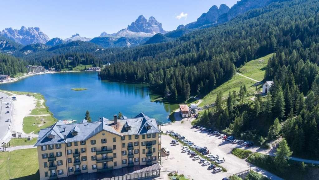
The large building on the south shore began life as a Grand Hotel: work started in 1896 and Queen Margherita of Savoy was among the first guests, in 1900. During the First World War it housed the Italian command for the fighting on Monte Piana. After the Second World War the Diocese of Parma bought it and turned it into the Pius XII Institute, a centre treating children with asthma and respiratory diseases with the mountain air.
Many guides still describe it as a working clinic, but that is out of date: the treatment centre closed at the end of 2022 because of high costs and falling patient numbers. Since 2023 the diocese has used it for summer projects and, since 2026, to host church and community groups. You can see it from outside; it is not a museum.
The mountains around the lake and the legend of Misurina
From the lake you see three mountain groups: the Sorapiss to the south, Monte Cristallo to the west and the spires of the Cadini di Misurina to the east. The name probably comes from the Ladin “meso ai rin”, “among the streams”. The legend tells of Misurina, the spoilt daughter of King Sorapiss: to grant her wish, her father was turned into a mountain, and his tears filled the lake.
The 1956 Olympic lake
At the 1956 Winter Olympics in Cortina, the speed skating events were held on the frozen lake. To get perfect ice, organisers cut the ice free from the shore, creating a kind of floating island. The lake still freezes almost every winter and hosts events on the ice.
Lake Antorno
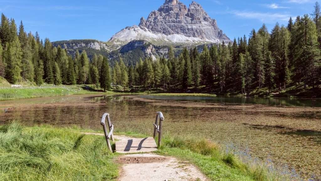
About 2 km north, on the road to the Tre Cime, Lake Antorno (Lago d’Antorno, 1,866 m) is much smaller, set in the woods with the Tre Cime behind it. The walk round is short and the car park is tiny. This is where the toll road to Rifugio Auronzo and the path up Monte Piana begin.
Cadini di Misurina
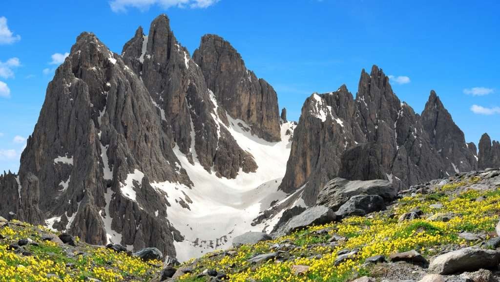
The Cadini di Misurina are the group of spires east of the lake; the highest, Cadin di San Lucano, reaches 2,839 m. “Cadini di Misurina” is also what everyone searches for when they mean one specific viewpoint: the rock outcrop looking down on the spires, one of the most photographed spots in the Dolomites.
The viewpoint: trail and timing
You do not start from the lake but from Rifugio Auronzo (2,333 m), at the end of the Tre Cime road. Take trail 117 towards Rifugio Fonda Savio: in about 30–45 minutes, with some gentle ups and downs, you reach the outcrop. The round trip is about 3 km, or 1–2 hours. To reach Rifugio Auronzo you need either a booked parking slot or the shuttle bus (see below).
Risks and crowds
The last stretch is easy but exposed: the outcrop drops away steeply on several sides. Skip it in rain, on wet ground or if you have no head for heights, and keep hold of children. At midday in summer there is a queue for the photo: go early in the morning or late in the afternoon. June and September are the quietest months.
Col de Varda and Rifugio Città di Carpi
On the Cadini side of the lake, the Col de Varda chairlift runs in summer as well as winter. It goes up to Rifugio Col de Varda (2,115 m); on foot from the lake it is about an hour on trail 120. From Col de Varda a path of about an hour leads to Rifugio Città di Carpi, at around 2,100 m, looking out on the Cadini, the Sorapiss and the Marmarole. Experienced hikers carry on along the partly protected Sentiero Bonacossa to Rifugio Fonda Savio (2,367 m).
Tre Cime di Lavaredo from Misurina
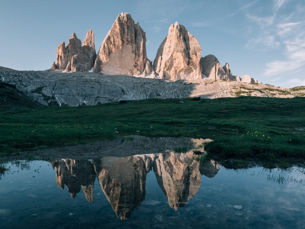
Misurina is the most popular starting point for the Tre Cime on the Veneto side. From the lake to Rifugio Auronzo is about 8 km; the last 6 km, from Lake Antorno, are the toll road run by the municipality of Auronzo. It is open in summer, usually from late May to October depending on snow, and closed in winter.
Compulsory booking and 2026 prices
Since summer 2025 you can only drive up with an online booking that includes your number plate: without one, you are turned back at the toll gate. The ticket is valid for 12 hours from the time you choose. 2026 prices: €40 per car, €26 per motorbike, €60 per campervan or caravan. Disabled visitors go free after registering and booking. Book early on the official Tre Cime parking portal: in August slots go fast.
By shuttle bus from Misurina or Dobbiaco
The cheaper option is to leave the car at Misurina and take the Dolomiti Bus shuttle: in summer 2026 it ran daily from 30 May from the Misurina Genzianella stop, via Lake Antorno, roughly between 7:30 am and 8 pm. A day ticket cost €10, bought in the app, by contactless card on board or at the ticket machine (no cash on the bus). Current timetables are on the Dolomiti Bus website.
From South Tyrol, bus 444 runs from Dobbiaco: in 2026 it operated from 31 May to 11 October, with compulsory online booking and payment (€22 return). Note that it does not stop at Misurina, but at Carbonin (Schluderbach), at the turn-off for the lake.
The Tre Cime loop
From Rifugio Auronzo the classic loop around the Tre Cime is about 9.5 km, with roughly 400 m of ascent and 3–4 hours of walking. It passes Rifugio Lavaredo, Forcella Lavaredo (2,454 m), the highest point, and Rifugio Locatelli, facing the north walls. There are no technical sections, but weather at altitude changes quickly. Full details in our guide to the Tre Cime di Lavaredo.
Monte Piana
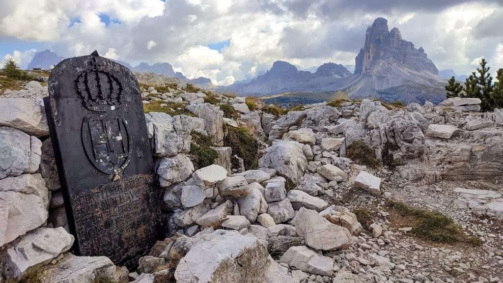
Monte Piana (2,324 m) is the plateau between Misurina and the Landro valley. The First World War front ran across it: Italian and Austro-Hungarian troops fought here for two years, often at close range. Since 1973 trenches, tunnels and positions have been restored to form an open-air First World War museum, with historic paths and information panels. The summit view over the Tre Cime, Cristallo and the Cadini is one of the widest in the area.
The road up from Misurina is closed to private cars. You have two options: walk up from Lake Antorno in about 1.5–2 hours (the Antorno car park fills early), or take the jeep shuttle to Rifugio Bosi (2,205 m), usually running from June into the autumn – check times locally. Allow at least 2–3 hours to explore the plateau.
Misurina in winter
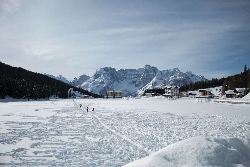
In winter the lake freezes almost every year and is covered in snow. People walk on the ice and there are sometimes events such as snow polo, but only go onto the lake when it is open to the public and follow the signs. Ice skating, when it is cold enough, takes place on nearby Lake Antorno.
Skiing in Misurina
Misurina has a small ski area: the Col de Varda chairlift and the Loita area with its beginners’ slope, between about 1,756 and 2,106 m. The runs are few, short and sunny, with snow usually from December to Easter: good for beginners, families and an easy day. For serious mileage, head to Cortina. The area belongs to the Cortina sector of Dolomiti Superski. Lift pass prices for 2026/27 have not been published yet: check the Tre Cime Dolomiti tourist consortium website.
Cross-country, snowshoeing and Monte Piana
Cross-country loops run through the woods around the lake. Classic snowshoe routes go to Col de Varda and Monte Piana, which in winter you reach on foot from Lake Antorno or by snowmobile. With thin or wind-blown snow, check the avalanche risk before leaving groomed routes.
When to visit Lake Misurina
- June: fewer people and meadows in flower, but snow can linger higher up and some huts only open mid-month.
- July and August: everything is open, shuttles and lifts are running, but expect crowds and full car parks by mid-morning. Book the Tre Cime road early.
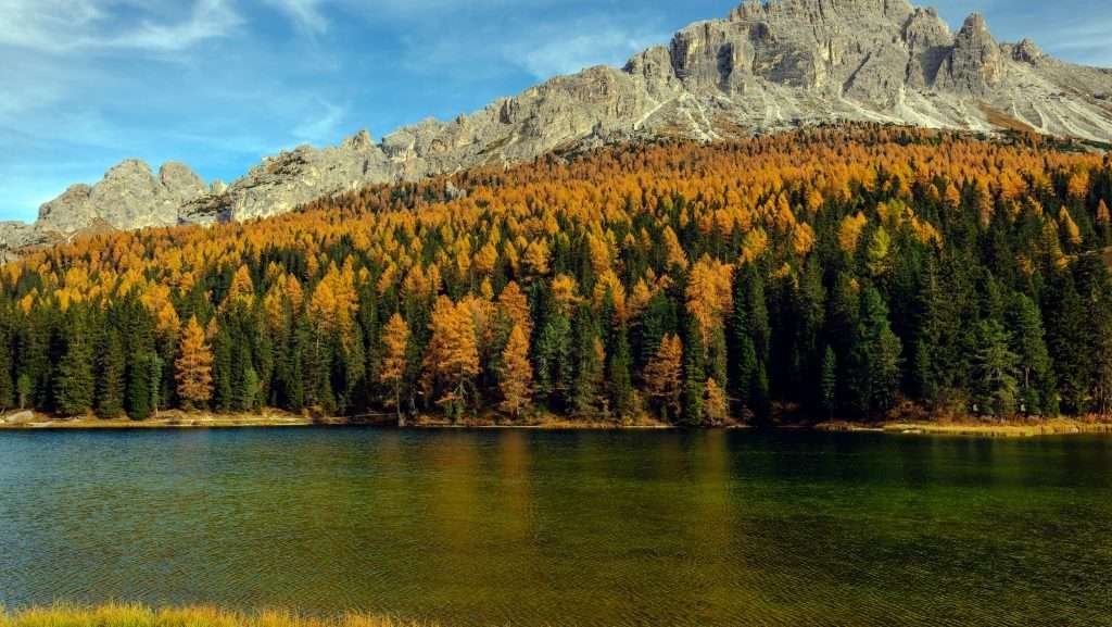
- September and early October: the best time for hiking. In late September the larches turn yellow; shuttles and huts close between September and October.
- November and spring: low season, many hotels closed and the Tre Cime road shut.
- December to March: frozen lake, skiing, cross-country and snowshoeing.
Day trips from Lake Misurina
- Cortina d’Ampezzo (about 14 km): the town centre, cable cars and the Dolomite passes.
- Lake Sorapis: start from Passo Tre Croci, between Misurina and Cortina, for a half-day hike with a few exposed sections protected by cables.
- Auronzo di Cadore (about 24 km): the town on Lake Santa Caterina, down the Ansiei valley.
- Dobbiaco (about 20 km): across the border into South Tyrol, passing Lake Landro and Lake Dobbiaco.
- Lake Braies: in the Puster valley, under an hour’s drive via Dobbiaco. Summer access by car has its own rules.
- Alta Pusteria: San Candido, Sesto and the valleys of the Sexten Dolomites.
- Passo Giau: beyond Cortina, one of the most scenic passes in the Dolomites.
Where to stay at Lake Misurina
Misurina is tiny: a handful of hotels on the shore and not much else. It is the best choice if you want to set off at dawn for the Tre Cime or the Cadini, but rooms are limited and sell out in summer. Otherwise look at the nearby towns: the lake is 20–30 minutes’ drive from each.
- Misurina: for hikers and photographers who want to be first at Rifugio Auronzo or see the lake at sunrise. Mountain hotels, many closed in spring and autumn. Quiet evenings, few bars.
- Auronzo di Cadore: for families and tighter budgets. A real town with shops, Lake Santa Caterina and a bus to Misurina. Hotels, apartments and campsites.
- Cortina d’Ampezzo: for a lively centre, restaurants and a wide choice of hikes; in winter, for keen skiers. More expensive. From town you drive up to Misurina over Passo Tre Croci.
- Dobbiaco and Alta Pusteria: for arriving by train or combining the Tre Cime, Lake Braies and the Puster valley cycle path. Hotels, apartments and bus 444 to Rifugio Auronzo.
For two or three days of hiking, Misurina or Auronzo are the most practical bases. For a week with several goals, Cortina or Dobbiaco work better. In July and August, book well ahead.
How to get to Lake Misurina
By car
From Cortina take the SS48 over Passo Tre Croci and drop down to Misurina: about 14 km, 20–25 minutes. From Dobbiaco follow the SS51 through the Landro valley to Carbonin, then turn off for Misurina: about 20 km. From Auronzo drive up the Ansiei valley on the SS48bis: about 24 km. From Venice it is about 170 km via the A27 motorway. The road to the lake is open all year; in winter you need winter tyres or snow chains.
By train
There is no station at Misurina. The closest are Calalzo di Cadore (about 40 km), end of the line from Belluno, Padua and Venice, and Dobbiaco (about 20 km), on the Puster valley line. From Calalzo continue by bus via Cortina; from Dobbiaco, in summer, take bus 444 towards the Tre Cime.
By bus
In summer Dolomiti Bus links Misurina with Auronzo (line 50) and Cortina (line 51); from Calalzo, line 30 runs to Cortina. Early and late in the season there are few services and direct buses from Cortina may not run. In winter the service is reduced: always check the current timetable.
By plane
The nearest airports are Treviso (about 145 km) and Venice Marco Polo (about 160 km), both around two and a half hours’ drive. Innsbruck is about 155 km away via the Brenner Pass and the Puster valley; Munich about 350 km. Without a car, take the train from Venice to Calalzo or a bus to Cortina, then continue by local bus. Private transfers from Venice airport are another option.
Parking
Around the lake there are car parks along the road, by the Col de Varda chairlift and towards the Genzianella on the Tre Cime road. In summer almost all are paid and fill up quickly on sunny days: arrive before 9 am. The Rifugio Auronzo car park is a different matter: you pay for it with the toll road and must book online.
Frequently asked questions about Lake Misurina
Where is Lake Misurina?
In the Veneto region of Italy, in the hamlet of Misurina, municipality of Auronzo di Cadore (Belluno), in the Dolomites. It is about 14 km from Cortina d’Ampezzo and 20 km from Dobbiaco.
What is the altitude of Lake Misurina?
1,754 m above sea level. Nearby Lake Antorno is at 1,866 m and Rifugio Auronzo, at the Tre Cime, at 2,333 m.
How long is the walk around Lake Misurina?
The path is about 2.5 km and nearly flat: 30–45 minutes at an easy pace. You can do it with a pushchair.
Can you swim in Lake Misurina?
It is not a swimming lake: the water stays cold even in August, it is no more than 5 m deep and there are no beaches. For walking and photos, yes.
Is parking at Lake Misurina free?
In summer almost all car parks around the lake are paid. The Rifugio Auronzo car park for the Tre Cime costs €40 per car (2026) and must be booked online.
How do you get from Lake Misurina to the Tre Cime di Lavaredo?
By car on the toll road to Rifugio Auronzo, with an online booking only, or on the Dolomiti Bus shuttle from the Misurina Genzianella stop (€10 day ticket in 2026). On foot it is a long climb, mostly on the road.
How do you reach the Cadini di Misurina viewpoint?
From Rifugio Auronzo on trail 117, in about 30–45 minutes. The last stretch is exposed: avoid it when wet.
Does Lake Misurina freeze in winter?
Yes, almost every year. You can walk on the lake when it is open to the public; nearby there is the Col de Varda chairlift, cross-country trails and snowshoe routes.
Is the Pius XII asthma institute still open?
No, the treatment centre closed at the end of 2022. The building, the former Grand Hotel on the south shore, now hosts church and community groups.
Can you get to Lake Misurina without a car?
Yes: by train to Calalzo di Cadore and then by bus via Cortina, or in summer by bus from Auronzo and Cortina. Bus 444 from Dobbiaco goes to the Tre Cime but stops at Carbonin, not Misurina.
Photos: Lago di Misurina


