


 Français
 Deutsch
 Italiano
ALLOGGI IN ALTO ADIGE
Scopri i migliori Hotel, B&B e Appartamenti in Montagna in base a migliaia di recensioni verificate.
HeightCima Grande 2,999 m
WhereSexten Dolomites, between Auronzo (BL) and Dobbiaco (BZ)
From Cortinaabout 22 km to Rifugio Auronzo
Tre Cime loopabout 9.5 km · 400 m · 3–4 hours
Toll roadbooking only · car €40 (2026)
SeasonJune – September · road closed in winter
Updated October 2026 · Sources: Auronzo di Cadore municipality (auronzo.info), Dolomiti Bus, drei-zinnen.bz (line 444), CAI, IDM South Tyrol, Wikipedia
Find a place to stay in Tre Cime di Lavaredo
The Tre Cime di Lavaredo (Three Peaks of Lavaredo, Drei Zinnen in German) are three rock towers in the Sexten Dolomites, right on the border between the Veneto and South Tyrol in north-east Italy. Cima Grande is 2,999 metres high, Cima Ovest 2,973 and Cima Piccola 2,857. The ridge divides the municipality of Auronzo di Cadore (province of Belluno) from Dobbiaco (province of Bolzano): the south faces look over the Veneto, the north faces, the ones in the famous photos, over South Tyrol.
The easiest starting point is Rifugio Auronzo, a mountain hut at 2,333 metres at the end of a toll road that starts just above Lake Misurina. From the hut it is about 8 km by road to Misurina, 22 km to Cortina d’Ampezzo and 27 km to Dobbiaco. The nearest airports are Treviso and Venice (about 155 and 170 km) and Innsbruck (about 160 km); Munich is about 355 km away.
You come here to hike: the Tre Cime loop is a circuit of about 9.5 km that takes 3 to 4 hours, with no difficult sections. But you need to plan ahead: since 2025 you can only drive up with an online booking (€40 in 2026), and the shuttle bus from Dobbiaco must be booked too. The hiking season runs from June to early October; in winter the road is closed.
In this guide
What to see at the Tre Cime di Lavaredo
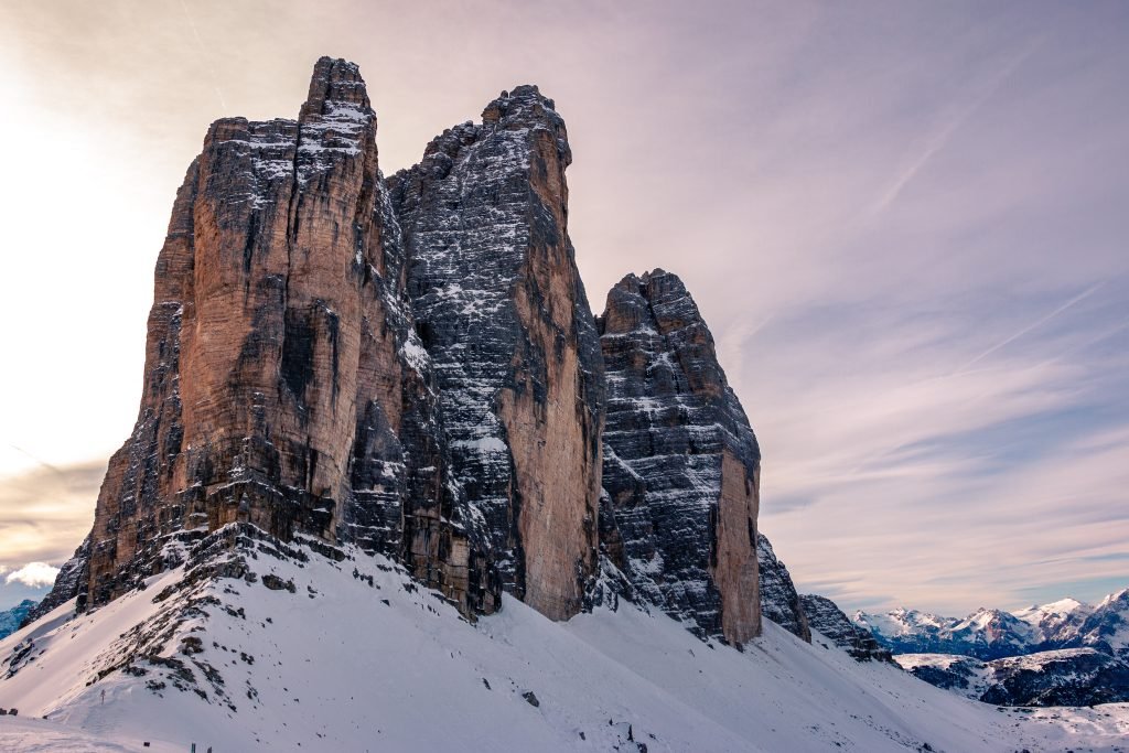
Almost everything is on the loop or within an hour’s walk of it; the rest is along the roads that lead up to the peaks.
The north faces from Rifugio Locatelli
This is the postcard view: the three north faces side by side, sheer, with nothing in front of them. You see it best from Rifugio Locatelli (Dreizinnenhütte, 2,405 m) on the South Tyrolean side, about an hour and a half from Rifugio Auronzo. The best light is early in the morning and late in the day.
The hut is also named after Sepp Innerkofler, the mountain guide from Sesto who died on nearby Monte Paterno in 1915. Below the hut are a few small lakes: on a still summer day the peaks are reflected in them.
Forcella Lavaredo
At 2,454 metres, this saddle is the highest point of the loop and the crossing between the two sides. The last stretch up is the steepest. From the top you see the north faces side-on for the first time, with Monte Paterno and Rifugio Locatelli ahead.
Rifugio Auronzo and Rifugio Lavaredo
Rifugio Auronzo (2,333 m) belongs to the Auronzo section of the Italian Alpine Club (CAI) and has 99 beds, at the end of the toll road. From here you see the south faces, the Cadini di Misurina and Monte Cristallo. Rifugio Lavaredo (about 2,340 m) is a smaller private hut half an hour from the Auronzo, below the south faces.
Langalm
Langalm (Malga Grava Longa, about 2,280 m) is a stone mountain farm on the north-west side of the loop, with no access road: you can only walk there. It is a good place to stop, with a three-quarter view of the peaks and meadows in the foreground. Open in summer, usually from June to September.
Drei Zinnen Blick and Lake Landro
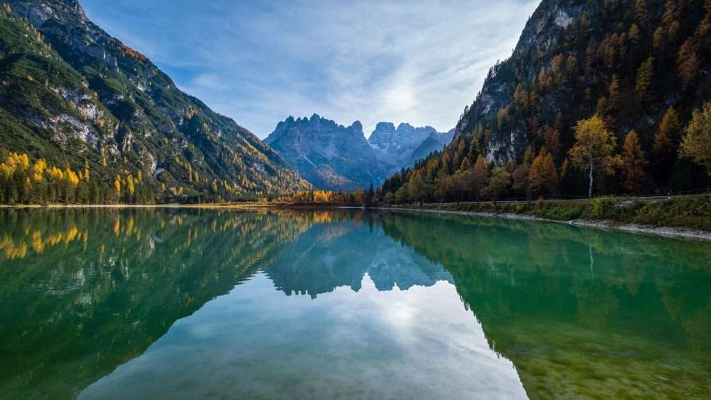
If you are not hiking, the easiest way to see the north faces is the Drei Zinnen Blick, a viewpoint in the Landro valley about 7 km south of Dobbiaco on the road to Cortina, with a wooden platform, information boards and a free telescope. The Tre Cime shuttle bus stops here. A little further south, Lake Landro (Dürrensee) mainly reflects Monte Cristallo.
Lake Antorno and Lake Misurina
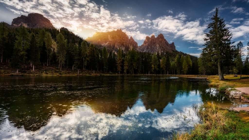
These are the two lakes on the road to the hut. Lake Antorno (1,866 m) is small, in the woods, with the peaks in the background; the toll road starts here. Lake Misurina (1,754 m), 2 km further down, takes 30 to 45 minutes to walk around.
Monte Paterno and the First World War tunnels
Monte Paterno, opposite Rifugio Locatelli, was on the front line in the First World War: the tunnels dug by soldiers are still inside the rock. A via ferrata runs through them; you need a head torch, via ferrata gear and experience. If you have never done a via ferrata, go with a mountain guide.
The Tre Cime loop

The Tre Cime di Lavaredo loop is a circuit of about 9.5 km starting and ending at Rifugio Auronzo. There is about 400 metres of ascent and the same in descent; allow 3 to 4 hours of walking, plus breaks. It is a hiking trail with no exposed sections, but the ground is often loose gravel: wear hiking boots, not trainers.
The classic direction is anticlockwise, on trails 101 and 105. The stages, with approximate times:
- Rifugio Auronzo → Rifugio Lavaredo: about 1.7 km, 30 minutes, on an almost flat gravel road (trail 101).
- Rifugio Lavaredo → Forcella Lavaredo (2,454 m): about 1 km, 20 minutes uphill.
- Forcella Lavaredo → Rifugio Locatelli: about 1.9 km, 40 minutes, with the north faces in front of you.
- Rifugio Locatelli → Langalm: about 2.8 km, 1 hour 15 minutes, with a descent and a climb back up (trail 105).
- Langalm → Forcella Col di Mezzo (2,315 m) → Rifugio Auronzo: about 2.1 km, 35 minutes.
Many people only walk out and back to Rifugio Locatelli, on the widest and easiest part: about 3 hours in total. The full loop is worth it, though: after the Locatelli it gets quieter and the peaks show a different side.
Practical tips: start early, before 9am, to avoid the crowds and get a table at the huts at lunchtime. Take water, a windproof jacket and a warm layer: you are above 2,300 metres and the weather changes fast. The huts are usually open from June to late September.
Other trails to the Tre Cime
Longer, quieter trails lead up from the South Tyrolean valleys and from Misurina.
Via the Fiscalina valley (Sesto)
From Moso, a hamlet of Sesto, you enter the Fiscalina valley (Fischleintal) and reach Rifugio Fondovalle (1,548 m). From there trail 102 climbs through the Sasso Vecchio valley to Rifugio Locatelli: about 1,000 metres of ascent, 3.5 to 4 hours up. No toll and no booking; in high season take the bus from Sesto, as the car park in the valley fills up early.
Via the Rienza valley (Landro)
From the Drei Zinnen Blick, trail 102 follows the Rienza valley up to Rifugio Locatelli: about 8 km and almost 1,000 metres of ascent, around 3.5 hours up. It is demanding but has no fixed-rope sections. You can walk up this way and ride shuttle 444 back down from Rifugio Auronzo (book your return).
On foot from Lake Antorno
If you have no parking slot, you can walk from Lake Antorno to Rifugio Auronzo: trail 101 runs next to the road, with about 470 metres of ascent. Allow around two hours up. It is the only free way to get up high from the south.
Monte Piana
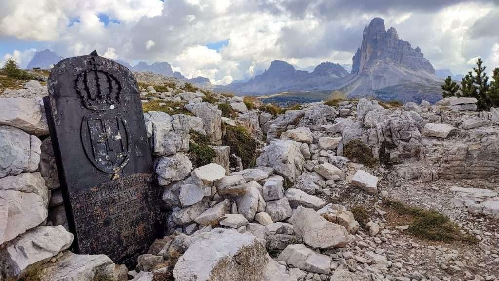
Monte Piana (2,324 m) is the plateau facing the Tre Cime, above Misurina. The First World War front ran across it; the Italian and Austrian trenches are now an open-air museum. You can walk up from Lake Antorno in about 1.5 to 2 hours or take the summer jeep shuttle from Misurina. From the top you look straight at the Tre Cime.
Cadini di Misurina
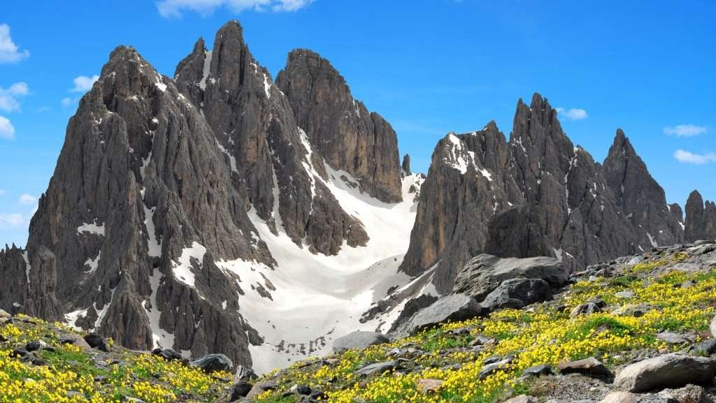
From Rifugio Auronzo, trail 117 towards Rifugio Fonda Savio leads in 30 to 45 minutes to the Cadini di Misurina viewpoint, over the spires south of the Tre Cime. The last part is a rock spur with drops on several sides: skip it in the rain or if you suffer from vertigo. Lower down, at the foot of the Cadini, Malga Maraia is a half-day forest walk from the area below Misurina.
History of the Tre Cime di Lavaredo
The first ascents
Cima Grande was first climbed on 21 August 1869 by Paul Grohmann with the guides Franz Innerkofler and Peter Salcher, from the south side. Cima Ovest followed in 1879 (Michel Innerkofler and Georg Ploner), Cima Piccola in 1881 (Michel and Hans Innerkofler). The north faces came later: Cima Grande in August 1933, by Emilio Comici with the brothers Giovanni and Angelo Dimai; Cima Ovest in 1935, by Riccardo Cassin and Vittorio Ratti. The Cima Grande direttissima followed at the end of the 1950s.
The First World War
From 1915 to 1917 the front between Italy and Austria-Hungary ran right through here: from Monte Paterno across Forcella Lavaredo, below the peaks, to Forcella Col di Mezzo. The Austrian hut, today’s Rifugio Locatelli, was destroyed by Italian artillery on 25 May 1915, a few days after Italy entered the war. Sepp Innerkofler, the guide from Sesto, died on Monte Paterno. Trenches and tunnels can still be seen along the trails.
The border and the park
The ridge follows a historic border between Cadore and Tyrol that today separates the Veneto from South Tyrol, and also the languages: Italian to the south, German to the north. That is why most places have two names. The South Tyrolean side is part of the Tre Cime Nature Park, and the Dolomites have been a UNESCO World Heritage Site since 2009.
When to visit the Tre Cime di Lavaredo

Season. For hiking, the best time is June to late September, when the huts are open. In June there can still be snow on the north sides; September is often the best month, with clear air and fewer people. The toll road normally opens in late May and closes at the end of October, depending on snow; in 2026 the shuttle from Dobbiaco ran from 31 May to 11 October.
Crowds. July and August are the busiest months, especially at weekends. Start early or go in the late afternoon: the parking slot lasts 12 hours, so you can stay for sunset.
Weather. In summer, thunderstorms often build in the early afternoon. Check the forecast the night before and be back early. Even in August, mornings are cold up high.
Winter. The toll road and the huts are closed (Rifugio Auronzo only keeps a small winter room). You can go up from Misurina or Lake Antorno on snowshoes or touring skis, but off the road the terrain is avalanche-prone: you need experience, a transceiver, shovel and probe, or a guide. For skiing, go to Misurina (Col de Varda), Cortina or the 3 Zinnen Dolomites ski area in Sesto and San Candido.
Where to stay near the Tre Cime di Lavaredo
There is no village at the foot of the Tre Cime: choose your base by how you plan to get up.
- Misurina: the closest base, 8 km from the hut and minutes from the toll gate. Ideal for driving up at dawn or taking the Dolomiti Bus shuttle, which starts here. Few hotels and quiet evenings: book early for July and August.
- Auronzo di Cadore: a proper town, with more holiday apartments and lower prices. About 45 minutes from the hut; in summer a bus runs up to Misurina. Good for families and longer stays.
- Sesto and San Candido, in the Alta Pusteria: for hiking up through the Fiscalina valley and combining the Tre Cime with other walks in the Sexten Dolomites. Hotels and apartments at every level; a ski area in winter.
- Dobbiaco (Toblach): the choice if you travel without a car. It has a railway station and the 444 shuttle to Rifugio Auronzo; handy for the Rienza valley and Lake Braies too.
- Cortina d’Ampezzo: the widest choice of hotels, restaurants and shops, but the most expensive. About 35 minutes’ drive to the hut; in high summer there is a bus to Misurina.
- In a mountain hut: staying at the Auronzo, Lavaredo or Locatelli means sunrise and sunset without the crowds. Book months ahead.
How to get to the Tre Cime di Lavaredo
By car: the toll road and booking
Most international visitors fly into Venice or Treviso and hire a car: the drive to Rifugio Auronzo takes about two and a half hours. From Innsbruck or Munich you come over the Brenner and through the Puster valley to Dobbiaco. You reach Misurina from Cortina (Passo Tre Croci), from Dobbiaco (Landro valley) or from Auronzo. At Lake Antorno starts the toll road, about 6 km long, to Rifugio Auronzo, normally open from late May to late October.
Since 2025 access is by online booking only, on the Auronzo municipality’s portal: choose day and time, enter email, phone and number plate (you can change the plate once, up to the evening before). At the toll gate your plate is what counts: no ticket to print, but keep the confirmation email handy. Without a booking you will be turned away, even if the car park looks empty.
- 2026 prices: car €40, motorbike €26, campervan €60, free for disabled visitors (with registration).
- Validity: 12 hours from your booked time. No entry before it; once you leave you cannot come back in; overstay and you pay a penalty equal to a full day.
- Cancellation: free up to the fifth day before; after that no refund, not even for bad weather.
Booking and rules on the Auronzo municipality website
By bus and shuttle
- From Misurina (Dolomiti Bus): shuttle Misurina – Lake Antorno – Rifugio Auronzo, daily from 30 May 2026, from early morning to evening. Day ticket €10, via the app, the website, contactless card on board or the ticket machine in Misurina (no cash on the bus).
- From Cortina and Auronzo: Dolomiti Bus to Misurina (from Cortina only in high summer), then the shuttle.
- From Dobbiaco (line 444): from Dobbiaco station to Rifugio Auronzo via Lake Dobbiaco, Drei Zinnen Blick, Lake Landro and Carbonin; in 2026 from 31 May to 11 October. Online booking and payment are compulsory both ways: €22 return, €16 one way. It does not stop in Misurina and does not take bikes.
Booking for shuttle 444 from Dobbiaco
On foot via the Fiscalina and Rienza valleys
There is no road on the South Tyrolean side: you walk up to Rifugio Locatelli through the Fiscalina valley (from Sesto, with a summer bus to the valley entrance) or the Rienza valley (from the Drei Zinnen Blick, a 444 stop). Either way, almost 1,000 metres of ascent and 3.5 to 4 hours up.
By train
Two stations are useful. Dobbiaco, on the Puster valley line (from Fortezza on the Brenner line, or from Lienz in Austria): the 444 shuttle leaves from here. Calalzo di Cadore, at the end of the line from Venice and Padua: buses to Cortina and on to Misurina, or to Auronzo.
By plane
The nearest airports are Treviso (about 155 km) and Venice Marco Polo (about 170 km), then Innsbruck (about 160 km) and Munich (about 355 km). Buses run from Venice and Treviso airports to Cortina.
Parking
Up high, the only car park is at Rifugio Auronzo, included in your booking. For the hikes from below: car parks in the Fiscalina valley (paid), in the Landro valley and in Misurina; for the 444, paid parking near Dobbiaco station.
Frequently asked questions about the Tre Cime di Lavaredo
Where are the Tre Cime di Lavaredo?
In the Sexten Dolomites in north-east Italy, on the border between the Veneto (Auronzo di Cadore, province of Belluno) and South Tyrol (Dobbiaco). The south faces are in the Veneto, the north faces in South Tyrol.
How high are the Tre Cime di Lavaredo?
Cima Grande is 2,999 metres, Cima Ovest 2,973 and Cima Piccola 2,857. None of them reaches 3,000 metres.
How much is the Tre Cime toll road?
In 2026 it cost €40 per car, €26 per motorbike and €60 per campervan, for 12 hours of parking at Rifugio Auronzo.
Can I drive up without a booking?
No. Since 2025 the toll road is open only to cars with an online booking and a registered number plate. Alternatives: the shuttle from Misurina, line 444 from Dobbiaco or walking.
How do I get to the Tre Cime without a car?
By train to Dobbiaco, then shuttle 444 (booking compulsory), or by bus to Misurina, then the Dolomiti Bus shuttle (€10 for the day). Or walk up through the Fiscalina or Rienza valleys.
How long is the Tre Cime loop?
About 9.5 km with 400 metres of ascent: 3 to 4 hours of walking, not counting breaks. Easy, but on gravel and above 2,300 metres.
Where is the best view of the north faces?
From Rifugio Locatelli and Langalm, on the loop. Without hiking, from the Drei Zinnen Blick in the Landro valley, on the road between Dobbiaco and Cortina.
When is the best time to visit the Tre Cime di Lavaredo?
June to late September, when the huts are open. September is often the best month; July and August are the busiest.
Can you visit the Tre Cime in winter?
Yes, but only on foot: the road and the huts are closed. You go up on snowshoes or touring skis, with avalanche gear or with a guide.
Weather in Tre Cime di Lavaredo
Photos of Tre Cime di Lavaredo


