


 Français
 Deutsch
 Italiano
ACCOMMODATION IN PASSO GIAU
Discover the best Hotels, B&Bs and Apartments in the Mountains based on thousands of verified reviews.
Altitude2,236 m
WhereDolomites, province of Belluno (Veneto)
From Cortinaabout 17.5 km via Pocol (SP638)
Road29 hairpins on the Selva di Cadore side
SkiingCinque Torri · Dolomiti Superski €89/day (high season 2026/27)
Openall year, except snow and avalanche closures
Updated October 2026 · Sources: Cortina Dolomiti, Dolomiti Superski, Dolomiti Bus, ENIT, Giro d'Italia
Find a place to stay in Passo Giau
Passo Giau (Giau Pass, Passo di Giau) is a Dolomites pass at 2,236 metres in the province of Belluno, in Italy’s Veneto region. The SP638 provincial road crosses it, linking Cortina d’Ampezzo with the Val Fiorentina, home to Selva di Cadore and Colle Santa Lucia. From Cortina it is about 17.5 km: 7 km to Pocol on the Falzarego road, then a 10 km climb. On the other side the road drops to Selva di Cadore through 29 hairpins and three avalanche tunnels.
There is no village at the top, just a wide meadow, a small chapel, a mountain hotel-hut and a car park. Above the pass rise the rock spires of Ra Gusela and Nuvolau. Around you are the Marmolada, Sorapiss, Cristallo, Croda da Lago and the Tofane. Trails start here for the Cinque Torri, Nuvolau and Lago Federa.
In summer the Giau draws hikers, motorcyclists and cyclists: the climb from Selva di Cadore is one of the hardest in the Dolomites, and the pass has been the Giro d’Italia’s Cima Coppi four times. In winter the road stays open except during snow and avalanche closures, and a chairlift on the Colle Santa Lucia side takes you up to the Cinque Torri slopes.
What to see at Passo Giau

Almost everything is within walking distance.
The pass and the view
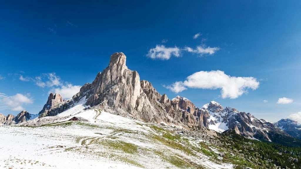
A few steps up the meadow give you the full panorama. To the north are Ra Gusela and Nuvolau, with Averau behind. Towards Selva di Cadore you see the Marmolada, the Sella and, on clear days, the Odle and Catinaccio (Rosengarten). Towards Cortina you can pick out Sorapiss and Cristallo. To the east is the skyline of Croda da Lago and Lastoi de Formin.
The pass is split between four municipalities: Colle Santa Lucia, Selva di Cadore, San Vito di Cadore and Cortina d’Ampezzo. That is why maps list it as “Passo Giau, Colle Santa Lucia” or “Passo di Giau, San Vito di Cadore”.
The Muraglia di Giau
Next to the road at the top are the remains of the Muraglia di Giau (Marogna de Giau in Ladin), a dry-stone wall built by the people of Cadore to fix the border with Ampezzo, then under Habsburg rule. A stone dated 1753 on the left of the road marks the border point. It still divides San Vito di Cadore and Colle Santa Lucia today.
Huts and farms around the pass
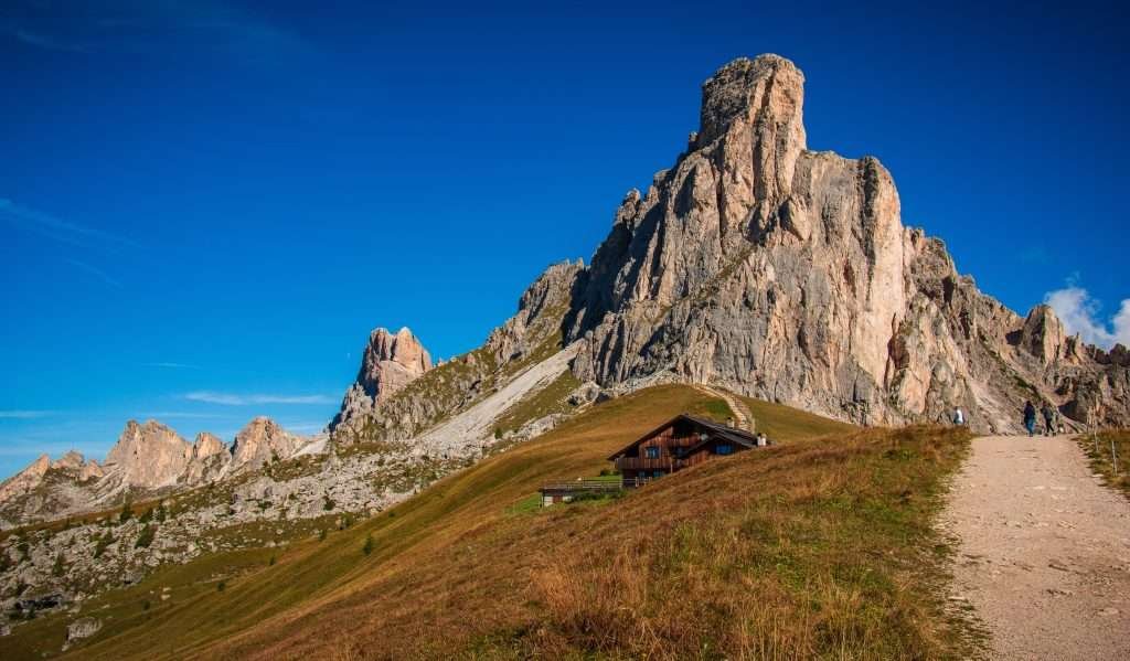
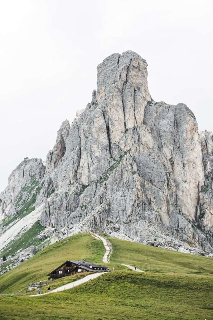
At the pass itself, at 2,236 metres, is Rifugio Passo Giau, which is also a hotel. A little lower, on the Colle Santa Lucia side, are Rifugio Da Aurelio (2,175 m) and Rifugio Fedare (2,000 m), where the chairlift to Averau starts. On the Cortina side, in the municipality of San Vito di Cadore, is Malga Giau at 1,900 metres. Opening dates change every season, so check before you go.
Ra Gusela and Nuvolau
Ra Gusela is the rock spire towering over the pass, about 2,595 metres high. Just behind it is Nuvolau, topped by Rifugio Nuvolau (2,575 m), built in 1883: the first mountain hut in the Ampezzo basin. The view stretches from the Marmolada to the Tofane.
Cinque Torri and the open-air museum
The Cinque Torri are a cluster of rock towers on the Cortina side, up to 2,361 metres (Torre Grande). In the First World War this was an Italian front line: trenches, gun positions and huts have been rebuilt as an open-air museum, with walks from half an hour to two hours.
Lastoi de Formin and Mondeval
The Lastoi de Formin are huge tilted rock slabs rising to 2,657 metres. Below them to the south lies the Mondeval de Sora plateau, with pastures and the small Lago delle Baste. Here, at around 2,150 metres, archaeologists found the grave of a Mesolithic hunter, the Mondeval Man. His skeleton and grave goods are on display at the Val Fiorentina civic museum “Vittorino Cazzetta” in Selva di Cadore.
Hiking from Passo Giau
Figures come from Cortina Dolomiti’s official route sheets where available; the others are approximate. Take the Tabacco 1:25,000 map, sheet 03.
To Rifugio Averau on trail 452
The easiest walk. From the pass follow trail 452 north, a balcony path under the cliffs of Ra Gusela and Nuvolau with a few ups and downs. You reach Forcella Nuvolau and Rifugio Averau (about 2,400 m) in around an hour, with just over 100 metres of ascent. From there Rifugio Nuvolau is about 20 minutes up a steep rocky path; trail 439 takes you down to Rifugio Scoiattoli (2,255 m) and the Cinque Torri.
Ra Gusela via ferrata and Nuvolau
If you want to try an easy via ferrata, this is the classic one. Go up on trails 452 and 443, then 438 along the protected section to Nuvolau. Return on 439 to Rifugio Averau, 464 towards Fedare and 452 back to the pass. About 3 hours and 420 metres of ascent in total. The Ra Gusela summit is a 15-minute detour. Easy or not, bring a via ferrata kit and a helmet.
Rifugio Nuvolau loop
The full loop without the via ferrata is 9.8 km with 612 metres of ascent and descent, about 5 hours. Start from the pass car park on trail 443, take 439 to Rifugio Scoiattoli, Averau and Nuvolau, and return on 464 and 452. Cortina Dolomiti rates it for experienced hikers.
Lago Federa and Croda da Lago
From the pass take trail 436, which is also Dolomites High Route (Alta Via) no. 1 and starts next to the chapel. It crosses Forcella Col Piombin, Forcella Giau and the Mondeval plateau below the Lastoi de Formin to Forcella Ambrizzola (2,277 m). From there trail 434 drops to Rifugio Croda da Lago on Lago Federa. Allow about 3 hours one way and about 600 metres of ascent counting the ups and downs. For a shorter hike, start from the Ru Curto bridge on the Giau road (Cortina side): trails 437 and 434 get you to the lake in about two hours.
Lastoi de Formin and the Mondeval plateau
Trail 436 brings you to Forcella Giau (about 2,360 m) and the Mondeval meadows in about two hours. To summit the Lastoi de Formin (2,657 m), leave trail 435 towards Forcella Rossa (2,462 m) and follow the cairns. In fog the route is easy to lose: go only in good visibility.
Cycling Passo Giau
The Giau is one of the most famous road bike climbs in the Dolomites. The Selva side is the harder one; the Cortina side is slightly gentler.
From Selva di Cadore
The hard side: about 10 km, about 920 metres of climbing and an average gradient of around 9%. The toughest part is the first section through the fir forest, with ramps close to 16%. After Rifugio Fedare it eases a little. There are 29 hairpins and three short tunnels. The 2026 Giro listed it at 9.9 km and 9.3%.
From Pocol (Cortina)
From Pocol the real climb is about 8.5 to 9 km, with about 700 metres of ascent and an average just over 8%. The last kilometres are the steepest. Starting from Cortina, add the 7 km climb to Pocol on the Falzarego road.
The Giau at the Giro d’Italia
The Giro first climbed the Giau in 1973 and has crossed it more than ten times since. It was the Cima Coppi, the highest point of the race, in 1973, 2011, 2021 and 2026. In 2021 the title moved to the Giau after bad weather took the Pordoi out of the route. In May 2026, stage 19 from Feltre to Alleghe linked Duran, Staulanza, Giau and Falzarego; Sepp Kuss won it. See also the climbs of Passo Pordoi and the Sella Ronda loop.
Maratona dles Dolomites
Since 1988 the Giau has been on the long course of the Maratona dles Dolomites, the sportive that starts in Val Badia every year in early July. It is the sixth of seven passes and the steepest.
Skiing near Passo Giau
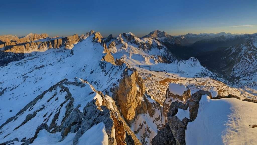
The Giau has no ski resort of its own, but it sits right next to the Cinque Torri slopes (Cortina ski area, Dolomiti Superski).
You get on the slopes at Rifugio Fedare, just below the pass on the Colle Santa Lucia side, where the Fedare chairlift climbs towards Averau. Up top you join the Cinque Torri runs and, with the Croda Negra chairlift, ski down to Passo Falzarego. From Falzarego you ride up to Lagazuoi, start of the Armentarola run to Val Badia: 7.5 km and 1,130 metres of descent. The Cinque Torri–Giau area has four lifts: the Cinque Torri, Fedare, Potor and Croda Negra chairlifts.
There are two ski passes. The Valle Skipass covers Cortina (including Cinque Torri and Lagazuoi down to Armentarola), San Vito di Cadore and Auronzo-Misurina, 120 km of slopes in total. The Dolomiti Superski is valid in 12 areas with 1,200 km of slopes: for the 2026/27 season an adult day pass in high season costs 89 euros, a 6-day pass 453 euros. Buy online at least two days ahead to save 5%. The 2026/27 Valle Skipass price had not been published when we wrote this guide: check it on the official Cortina Dolomiti website.
For ski touring and snowshoeing the avalanche risk here is real: always read the Veneto avalanche bulletin and go with a mountain guide if you do not know the terrain.
Photographing Passo Giau

You drive up to 2,236 metres and the mountains are right in front of you. The classic shot is Ra Gusela with the pass meadows in the foreground. Walk a few minutes up the grass south-east of the car park, on trail 436 towards Forcella Col Piombin, and you have it all in frame.
The best time is sunset. The walls turn red, then purple: this is the enrosadira, the alpenglow the Dolomites are famous for. At sunrise there are fewer people and low light across the meadows and Croda da Lago. In winter, after snowfall, check first that the road is open.
There are no drone rules specific to the pass: check the flight zones on D-Flight, Italy’s drone portal, before you fly.
When to visit Passo Giau
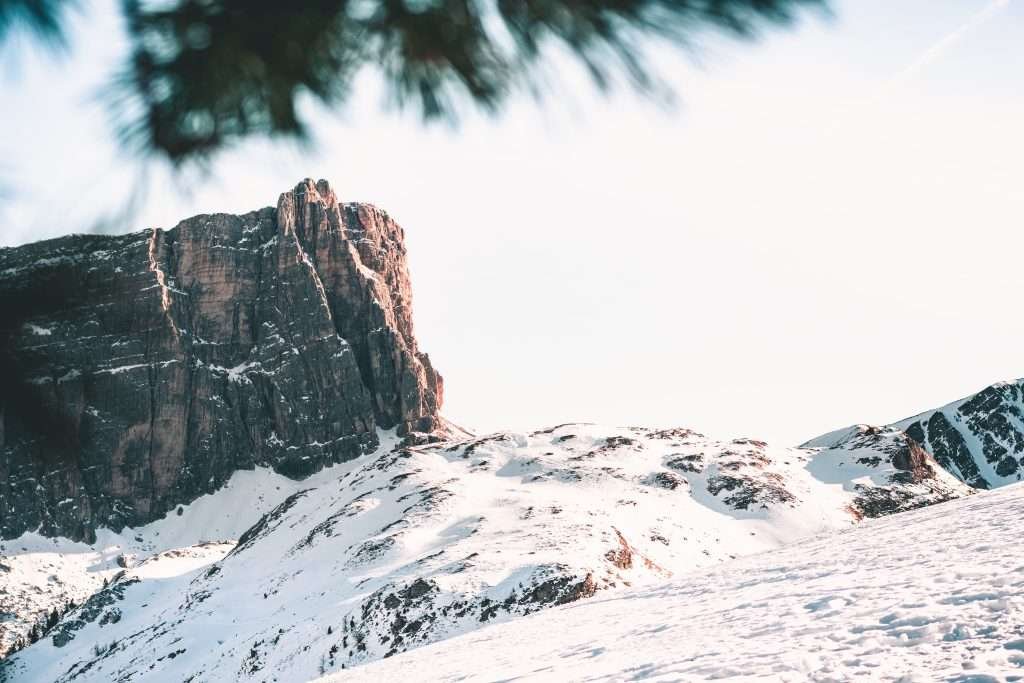
The road is open all year. There is no fixed winter closure and no night closure, but the provincial road is closed whenever there is heavy snow or high avalanche danger, sometimes for days. In winter, check road conditions before you set off and carry snow chains or winter tyres.
The best hiking season runs from late June to September, when the huts are open and the trails are snow-free. July and August are the busiest months, with lots of motorbikes and cyclists at weekends; September is quieter. In winter you can ski at the Cinque Torri.
On some days the road is closed for events. On Sunday 5 July 2026, the Selva di Cadore – Passo Giau – Pocol section was closed from 9am to 2pm for the Maratona dles Dolomites. Similar closures happen when the Giro passes. Unlike Falzarego, Valparola and Campolongo, the Giau was not among the passes closed for the Dolomites Bike Day on 20 June 2026. The 2027 dates are not out yet: check them before you plan.
Day trips from Passo Giau
- Cortina d’Ampezzo (about 17.5 km): the valley’s hub, with shops, lifts and the Tofana.
- Passo Falzarego and Lagazuoi: a few kilometres from Pocol, with the Lagazuoi cable car and the First World War tunnels.
- Lago di Sorapis: one of the best-known lakes in the Dolomites, starting from Passo Tre Croci above Cortina.
- San Vito di Cadore: a village below Antelao and Pelmo, on the road to Venice.
- Alleghe and its lake, down the Val Fiorentina into the Agordino.
- Arabba and the Marmolada, over Passo Falzarego and through Livinallongo.
- Selva di Cadore: the “Vittorino Cazzetta” museum and the Mondeval Man.
Where to stay near Passo Giau
At the pass a hotel-hut has rooms, handy for sunrise. Otherwise you have four areas to choose from.
- Cortina d’Ampezzo: the easiest base if you want restaurants, buses and lifts. Hotels in every category and apartments, but high prices, especially in August and at Christmas. Best for skiers and travellers without a car.
- Colle Santa Lucia: a small village on the southern side, towards the Agordino. Closest to the Fedare chairlift and the Cinque Torri. Good if you want quiet and early starts.
- Selva di Cadore and Pescul: in the Val Fiorentina, at the foot of the hard side of the Giau. Ideal for cyclists and hikers, with apartments and small hotels cheaper than Cortina.
- San Vito di Cadore: south of Cortina, on the road from Venice. Lower prices and lifts included in the Valle Skipass: a good choice for families and smaller budgets.
How to get to Passo Giau
By car
From Cortina take the Passo Falzarego road (SS48) to Pocol, then turn left onto the SP638. From central Cortina to the pass is about 17.5 km. From the south you come up from the Val Fiorentina, via Selva di Cadore or Colle Santa Lucia and the 29 hairpins. The provincial road is about 19 km long between Pocol and the Val Fiorentina road, and it is open to coaches and lorries.
From Venice take the A27 motorway to its end, then the SS51 Alemagna road to Cortina. From Austria and South Tyrol come via the Brenner, the Val Pusteria and Dobbiaco, or through Val Badia over the Valparola and Falzarego passes to Pocol.
By train
There is no station near the pass. The closest to Cortina are Calalzo di Cadore (35 km), connected by Dolomiti Bus, and Dobbiaco (31 km), connected by SAD buses. From Cortina continue by car or, in summer, by bus.
By bus
Cortina Express, Flixbus and ATVO connect Cortina with Venice airport and Venezia Mestre station. In summer 2026 Dolomiti Bus added a new Cortina – Passo Giau – Pescul line, alongside its other summer buses to the Dolomite passes, until 9 September. Timetables and whether it returns in 2027 are on the Dolomiti Bus app.
By air
The most convenient airport is Venice Marco Polo, 162 km from Cortina, with direct flights from the UK and much of Europe; airport transfers run by bus or private shuttle. In high season there are also buses from Treviso airport. Innsbruck and Munich are alternatives if you are driving in from the north via the Brenner.
Parking
There is a car park next to the hut at the pass and some lay-bys along the road. On fine summer days it fills early: if you plan to hike or take photos, arrive before 8am. Camper van parking was the subject of bans and disputes in 2026: follow the signs on site.
Frequently asked questions about Passo Giau
How high is Passo Giau?
Passo Giau is at 2,236 metres. Some sources, including the Giro, give 2,233 metres: the difference depends on the point measured.
Where is Passo Giau?
In the Dolomites, province of Belluno (Veneto, Italy), between Cortina d’Ampezzo and the Val Fiorentina. The pass is shared by Colle Santa Lucia, Selva di Cadore, San Vito di Cadore and Cortina.
How far is Passo Giau from Cortina?
About 17.5 km: 7 km to Pocol on the Falzarego road, then a 10 km climb on the SP638. Around half an hour by car.
How many hairpins does Passo Giau have?
The Selva di Cadore side has 29 hairpins and three avalanche tunnels.
Is Passo Giau open in winter?
Yes, the road is open all year, but it closes during heavy snow or high avalanche danger. There is no fixed night closure. Check road conditions before you set off.
Where do you park at Passo Giau?
In the car park next to the hut at the top and in the lay-bys along the road. In summer it fills quickly: arrive before 8am.
Can you get to Passo Giau by bus?
Only in summer. In 2026 Dolomiti Bus ran a Cortina – Passo Giau – Pescul line until 9 September. Check timetables on the Dolomiti Bus app.
How many times has the Giau been the Giro's Cima Coppi?
Four: 1973, 2011, 2021 and 2026. The Giro first climbed it in 1973.
What is the easiest hike from Passo Giau?
Trail 452 to Rifugio Averau: about an hour, with just over 100 metres of ascent. From there you can go up to Rifugio Nuvolau or down to the Cinque Torri.
Where is Malga Giau?
On the Cortina side, at 1,900 metres, in the municipality of San Vito di Cadore.
Weather in Passo Giau
Photos of Passo Giau


