


 Français
 Deutsch
 Italiano
ACCOMMODATIONS IN THE DOLOMITES
Discover the best Hotels, B&Bs and Apartments in the Mountains based on thousands of verified reviews.
Altitude1,498 m
WhereCuron Venosta, upper Val Venosta, South Tyrol
From Innsbruckabout 120 km · 1 h 40
Lake loop15 km · about 4 h on foot
Surface6.77 km² · about 6 km long
SkiingSchöneben-Haideralm, gondolas on the shore
Updated October 2026 · Sources: Resia Pass tourist office, IDM South Tyrol, Südtirolmobil
Find a place to stay near Lake Resia
Lake Resia (Lago di Resia in Italian, Reschensee in German) is in South Tyrol, northern Italy, at the top of the Val Venosta (Vinschgau), at 1,498 metres, a few kilometres below the Resia Pass and the Austrian border. It belongs to the municipality of Curon Venosta (Graun, province of Bolzano) and touches three villages: Resia to the north, Curon in the middle and San Valentino alla Muta to the south. Malles is about 17 km away, Merano about 74 km and Bolzano about 103 km. From Innsbruck it’s about 120 km; from Munich and Zurich, a little over 210 to 230 km.
It isn’t a natural lake but a hydroelectric reservoir, filled in 1950: the dam joined two smaller lakes and drowned the old village of Curon (which is why it’s also called Lake Curon). The church bell tower still rises from the water, and it’s the reason almost everyone comes. The lake is about 6 km long, up to 1 km wide, with a surface of 6.77 km².
In summer, come for the 15 km almost flat loop around the lake on foot or by bike, for the wind that draws kitesurfers and sailors, and for the downhill cycle path through the Val Venosta. In winter the lake freezes: snowkiting, skating, winter walks, and two small ski areas above the shore. Below you’ll find what to see, the story of Curon, the lake loop, sensible rules for the ice, where to stay and how to get there by car, train, bus or plane.
In this guide
What to see at Lake Resia
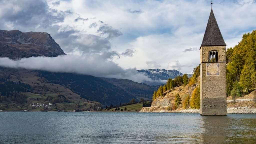
Everything is on the shore or a few kilometres away. Half an hour is enough for the bell tower; add the lake loop and plan half a day.
The Curon bell tower

The Romanesque tower of the old parish church of St Catherine, consecrated in 1357, is the only building of old Curon still standing. It stands a few metres off the shore in front of the new village and is a protected monument. Depending on the water level, it’s half submerged or almost dry at the base. For photos, come early in the morning, when the water is calmest.
Curon, the rebuilt village
Curon (Graun in German) is the main village of the municipality. Today’s village was rebuilt after 1950 on the slope above the lake, higher than the old one. This is where you’ll find the main car park, the boat pier and the start of the lake loop.
Resia and the Resia Pass
Resia (Reschen) is the village at the north end of the lake. Above it is the Resia Pass (1,507 m), which lies entirely in Italy: the Austrian border is about 2 km further north, towards Nauders. The Via Claudia Augusta, a Roman road opened around AD 50 between the Po Valley and Bavaria, crossed the Alps here.
The source of the Adige
The Adige, Italy’s second-longest river, rises in the Resia Pass area. It flows through the lake, leaves it at the dam and runs down the whole Val Venosta to Merano and Bolzano.
San Valentino alla Muta and the dam
At the south end is San Valentino alla Muta (St. Valentin auf der Haide). Here an earth dam, 32.5 m high and 415 m long, closes the lake. A little further south is a second, smaller lake, Lake Muta, which isn’t part of the reservoir. Water from Lake Resia runs through a tunnel to a power station further down the valley.
The boat trip
In summer a boat sails around the lake from near the bell tower and tells the story of the drowned villages. Times change every year: ask at the Curon tourist office or at the pier.
Vallelunga
From Curon the Vallelunga (Langtaufers) branches off: a quiet side valley of farms and meadows, with easy walks in summer and cross-country skiing and snowshoeing in winter. In 1950 the families forced out of Curon were housed in a makeshift camp at its entrance.
Malga di Resia
Above the village of Resia is the Malga di Resia, a mountain hut open in summer with a view over the whole lake. You walk up on an easy path from a car park on the road that climbs from Resia. Check opening times before you go: alpine huts only open in season.
The submerged bell tower and the story of Curon

The dam was planned in the 1920s, under Fascism, and built after the war by Montecatini, Italy’s big industrial group of the time, between 1947 and 1949. The reservoir joined the old Lake Resia and Lake Mezzo in front of Curon, raising the water level considerably.
In summer 1950 the reservoir was full. Before the valley was flooded, 163 houses were blown up. Curon disappeared completely, Resia in part. More than 500 hectares of meadows and fields were lost, the backbone of the farming economy. More than a hundred families lost their homes: many emigrated, others were housed in a makeshift camp at the entrance to the Vallelunga. The villagers, almost all German speakers, were expropriated in the “national interest”, mostly against their will.
The tower, already a protected monument, was the only building spared. Its masonry was restored in 2009. In 2021 the lake was drained for maintenance work and the foundations of the old village resurfaced.
A legend says that in winter, when the lake is frozen, you can hear the bells ringing from the bottom. It’s a story, not a fact. To understand what really happened, read Marco Balzano’s novel “Resto qui” (2018; in English “I’m Staying Here”), set in Curon in the years of the dam. The lake also inspired the Netflix series “Curon” (2020), which is pure fiction.
Walking and cycling around Lake Resia

The lake loop is about 15 km long (15.3 km according to the official route description) and almost flat. It starts at the bell tower in Curon, where the car park is, and passes through Resia and San Valentino. On foot allow about 4 hours; by bike, at an easy pace, an hour and a half.
- Surface: tarmac or well-kept gravel. On the west side there’s a paved cycle and footpath; the east side is partly unpaved.
- Who it suits: families, runners, Nordic walkers, touring bikes and e-bikes. With a pushchair, take the paved side and come back the same way.
- When: early morning, with calm water and fewer people. On summer afternoons the wind often picks up.
- Closures: in recent years a stretch of the cycle path between Curon and San Valentino has been closed to bikes and walkers. Ask the tourist office about diversions before you set off.
Cycling down the Val Venosta
The Val Venosta cycle path starts at the lake, on the route of the Via Claudia Augusta. It’s about 20 km to Malles, almost all downhill; strong riders carry on to Glorenza and Merano. Many ride down and come back by train and bus: check bike carriage first, as it isn’t always allowed on replacement buses.
Sports on Lake Resia
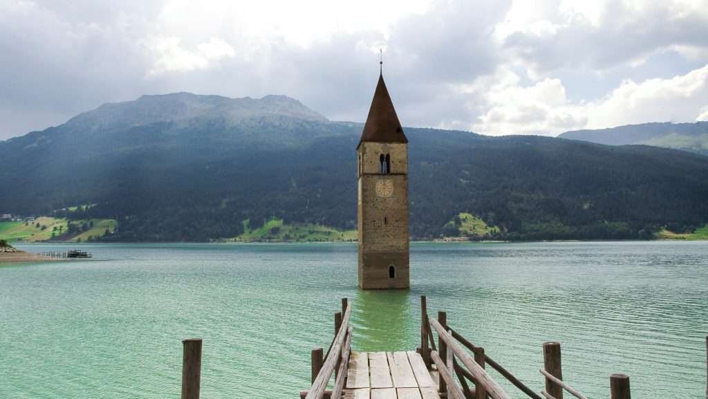
The Resia Pass funnels wind between Austria and Italy, and the lake makes the most of it. In summer it’s one of the best-known spots in the Alps for kitesurfing, windsurfing and sailing: the wind usually builds during the day, so the water is calmer early in the morning.
- Kitesurfing and windsurfing: if you’re a beginner, take lessons with a local school: the wind can be strong and the water is cold.
- Sailing and SUP: there’s a sailing club on the lake; SUP is best in the morning.
- Fishing: whitefish, trout, perch and pike. You need a permit: ask locally where to get one.
- Swimming: some people swim in high summer, but the water stays cold even in August and the lake bed changes with the reservoir level.
Lake Resia in winter

In winter the lake freezes and the landscape changes completely: the bell tower rises out of a white plain. The ice season usually runs from January to February, depending on how cold the winter is.
Walking on the frozen lake
Lake Resia is a hydroelectric reservoir: the water level can drop in winter too, because the water is used to generate power. Gaps can form under the ice, and it can give way even when it looks thick. So:
- only go on the ice in the areas and on the days marked locally, and follow all signs and bans;
- ask the Curon tourist office about ice conditions before leaving the shore;
- never walk alone to the bell tower or to the middle of the lake, and keep away from the dam and the inflows;
- early and late in the season, with thin or wet ice, stay on the shore: the lake loop on foot (15 km, about 4 hours) is open in winter too.
Snowkiting, skating and ice swimming
When the lake is frozen and snow-covered, the snowkiters arrive: the pass wind blows in winter too, and competitions are held on the lake. Skating is on natural ice, when conditions allow. In Resia and Curon there are entry points on the shore for ice swimmers: only if you’re experienced, and never alone.
Skiing near Lake Resia

Two gondolas start from the shore: Schöneben above Resia, with its valley station on the west shore, and Haideralm above San Valentino. Together they form the Schöneben-Haideralm ski area: medium-sized, mostly easy and intermediate runs, with lake views. It suits families and anyone who wants to ski without queues. Lift pass prices and dates for the 2026/27 season are on the lift company’s website.
- Other ski areas nearby: Watles above Malles (small, family-friendly), Solda below the Ortler (about 47 km, higher and more challenging) and, across the border, Nauders (about 11 km).
- Cross-country and snowshoeing: trails in the Vallelunga and on the plateau between Resia and San Valentino.
- A big resort: for a day in a large ski area, head to Livigno (about 70 km, via Switzerland).
When to visit Lake Resia
- June and July: green meadows, huts open, good kite wind. July is busy at weekends.
- August: the busiest month at the bell tower. Arrive early.
- September and October: the best time for the lake loop and photos, with golden larches in October. Many places close at the end of October.
- December to March: snow, skiing at Schöneben-Haideralm, lake usually frozen from January.
- April, May and November: shoulder season. The reservoir can be low and the landscape less green: fine if you want peace and quiet.
Day trips from Lake Resia
- Malles and Glorenza (about 17 and 19 km): Malles with its church towers and, above Burgusio, the Benedictine abbey of Marienberg; Glorenza, a tiny town still enclosed by its walls.
- Val Müstair (Switzerland, about 27 km): the Convent of St John in Müstair, a UNESCO World Heritage Site.
- Nauders (Austria, about 11 km): the village just over the border, with its fortress.
- Stelvio Pass (about 48 km): Italy’s highest road pass, open in summer only.
- Bormio (about 63 km): over the Stelvio in summer, with thermal baths and an old town.
- Merano (about 74 km): the spa town at the bottom of the Val Venosta, with promenades and the Trauttmansdorff Castle gardens.
- Val d’Ultimo (about 97 km): a quiet side valley above Merano, off the tourist track.
Where to stay at Lake Resia

The three lakeside villages have hotels, guesthouses and holiday apartments. They’re less than 10 km apart and linked by the cycle path and the bus, so choose by what you want to do.
- Curon: the centre, next to the bell tower and the pier. For one or two nights with the lake on your doorstep.
- Resia (about 4 km from the bell tower): close to the pass and the Schöneben gondola. For skiers, kiters and anyone arriving from Austria.
- San Valentino alla Muta (about 5 km): close to the Haideralm gondola and Lake Muta. For families and smaller budgets.
- Vallelunga: farms and apartments in a quiet side valley. For a week of walking or cross-country skiing.
- Malles and Glorenza (about 17–19 km): for train travellers and anyone exploring the whole upper Val Venosta.
For a family week, an apartment is more practical; for an overnight stop on a drive across the Alps, a hotel in Curon or Resia is enough.
How to get to Lake Resia
By car
From Italy, take the A22 motorway to Bolzano, then the expressway to Merano and the Val Venosta road (SS 38, then SS 40) to Malles and the Resia Pass: about 1 hour 45 minutes from Bolzano. From Innsbruck, drive to Landeck and up the Reschen road through Nauders: about 1 hour 40 minutes. From Zurich, go through the Lower Engadine (Scuol) and Nauders, or over the Ofen Pass and Val Müstair to Malles: about 3 hours 15 minutes. In summer you can also come over the Stelvio Pass from Bormio.
By train
The nearest station is Malles, the end of the Val Venosta railway from Merano. The line was closed for electrification until March 2026 and has been reopening in stages since, with some services replaced by buses. Check the current timetable on Südtirolmobil. Merano is reached from Bolzano by regional train.
By bus
From Malles, bus 273 climbs towards Resia and stops by the lake in Curon. South Tyrol’s integrated tickets are valid on both trains and buses. Check times on Südtirolmobil, especially in the evening and on public holidays.
By plane
The nearest airports are Bolzano (about 100 km) and Innsbruck (about 115 km). For international flights, Milan Bergamo (about 215 km, but slower roads), Zurich (about 240 km), Verona (about 250 km) and Munich (about 255 km) all work. Hiring a car is easiest: by public transport you’ll need several changes.
Parking
The main car park is paid, next to the bell tower in Curon, and it’s also the start of the lake loop. On busy days it fills up: use the car parks at the valley stations of the Schöneben (Resia) and Haideralm (San Valentino) gondolas, which are free or cheaper, and walk or cycle along the shore to the tower. With a campervan, ask the tourist office where overnight parking is allowed.
Frequently asked questions about Lake Resia
Where is Lake Resia?
In South Tyrol, northern Italy, at the top of the Val Venosta, in the municipality of Curon Venosta (Bolzano), below the Resia Pass and a few kilometres from Austria and Switzerland. It’s about 17 km from Malles, 74 km from Merano and 103 km from Bolzano.
What is the altitude of Lake Resia?
1,498 metres when the reservoir is full. The Resia Pass, just above, is at 1,507 metres.
Why is there a bell tower in Lake Resia?
It’s the tower of St Catherine’s church in the old village of Curon, drowned by the hydroelectric reservoir in summer 1950. The houses were blown up; the tower, a protected monument, was left standing.
Can you walk to the bell tower?
In summer you see it from the shore or the boat. In winter, with the lake frozen, people sometimes walk out to it, but only when the ice is safe and local signs allow it: ask the tourist office first.
How long is the walk around Lake Resia?
About 15 km and almost flat: about 4 hours on foot, an hour and a half by bike. It starts at the bell tower in Curon.
Can you walk on frozen Lake Resia?
Only in the areas and on the days marked locally. It’s a hydroelectric reservoir: the level can drop in winter and the ice can give way even if it looks thick. Always check first.
Which river starts at the Resia Pass?
The Adige. It rises near the pass, flows through the lake and runs down the Val Venosta to Merano, Bolzano and Verona.
Where do you park at Lake Resia?
At the paid car park next to the bell tower in Curon or, on busy days, at the Schöneben and Haideralm gondola valley stations, then on foot along the shore.
How do you get to Lake Resia without a car?
By train from Merano to Malles on the Val Venosta line, then bus 273 to the lake stop in Curon. Check times on Südtirolmobil: the railway was upgraded in 2026.
Is Lake Resia in Austria or Italy?
Italy. The lake is entirely in South Tyrol; the Austrian border runs about 2 km north of the top of the pass, just before Nauders.
Photos: Lago di Resia


