


 Français
 Deutsch
 Italiano
ACCOMMODATIONS AT THE FUSINE LAKES
Discover the best Hotels, B&Bs and Apartments in Mountain based on thousands of verified reviews.
Altitude924 m (Lower) · 929 m (Upper)
WhereTarvisio, Julian Alps · Friuli Venezia Giulia
From Tarvisioabout 11 km · 14 minutes by car
Lake loop5.4 km · about 2 h, easy
From Villachabout 38 km · 35 minutes
Nature parkprotected since 1971
Updated October 2026 · Sources: PromoTurismoFVG, italia.it, Wikipedia, Tarvisiano
Find a place to stay at the Fusine Lakes
The Fusine Lakes (Laghi di Fusine in Italian, Weißenfelser Seen in German, Belopeška jezera in Slovenian) are two glacial lakes in the Julian Alps, in the far north-east of Friuli Venezia Giulia, a few kilometres from the Slovenian border. They belong to the municipality of Tarvisio, above the village of Fusine in Valromana, at 924 m (Lower Lake) and 929 m (Upper Lake). From Tarvisio it is about 11 km on a paved road, 15 minutes by car.
People come for a simple reason: the water is an intense green-blue, spruce forest runs down to the shore, and above the lakes rises the wall of Mount Mangart (2,677 m). You do not need hours of hiking: the walk around both lakes is 5.4 km, about two hours, easy and almost flat. The area has been protected as a natural park since 1971.
For most visitors from abroad this is a day trip. The nearest airports are Trieste (about 145 km), Ljubljana (about 98 km) and Venice (about 231 km), and Villach in Austria is only 38 km away. Three practical things: parking is paid at certain times of year and the prices you find online contradict each other; in winter the road is paved and usually cleared, but carry chains or winter tyres; and in summer, arrive early.
What to see at the Fusine Lakes

Half a day is enough. The two lakes are close together, linked by a path and boardwalks through the forest. With little time, park at the Upper Lake and walk the loop slowly; with a full day, add the Zacchi hut or a trip to Tarvisio.
The Lower Lake
It is the bigger of the two: about 13.5 hectares and up to 25 m deep (figures from Wikipedia, to be double-checked), at 924 m. You reach it straight from the road, and the official walk around the lakes starts here. Near the shore there are two small ponds, half hidden by vegetation.
The Upper Lake
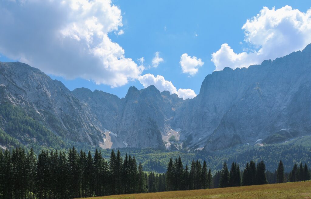
It sits five metres higher, at 929 m, and is smaller and shallower: about 9 hectares and 10 m deep. It has the biggest car park, at the end of the road, and the best view of the Mangart. The climb to the Zacchi hut starts here too. In autumn the yellow larches stand out among the spruces.
Mount Mangart above the lakes
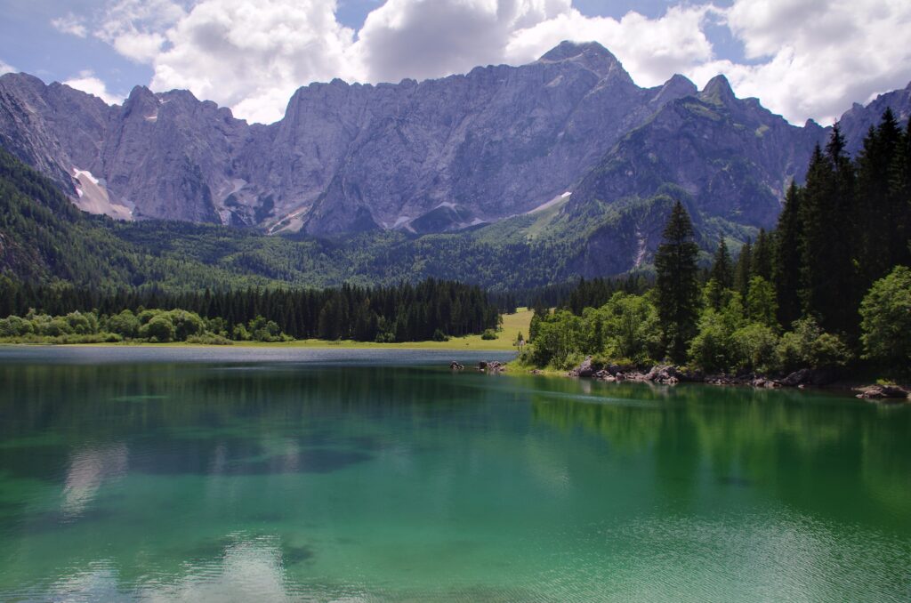
The lakes lie at the foot of the Mangart massif (2,677 m), in a limestone amphitheatre formed by the Picco di Mezzodì ridge. In autumn the valley floor can stay in shade for most of the day, while the rock walls catch the sun later. Climbing the Mangart is a different matter, with a map and proper preparation: here it is enough to look at it from the lake.
The Tarvisio forest and the nature park
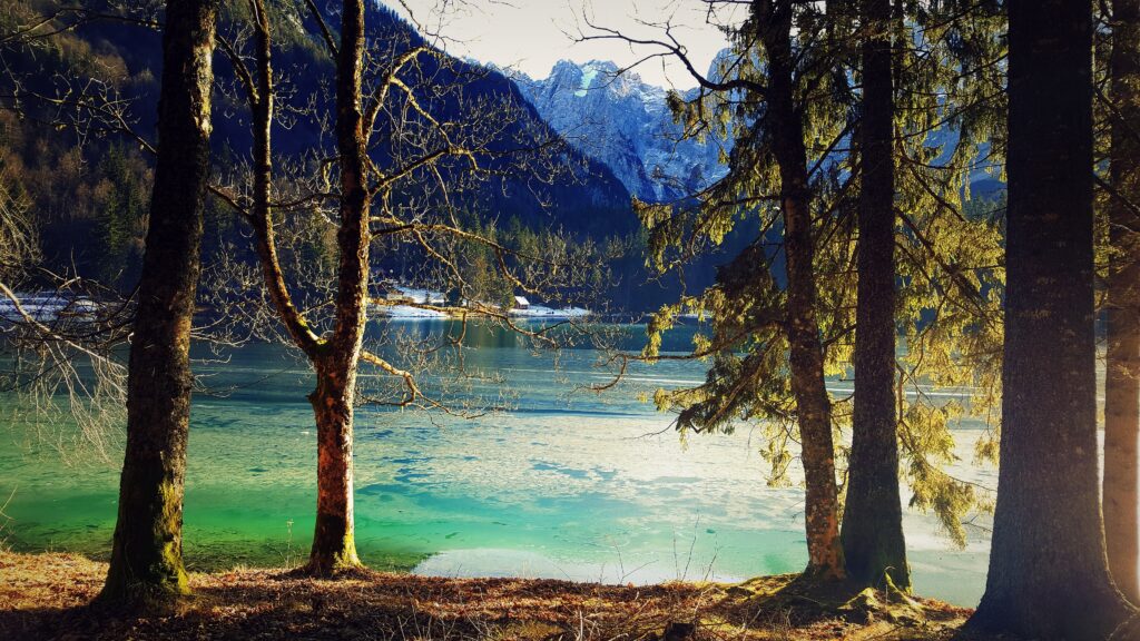
Around the lakes stretches the large Tarvisio forest: Norway spruce, silver fir, beech, larch, maple. Chamois, red deer and golden eagles live in the park, and the otter has come back on its own. They are shy animals, seen with luck and silence. The area has been a nature park since 1971. Stay on the paths and take your litter with you. For detailed rules (swimming, dogs, boats) read the signs at the entrance or ask the tourist office: we did not find a clear official source.
Fusine in Valromana and the church of San Leonardo
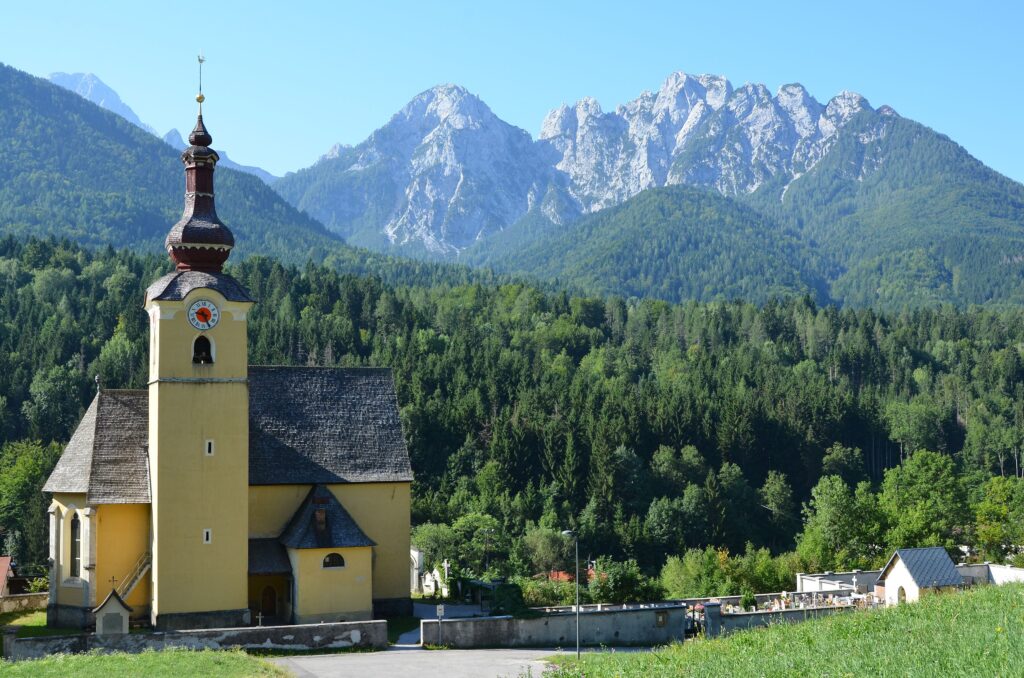
The village, at 773 m, is a hamlet of Tarvisio with fewer than 500 inhabitants, about 8 km east of the centre of Tarvisio. Its name comes from old ironworks. The parish church is dedicated to Saint Leonard, whose feast day is 6 November. The German name Weißenfels and the Slovenian Bela Peč both mean “white rock”: three cultures meet here, Italian, Slovenian and German.
The border with Slovenia
State road 54 climbs from Fusine to the border crossing. Beyond it the road drops to Rateče (about 8 km from the lakes) and continues to Kranjska Gora (about 14 km). With your passport or ID card you can have lunch or a walk on the other side within half an hour.
Walks and trails at the Fusine Lakes

The trails are few, well marked and of different levels. For the lake loop you need no mountain gear; for the hut, good shoes.
The lake loop
The regional tourism board’s official route is 5.4 km and takes about two hours. The ascent is 104 m up and 104 m down, between 878 and 980 m. It is rated T1, which means easy. The route is scenic, partly in forest, with boardwalks and erratic boulders left by the glacier. There are a few places to eat along the loop.
With little time or small children, walk just a section: between the two lakes the path is flat. Wear shoes with good soles even in summer: boardwalks and roots can be slippery after rain.
The Luigi Zacchi hut
This is the best-known walk above the lakes. Rifugio Zacchi stands at about 1,360 m, in an amphitheatre of rock walls under the Mangart. From the Upper Lake it is about 400 m of climbing in about an hour and a half. There are two ways: a wide, comfortable track that is longer, and shorter, steeper paths through the forest. A good idea is to go up the path and come down the track.
Opening depends on the season: some sources say summer and winter, others May to the end of September. Call or check before you climb, especially if you want to eat there. The lake loop plus the hut makes half a day, between 10 and 12 km.
Mountain biking and other routes
In the Tarvisio forest there are other paths of different levels. For cycling, ask the Tarvisio tourist office which sections are suitable and allowed in the park area. The Alpe Adria cycle route starts from Tarvisio and runs down towards Udine and Grado.
The lakes in winter

In winter the Fusine Lakes are quieter and much colder. The area is among the coldest in Friuli Venezia Giulia and the lakes freeze. Never walk on the ice: nobody checks its thickness.
The road to the lakes is paved and usually cleared after snowfall, but check conditions before leaving and keep chains in the car. With little snow, the real danger is ice in the forest, where the sun never reaches. That is why microspikes are more useful than snowshoes.
- Walk around the lakes: in winter the loop shortens to about 4 km with 34 m of ascent if you park near the restaurants by the shore. Allow about an hour and a half of easy walking, stops not included.
- Snowshoes: after heavy snowfall they are useful for the climb to the Zacchi hut (about 400 m, an hour and a half). Follow the track and do not damage the cross-country ski trail.
- Cross-country skiing: a ski track starts from the Upper Lake. Length and grooming are not confirmed: ask locally or at the tourist office.
- Eating: a few places near the lakes stay open in winter, but hours change.
If you want downhill skiing, it is not here but in Tarvisio: see the Tarvisio page, with the Monte Lussari ski area and the cross-country trails of the Tarvisiano.
When to go to the Fusine Lakes
- Summer: the busiest time. Arrive early or after 4 pm to find a space and see the lake without the crowd. Paid parking.
- Autumn: larches and leaves turn yellow and orange, and the light is lower. It is the photographers’ season. In early October one blog found the toll booth closed and a sign saying parking was free, while the hotel said to pay: ask.
- Winter: snow, ice and silence. Bring microspikes and chains.
- Spring: during the thaw paths can be wet, and the hut or restaurants may keep short hours: check before you climb.
Day trips from the Fusine Lakes
The lakes sit in a border area, with several destinations within an hour’s drive.
- Tarvisio (about 11 km): the town at 754 m, with the church of Saints Peter and Paul and the Monte Lussari ski area. Lussari has a gondola in summer and slopes in winter.
- Lake Predil and Cave del Predil: the region’s second natural lake after Lago dei Tre Comuni, near the Slovenian border. At Cave del Predil you can visit the former Raibl mine, closed in 1991, and its museum.
- Kranjska Gora (Slovenia): about 14 km, 17 minutes. A Slovenian winter sports resort just across the border.
- Villach (Austria): about 38 km, 35 minutes. The nearest Austrian city, in Carinthia.
- Udine: about 105 km, an hour and twenty. To combine mountains and a city.
Where to stay near the Fusine Lakes
There is no real village at the lakes: the choice is between Fusine in Valromana and Tarvisio. Fusine is quiet, a few minutes from the lakes, with few places to stay; Tarvisio has many more, plus services and restaurants.
- To stay close to the lakes: Fusine in Valromana or the road up to the car parks, where you find a few hotels and restaurants. Handy for an early start.
- For families: Tarvisio, with a wider choice of accommodation and services, 15 minutes by car from the lakes.
- For travellers by train: Tarvisio, close to Tarvisio Boscoverde station.
- For skiers in winter: Tarvisio and Camporosso, near the Lussari lifts.
- On a budget: Villach in Austria or Kranjska Gora in Slovenia, within half an hour.
In high season and on October weekends, book early: the area is small.
How to get to the Fusine Lakes
By car
The reference point is Tarvisio. From the A23 motorway take the Tarvisio Nord exit and follow state road 54 towards the Slovenian border. Just before the village of Fusine in Valromana, turn right onto the uphill road to the lakes: it is paved and leads to the car parks. Driving distances (calculated from the Upper Lake):
- Tarvisio: about 11 km, 14 minutes
- Villach: about 38 km, 35 minutes
- Klagenfurt: about 73 km, 54 minutes
- Ljubljana: about 98 km, an hour and twenty
- Udine: about 105 km, an hour and twenty
- Venice: about 231 km, two hours forty
- Salzburg: about 224 km, two hours forty
By train
The nearest station is Tarvisio Boscoverde, on the Udine–Tarvisio line. From there to the lakes there is no connection guaranteed all year: in summer a shuttle from Tarvisio may run, but operator and times are not confirmed. Ask the tourist office or look up times on the Tarvisiano website and on Trenitalia. Otherwise you need a taxi or a lift: about 11 km.
By bus
There are local buses between Udine and Tarvisio, but we found no official timetable for the ride up to the lakes. Plan the trip as far as Tarvisio and check the last stretch locally.
By plane
The most convenient airport is Trieste (about 145 km, an hour and three quarters). Other options are Ljubljana (about 98 km by road) and Venice (about 231 km); on the Austrian side there is Klagenfurt (about 73 km).
Parking
There are car parks along the road: the biggest is at the end, near the Upper Lake, with an area for campervans. The regional tourism board says parking is paid at certain times of the year. The prices you read online (4 or 5 euros for a car, 15 for a campervan) are not confirmed. Before the toll booth there are a few free spaces: from there it is about a kilometre on foot to the lakes. For the current period, hours and price, ask the Tarvisiano. For the route, see also the PromoTurismoFVG page on the lake loop.
Frequently asked questions about the Fusine Lakes
Where are the Fusine Lakes?
In the municipality of Tarvisio, province of Udine, in the Julian Alps, a few kilometres from the Slovenian border. They are about 11 km from Tarvisio, above Fusine in Valromana.
What is the altitude of the Fusine Lakes?
The Lower Lake is at 924 m, the Upper Lake at 929 m.
How long does it take to walk around the lakes?
The official loop is 5.4 km, about two hours, with 104 m of ascent. It is easy.
Do you have to pay for parking at the Fusine Lakes?
At certain times of year, yes. Online prices contradict each other and are not confirmed: ask the Tarvisio tourist office before you go.
How do I get from Tarvisio to the Fusine Lakes?
By car, about 11 km: state road 54 towards the border and, just before Fusine in Valromana, right to the lakes. A summer shuttle may exist, so check.
Can you swim in the Fusine Lakes?
We found no official rule. The water is cold and the area is a nature park: read the signs at the entrance.
Do the Fusine Lakes freeze in winter?
Yes, the area is among the coldest in the region and the lakes freeze. Do not walk on the ice.
Can you visit the Fusine Lakes in snow?
Usually yes: the road is paved and cleared. Carry chains and check conditions before leaving.
How long does it take to reach the Zacchi hut?
About an hour and a half from the Upper Lake, with about 400 m of ascent. Check that it is open.
When is the best time to visit the Fusine Lakes?
Autumn for colours, summer for walking, winter for silence. In summer avoid midday on busy days.
Photos from Wikimedia Commons: Naturpuur (CC BY-SA 4.0), Mauricio Fadel Argerich (CC BY-SA 4.0), Hubertl (CC BY-SA 4.0), Frerk Meyer from Buchholz in der Nordheide, Niedersachsen (CC BY-SA 2.0), Cecilia Famà (CC BY-SA 4.0), Johann Jaritz (CC BY-SA 3.0), Cecilia Famà (CC BY-SA 4.0), Cecilia Famà (CC BY-SA 4.0).


