


 Français
 Deutsch
 Italiano
HOUSING IN VAL SUSA
Discover the best Hotels, B&Bs and Apartments in the Mountains based on thousands of verified reviews.
Altitude383 m (Avigliana) to 3,538 m (Rocciamelone)
WherePiedmont, west of Turin · about 80 km to France
From TurinAvigliana 20 km · Susa 53 km · Bardonecchia 90 km
SlopesVia Lattea about 400 km · Bardonecchia 100 km
Day passBardonecchia from €40 (2026/27)
Ski seasonDecember – April
Updated October 2026 · Sources: Piedmont Region (Cottian Alps protected areas), Turismo Torino, Sacra di San Michele, Trenitalia, Bardonecchia Ski, italia.it
Find a place to stay in Val di Susa
The Susa Valley (Val di Susa) is the valley of the Dora Riparia river in Piedmont, north-west Italy. It starts on the edge of Turin and runs west for about 80 km to the border with France. Altitude ranges from 383 m at Avigliana, 20 km from Turin, to 3,538 m on Rocciamelone, the peak above the town of Susa. The valley has 37 municipalities and more than 90,000 inhabitants.
Think of it in two halves. The lower valley, from Avigliana to Susa, is about history: the Sacra di San Michele abbey, Susa’s Roman arch, Novalesa Abbey and the lakes of Avigliana. The upper valley, above Susa, is about the mountains: Oulx, Bardonecchia, Sauze d’Oulx, Cesana, Claviere and Sestriere, with around 500 km of slopes split between two ski areas.
Getting there is easy. Turin airport is the closest, the A32 motorway and the Turin–Modane railway run up the whole valley, and the TGV and Frecciarossa trains between Paris and Milan stop at Oulx. Susa is 53 km from Turin, Bardonecchia about 90 km. Come in winter to ski, in summer to hike, cycle the old military roads and visit forts and abbeys you won’t find in other Alpine valleys.
What to see in the Susa Valley
The most visited sights are in the lower valley, less than an hour from Turin. With only one day, combine the Sacra di San Michele and Susa: they are close and easy to link by car. Forts, parks and peaks of the upper valley are covered further down.
Sacra di San Michele
This abbey sits on top of Monte Pirchiriano, at 962 m, right at the mouth of the valley, above Sant’Ambrogio and Chiusa di San Michele. It was built between 983 and 987 and since 1994 has been the official symbol of Piedmont. Umberto Eco drew on its history for The Name of the Rose. From the top you look over the whole lower valley and the lakes of Avigliana.
You can drive up to the car park below the abbey, or walk from Sant’Ambrogio along the Stations of the Cross path, about an hour and a half. It is open all year, with different hours on weekdays and holidays: check the Sacra di San Michele website before you go.
Susa, the Roman town
Susa (503 m) gives the valley its name. In Roman times it was Segusium, capital of the kingdom of Cottius, who allied himself with Augustus. That pact is carved on the Arch of Augustus, built in 9–8 BC and still standing in the park above the old town. Nearby are remains of the Roman aqueduct and, a little outside the centre, the amphitheatre, rediscovered in the 1960s.
In the old town you’ll find Porta Savoia, one of the best-preserved Roman gates in Piedmont, San Giusto cathedral, founded as a Benedictine abbey in the early 11th century, and the Castle of Countess Adelaide, home to the town museum. The centre is small: half a day on foot is enough.
Novalesa Abbey
Above Susa, in the side valley of Val Cenischia, Novalesa Abbey was founded in 726 on the road up to the Mont Cenis pass. It is one of the oldest abbeys in the Western Alps. Its grounds hold four medieval chapels; the best known is Sant’Eldrado, with medieval frescoes. Visits are guided only, at fixed times that change between summer and winter: check before you drive up.
Avigliana
Avigliana is the first town you reach from Turin. The medieval centre is built around Piazza Conte Rosso, with the clock tower and Porta Ferronia. A short path climbs to the ruins of the castle, destroyed in the 17th century. The two lakes lie just south of town (see Nature). The station is on the Turin–Modane line: the easiest day trip without a car.
Sant’Antonio di Ranverso
Between Avigliana and Turin, at Buttigliera Alta, the preceptory of Sant’Antonio di Ranverso is one of the finest Gothic complexes in Piedmont, with 15th-century frescoes. Worth a half-hour stop on the way in or out.
Mont Cenis Pass
Mont Cenis (Moncenisio) is the pass above Susa: the SS25 road climbs from Susa to about 2,080 m and drops into Savoy towards Lanslebourg. Since 1947 the pass and its reservoir have been French territory. In summer it is a scenic road and the most direct way into France without the tunnel; in winter it may be closed by snow.
Colle delle Finestre

The Colle delle Finestre (2,176 m) links the Susa Valley with Val Chisone. From Meana di Susa the road climbs about 18.5 km and 1,700 m, and the last 8 km or so are gravel. The Giro d’Italia made it famous, most recently in 2025. It is open only in summer, once the snow is cleared. A classic for cyclists and motorcyclists: take it slowly.
Skiing in the Susa Valley

The upper valley has two separate ski areas with different lift passes. Decide where you want to ski first, then where to stay.
Via Lattea (Milky Way)
The Via Lattea is the bigger area: about 400 km of slopes between 1,350 and 2,800 m. It links Sestriere (2,035 m), Sauze d’Oulx (1,509 m), Sansicario, Cesana and Claviere, and crosses the border to Montgenèvre in France. Sauze has the Gran Pista, 9 km long. Intermediate runs dominate. Check 2026/27 lift pass prices on the Via Lattea website.
Bardonecchia
Bardonecchia has its own ski area, not part of the Via Lattea: 100 km of slopes and 23 lifts on two sides of the valley, Colomion–Melezet and Jafferau. For the 2026/27 season an adult day pass costs from €40 (early and late season deals) to €52 (Christmas period). Mostly easy and intermediate runs: good for families and beginners. Every snowboard event of the 2006 Winter Olympics was held here.
Cross-country and snowshoeing
For cross-country skiing, head to Claviere, with 15 km loops, or Pian del Colle in Bardonecchia. Bardonecchia also has marked snowshoe routes; elsewhere ask locally and always check the avalanche bulletin.
Towns of the Susa Valley
The towns that matter to visitors, from top to bottom.
Bardonecchia
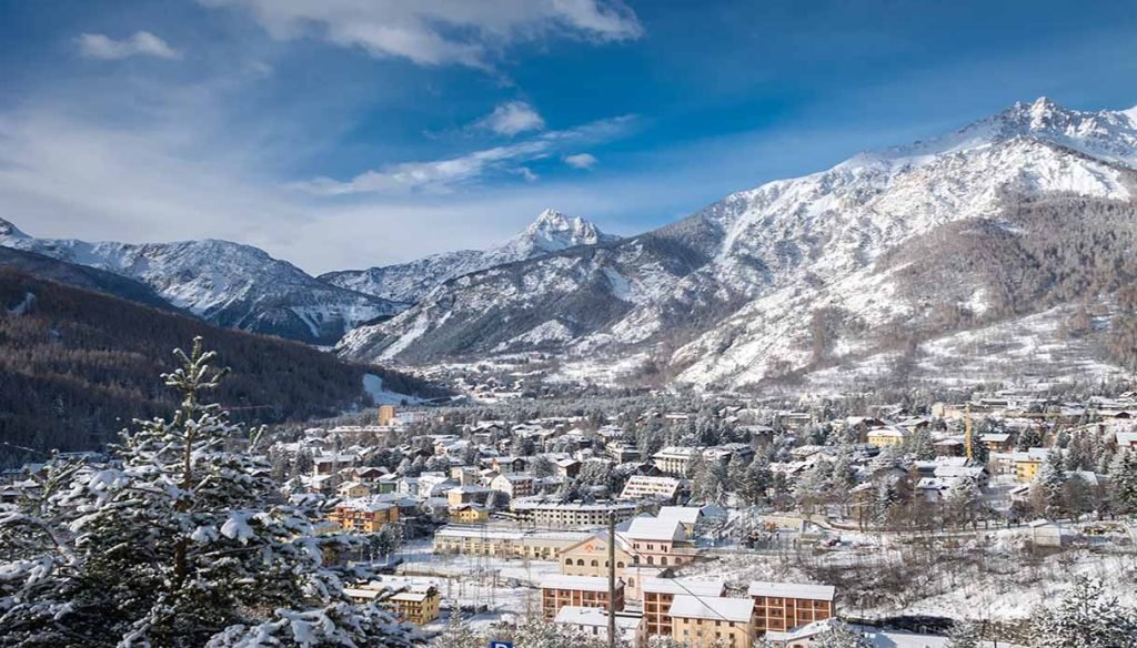
At 1,312 m, in a basin where four valleys meet, it is the last Italian town before the Fréjus tunnel. A real old town (Borgo Vecchio), a station with direct trains to Turin, its own ski area and plenty of summer hikes.
Oulx
Oulx (1,100 m) is the hub of the upper valley: the road splits here for Bardonecchia and Montgenèvre, and international trains stop here. Less touristy, but practical and cheaper.
Sauze d’Oulx
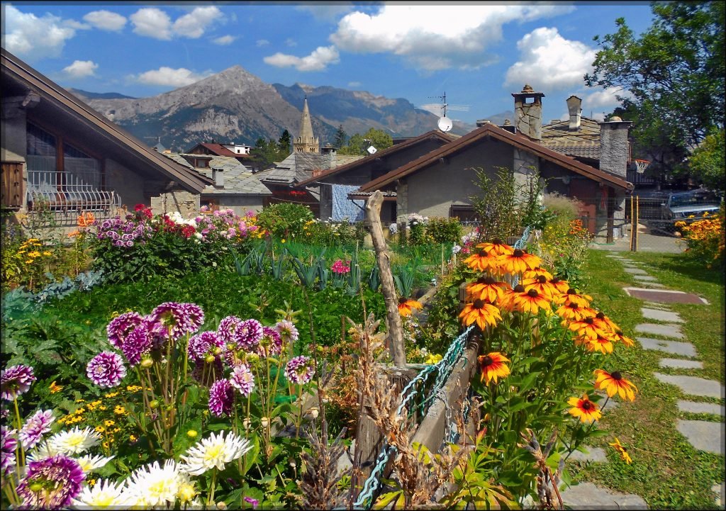
At 1,509 m above Oulx, this is the liveliest Via Lattea resort at night, with slopes starting in the village. Popular with groups of friends.
Sestriere
Sestriere (2,035 m) sits on the pass between the Susa Valley and Val Chisone. A purpose-built ski resort with the highest and most challenging slopes of the Via Lattea, and a golf course in summer.
Cesana, Claviere and Sansicario
Cesana (about 1,350 m) is a quiet village with access to the Via Lattea. Above it are Sansicario and Claviere (1,760 m), 2 km from Montgenèvre: you ski between Italy and France.
Exilles, Chiomonte and Salbertrand
The mid-valley villages between Susa and Oulx: Exilles fort and the Gran Bosco nature park at Salbertrand. Few tourists, a good stop on the way.
Susa, Novalesa and Avigliana
The cultural stops of the lower valley, described above. Susa and Avigliana are on the SFM3 line from Turin.
Forts and history
For two thousand years the valley has been a road to France: for the Romans, for pilgrims on the Via Francigena, for the armies of Savoy and the kings of France. Hence all the fortifications.
Exilles Fort

The fort controls the valley at 870 m, between Susa and Oulx. Its origins are unclear, but in 1339 it was already described as a “road castle” on the route to Montgenèvre. The French razed it in 1796 and the House of Savoy rebuilt it in 1818–1829: that is the fort you see today. It was also a prison, and tradition says the Man in the Iron Mask was held here from 1681 to 1687.
It opens in summer, with a ticket of a few euros and guided tours of the tunnels, dungeons and stables. Opening dates change every year: check with Turismo Torino.
Fenestrelle is not in the Susa Valley
Fenestrelle Fort, the “Great Wall” of Piedmont, is often listed among the Susa Valley forts, but it is in Val Chisone. From the Susa Valley you reach it in summer over the Colle delle Finestre, or all year round via Sestriere.
Chaberton and Brunetta
Above Claviere rises Mont Chaberton (3,131 m), topped by the battery Italy built before the First World War, then the highest fortress in Europe. It has been French since 1947, and entry into the structure is banned because of the risk of collapse. In Susa stood the Brunetta fort, an 18th-century fortress cut into the rock.
Fréjus railway tunnel
In 1871 the Fréjus railway tunnel opened at Bardonecchia, the first major tunnel through the Alps. It is still the line you ride from Turin to Modane.
Nature
The valley has three regional nature parks, run by the Cottian Alps protected areas authority, and one of the highest peaks in Piedmont.
Orsiera-Rocciavrè Nature Park

About 11,000 hectares between the Susa Valley, Val Chisone and Val Sangone. The highest point is Monte Orsiera (2,890 m). Chamois, ibex, marmots, deer and wolves live here. From Villar Focchiardo in the lower valley you can hike up to the Certosa di Montebenedetto, a 12th-century monastery in the forest at about 1,160 m.
Gran Bosco di Salbertrand
On the right side of the upper valley, between 1,000 and 2,600 m, this park protects a forest of silver fir and Norway spruce that is rare in the Western Alps. The park office is in Salbertrand, the start of easy loop trails.
Lakes of Avigliana

Lago Grande and Lago Piccolo are glacial lakes at the foot of the Sacra. Lago Grande covers more than 90 hectares and is open for swimming, with sailing clubs and a free beach. Lago Piccolo, higher up, is ringed by reeds and marshland: good for a walk and birdwatching.
Rocciamelone

Rocciamelone (3,538 m) is the mountain above Susa. On the summit there is a chapel and a bronze statue of the Virgin Mary from 1899. The normal route starts at La Riposa above Mompantero and passes the Ca’ d’Asti hut (2,854 m): about 1,500 m of ascent, for experienced hikers only. Many split it over two days with a night at the hut, which opens only in summer.
Mountain huts in the Susa Valley
Besides Ca’ d’Asti, the Orsiera-Rocciavrè park has the Selleries, Toesca and Amprimo huts, and above Bardonecchia there is Rifugio Scarfiotti. Almost all open in summer only: check dates before you set off.
Where to stay in the Susa Valley
The valley is long, so pick your base by what you want to do.
- Skiing the Via Lattea: Sestriere for the highest slopes and most reliable snow; Sauze d’Oulx for ski-from-the-door and nightlife; Claviere or Cesana for smaller, cheaper villages.
- Families: Bardonecchia. Easy slopes, a real town with shops, a free town bus and direct trains from Turin.
- Without a car: Bardonecchia or Oulx, both with a station. Oulx also has trains to Paris.
- Culture and hiking in the lower valley: Susa, handy for Novalesa, Mont Cenis, Rocciamelone and Exilles.
- A weekend near Turin: Avigliana, with the lakes and the Sacra minutes away.
- On a budget: Oulx and the mid-valley villages cost less than the ski resorts.
Ski resorts are mostly apartments and residences; the lower valley has farm stays, B&Bs and small hotels. Book early for Christmas, New Year and February.
How to get to the Susa Valley
By car
From Turin take the A32 Turin–Bardonecchia motorway, which runs up the whole valley. Main roads: the SS24 to Montgenèvre (Susa, Oulx, Cesana, Claviere), the SS25 to Mont Cenis and the SS335 to Bardonecchia. From France you come through the Fréjus road tunnel (Modane–Bardonecchia, about 13 km, toll: prices on the SITAF website), over the Montgenèvre pass from Briançon or, in summer, over Mont Cenis.
By train
The Turin–Modane line runs up the whole valley. SFM3 regional trains leave Turin Porta Nuova and split at Bussoleno: one branch goes to Susa (about 1 h 10), the other to Oulx and Bardonecchia (about 1 h 30). Timetables on the Trenitalia website. TGV and Frecciarossa trains from Paris and Lyon to Turin and Milan also stop at Oulx.
By bus
From Oulx, buses run to Bardonecchia and Modane, and French line ZOU! 76 goes to Montgenèvre and Briançon (a few runs a day, tickets online in advance). For Sauze d’Oulx, Sestriere and Cesana, check the seasonal bus timetables.
By plane
The nearest airport is Turin Caselle, 95 km from Bardonecchia. Milan, Lyon and Geneva are alternatives, with a hire car or transfer.
Parking
In the ski resorts the most convenient car parks are by the lift stations and fill up on peak-season weekends. The Sacra and Exilles Fort have parking near the entrance; in Susa, leave the car outside the old town.
Frequently asked questions about the Susa Valley
Where is the Susa Valley?
In Piedmont, west of Turin. It is the valley of the Dora Riparia, about 80 km long, from Avigliana to the French border.
What is there to see in Susa, Italy?
The Arch of Augustus, Porta Savoia, the Roman amphitheatre and San Giusto cathedral. Nearby: Novalesa Abbey and the Sacra di San Michele.
Which pass overlooks Susa?
Mont Cenis (Moncenisio), about 2,080 m, reached from Susa on the SS25. It has been in France since 1947.
Is Bardonecchia part of the Via Lattea?
No. Bardonecchia has its own ski area and lift pass (100 km). The Via Lattea covers Sestriere, Sauze d’Oulx, Sansicario, Cesana, Claviere and Montgenèvre.
What can I see in the Susa Valley in one day?
The Sacra di San Michele in the morning, Susa and the Arch of Augustus in the afternoon. If there’s time, the lakes of Avigliana.
Is Fenestrelle Fort in the Susa Valley?
No, it is in Val Chisone. The Susa Valley has Exilles Fort.
Can I get to the Susa Valley by train?
Yes. SFM3 regional trains run from Turin to Susa and Bardonecchia, and TGV and Frecciarossa trains between Paris and Milan stop at Oulx.
How far is the Susa Valley from Turin airport?
Turin Caselle is the closest airport; Bardonecchia, at the top of the valley, is 95 km away.
How far is the Susa Valley from Turin?
Avigliana is 20 km away, Susa 53 km, Bardonecchia about 90 km.
Weather in Val di Susa
Photos of Val di Susa


