


 Français
 Deutsch
 Italiano
ACCOMMODATIONS IN THE DOLOMITES
Discover the best Hotels, B&Bs and Apartments in the Mountains based on thousands of verified reviews.
Altitude1,923 m
WhereCortina d'Ampezzo, Veneto (Italy)
TrailheadPasso Tre Croci, 10 km from Cortina
Trail 21510.5 km return · 4 h · exposed sections
Bus summer 2026line 51, 8/6–9/9, 23 min from Cortina
Rifugio Vandelli1,926 m · usually late June – late Sept.
Updated October 2026 · Sources: Cortina Marketing, CAI Venice, Dolomiti Bus, Cortina d'Ampezzo council
Find a place to stay near Lake Sorapis
Lake Sorapis (Lago di Sorapis or Sorapiss in Italian) is a small mountain lake at 1,923 metres on the north side of the Sorapiss group, in the municipality of Cortina d’Ampezzo (province of Belluno, Veneto). No road goes there: you can only reach it on foot, usually from Passo Tre Croci (about 1,805 m), 10 km from Cortina, on CAI trail 215. The round trip is about 10.5 km and 4 hours of walking, including an exposed ledge fitted with steel cables and metal ladders.
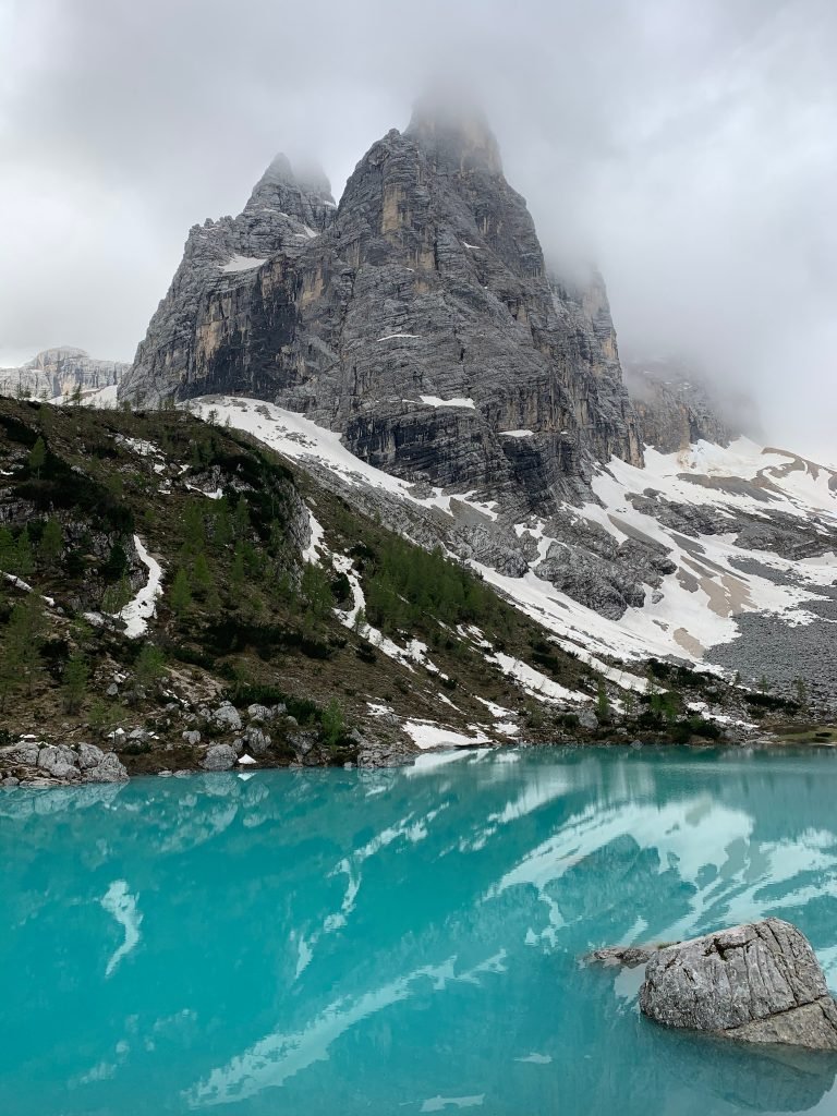
The lake is famous for its milky blue-to-turquoise water and for the Dito di Dio (“God’s Finger”), a 2,603-metre spire rising right above the shore. Next to the lake stands Rifugio Vandelli (1,926 m), run by the Venice section of the Italian Alpine Club (CAI). Venice Marco Polo airport is about 160 km from the trailhead.
Three things to know before you go. The trail is graded for experienced hikers (EE on the Italian scale): nothing technical, but there are exposed sections where you need to concentrate. In high summer you share it with thousands of people: in 2026 the local press reported around 3,000 visitors a day at peak times. And swimming is banned. Below you’ll find the route section by section, bus times, parking, the rules, the lake in winter and where to stay.
In this guide
What to see at Lake Sorapis

Everything is packed into a bowl ringed by rock walls: the lake, the hut and the spires above. Allow at least an hour at the lake, on top of the 4 hours of walking.
The lake and its colour
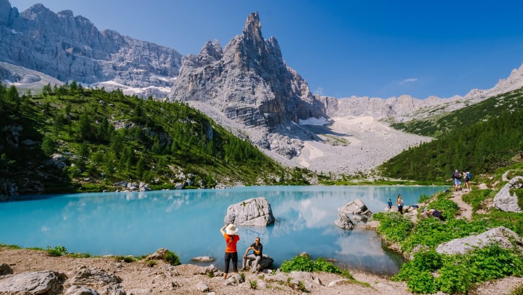
The lake is narrow and long, tucked between scree slopes and the walls of the Sorapiss. Its blue-to-turquoise colour comes from very fine rock flour that the glacier washes into the water as it melts in spring and summer. The more sun, the brighter the colour: the best photos come when the lake is in full light, from late morning on. By late summer the water level can drop and expose the shoreline.
The Dito di Dio
The spire in every photo, above the south shore, is the Dito di Dio (2,603 m). Behind it rises Punta Sorapiss, the highest summit of the group at 3,205 metres. From the north shore the Dito di Dio is reflected in the water: that’s the classic shot.
The view from above
Many people search for the Lake Sorapis “viewpoint”: it’s the view from a few metres up on the rises around the bowl. Stay on existing paths and keep away from rock edges: the ground is loose scree and it’s crowded in summer.
The “el Piss” waterfall
The lake has no surface outflow: the water drains underground and reappears lower down as a waterfall called “el Piss”. That’s where the name comes from: “Sora el Piss”, “above the waterfall”, became Sorapiss.
Rifugio Vandelli
Rifugio Alfonso Vandelli sits at 1,926 metres, a few minutes from the lake, in the cirque below the Sorapiss. It belongs to CAI Venice, has 34 beds plus 6 in the winter room, and is usually open from late June to late September. You can eat or stay the night; book overnight stays directly with the hut keeper. In July 2026, during the drought, its springs ran dry and for a while there were no toilets or water for refilling bottles: carry all the water you need.
The views along the trail
Trail 215 traverses the north flank of the Sorapiss. From the forest and clearings you see Cristallo, Piz Popena, the Cadini di Misurina and, to the east, the Tre Cime di Lavaredo. They’re not around the lake, as many sites say: you see them on the way.
The Sorapiss group
The Sorapiss is one of the big Dolomite groups around Cortina, between Passo Tre Croci and San Vito di Cadore. Above the lake there are scree slopes, small remnant glaciers and walls hundreds of metres high. Routes beyond the hut are via ferratas and mountaineering paths: terrain for climbers, not hikers.
Trail 215 from Passo Tre Croci
This is the standard approach, numbered 215 and waymarked red and white by the CAI. Figures from Cortina’s official tourism site: 10.5 km round trip, about 430 metres of ascent adding up all the ups and downs, 4 hours in total, graded “for experts”. The net height difference between the pass and the lake is only just over 100 metres: the effort comes from the constant up and down. The CAI gives 1 hour 30 one way; with crowds and stops, allow 2 hours.
First section: the forest
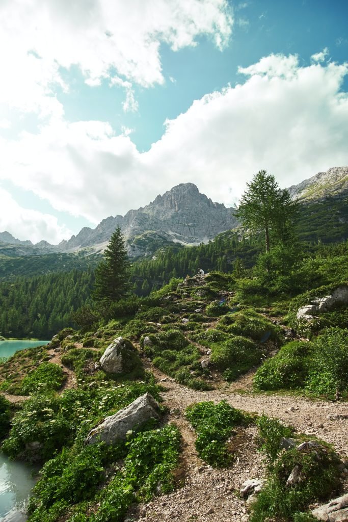
From the pass the trail starts almost flat on a wide track through the forest. This first part is easy, with early views of Cristallo and towards Misurina.
The exposed section: cabled ledge and ladders
After the forest the trail crosses scree and gets harder. There are a few metal ladders over small rock steps and a ledge a few hundred metres long protected by a steel cable, with a drop below. The path is wide enough to walk steadily, but in summer you meet people coming down and have to stop and wait.
- A via ferrata kit isn’t needed if you’re sure-footed. If you suffer from vertigo, a harness and lanyards help; otherwise, it’s better to turn back.
- Keep a hand on the cable on exposed stretches and let slower walkers pass.
- In rain, snow or ice the ledge becomes dangerous: if the weather turns, head back.
- Children: only if they’re used to mountain trails, held by the hand on the uphill side. Not suitable with toddlers in a carrier.
Last section: the hut and the lake
After the ledge the trail comes out into the bowl. You reach Rifugio Vandelli and drop to the lake in a few minutes. Return the same way: that’s also the advice of Cortina’s tourist office.
What to bring
- Hiking boots with a good tread: no smooth trainers.
- At least 1.5 litres of water each, even when the hut is open.
- Rain jacket and a warm layer: afternoon thunderstorms are common in summer.
- Head torch if you start at dawn.
- Hiking map or GPS track on your phone, fully charged.
Other trails to Lake Sorapis
For a first visit we recommend only trail 215. There are alternatives, but they’re quieter for good reason.
Trail 217 from Federavecchia–Valbona
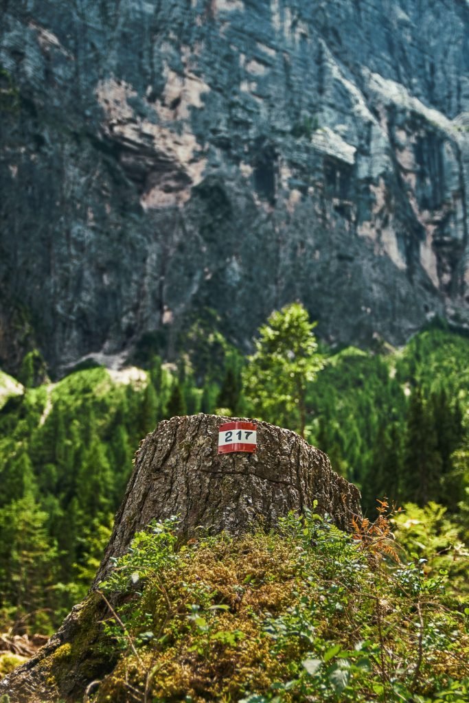
It starts on the road between Passo Tre Croci and Misurina, at Federavecchia in the Valbona forest. CAI Venice gives 1 hour 30 to the hut. Fewer people, but less information: ask at the hut or the tourist office about conditions.
The Forcella Marcuoira loop
From the lake you can climb to Forcella Marcuoira and descend into Valbona. The CAI describes it as about 6 hours, about 12 km and about 800 metres of ascent, topping out at 2,306 metres. Long, steep, with tricky descents on scree: experienced hikers only, in settled weather.
Via ferratas and the Sorapiss circuit
The hut is the base for the Sorapiss via ferratas (Vandelli, Berti) and the two-day circuit of the group. These are long mountaineering routes in remote terrain. If they appeal, hire a mountain guide in Cortina.
When to visit Lake Sorapis (and avoid the crowds)
- June: the trail is usually passable, but there may still be snow on the ledge. Check before you go. The hut usually opens towards the end of the month.
- July and August: peak season, hut open, bus 51 running. On the busiest days around 3,000 people walk up: be at the pass before 7am or start after 2pm.
- September: fewer people, often settled weather. Our pick. The hut usually closes around the 20th; in 2026 bus 51 ran until 9 September.
- October: golden larches, very few people, short days. After the first snow the ledge can be icy: if so, don’t go.
- November to May: snow and ice. See the winter section.
To avoid the crowds, skip August weekends and the week around 15 August (Ferragosto, Italy’s main summer holiday), go on a weekday and start early. In the afternoon the ledge is busy in both directions: expect to wait.
Rules at Lake Sorapis
The lake is not inside the Ampezzo Dolomites Nature Park, despite what many sites say: the land belongs to the Regole d’Ampezzo, Cortina’s historic community of landowners, and local bodies are considering extending the park to include it. Meanwhile, these are the rules:
- No swimming: a Cortina council ordinance has banned it since 2019. The ban also covers paddleboards, lilos and inflatable boats. Police patrol, including up in the mountains.
- No tents: camping on the shore isn’t allowed. If you want to sleep up there, book the hut.
- Litter: carry everything back down.
- Stay on the trails: the shores and scree around the lake suffer from thousands of feet.
Lake Sorapis in winter
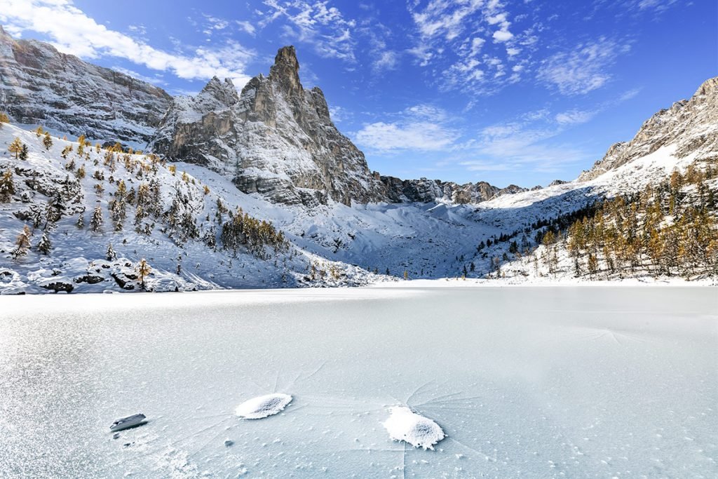
In winter the lake freezes and disappears under snow, below the white walls of the Sorapiss. The photos are stunning, but the trip is nothing like the summer hike.
- Trail 215 is dangerous in winter: the ledge and ladders are covered in snow and ice, and the trail crosses steep slopes prone to avalanches. On snowshoes, only the first section on the wide forest track is suitable.
- The hut is closed: only the 6-bed winter room is open, with no services.
- Days are short, and coming back along the ledge at dusk adds risk.
- CAI Venice lists trail 217 from Federavecchia as the winter access: still only for people with winter mountain experience, avalanche gear (transceiver, shovel, probe) and the skills to read the avalanche bulletin.
Our advice: without winter mountaineering experience, don’t go to Lake Sorapis between December and April, or go with a mountain guide. Always check the ARPAV Veneto avalanche bulletin. For an easy snowshoe outing with a frozen lake, Lake Misurina is a few kilometres away and reachable by car.
Day trips from Lake Sorapis
- Cortina d’Ampezzo (10 km from Passo Tre Croci): the main town, with buses, outdoor shops and mountain guides.
- Lake Misurina (12 minutes by bus from the pass): the lake facing the Tre Cime, easy, with a shoreline walk.
- Tre Cime di Lavaredo: from Misurina the Dolomiti Bus shuttle goes up to Rifugio Auronzo, start of the Tre Cime loop.
- Auronzo di Cadore: down from Misurina through the Ansiei valley, on the east side of the area.
- San Vito di Cadore (12 km south of Cortina): at the foot of the south side of the Sorapiss and Antelao.
- Passo Giau (2,236 m, 16 km from Cortina): one of the most scenic Dolomite passes, facing Nuvolau and the Cinque Torri.
- Lake Braies: the area’s other famous lake, in South Tyrol, via Dobbiaco.
Where to stay near Lake Sorapis
At the lake there’s only Rifugio Vandelli. Everything else is along the road between Cortina and Misurina. Pick your base by how you want to reach the trailhead.
- Cortina d’Ampezzo: the most convenient base, with the widest choice of hotels, apartments and B&Bs. In summer bus 51 leaves Cortina Scuole and drops you at Passo Tre Croci in 23 minutes. Best if you’re travelling without a car or combining Sorapis with other hikes.
- Passo Tre Croci and Rio Gere: the few places along the road are closest to the trailhead. Best for starting at dawn, ahead of the crowds.
- Misurina: hotels on the lake, 12 minutes by bus from the pass. Best if you also want to hike the Tre Cime.
- Auronzo di Cadore and San Vito di Cadore: often cheaper than Cortina, family apartments. Best for a week’s stay with a car.
- Rifugio Vandelli: 34 beds, book with the hut keeper. Sleep up there and you’ll have the lake almost to yourself in the evening and early morning.
Cortina fills up in July and August: book well ahead.
How to get to Lake Sorapis
You get to Passo Tre Croci by car or bus, then continue on foot. The pass is on regional road 48 between Cortina and Misurina.
By car
From Venice take the A27 to the end of the motorway, then the SS51 Alemagna road via Pieve di Cadore to Cortina. From Cortina follow signs for Misurina and Auronzo: Passo Tre Croci is about 10 km on. From Venice it’s about 160 km to the pass. From Austria and Germany, come over the Brenner into the Pusteria valley, then from Dobbiaco down the Landro valley towards Cortina or Misurina.
By train
Cortina has no station. The nearest are Calalzo-Pieve di Cadore-Cortina (line to Belluno, Padua and Venice) and Dobbiaco (Pusteria valley). From Calalzo, the Cortina Link service (train plus Dolomiti Bus) takes you to Cortina Scuole in about an hour: the same stop where bus 51 leaves for the pass.
By bus
In summer Dolomiti Bus line 51 links Cortina, Passo Tre Croci and Misurina. In 2026 it ran daily from 8 June to 9 September:
- From Cortina Scuole at 8:00, 9:00, 10:00, 11:00, 12:00, 14:00, 15:00, 16:00 and 17:00; it reaches Passo Tre Croci 23 minutes later.
- From Passo Tre Croci to Cortina at 9:32, 10:32, 11:32, 13:32, 14:32, 15:32, 16:32, 17:32 and 18:32. The last bus is at 18:32: don’t miss it.
- From Misurina the bus takes 12 minutes to the pass.
Summer 2027 timetables come out in spring: check the Dolomiti Bus website. From Venice, Mestre and the airport, Cortina Express coaches run to Cortina.
By plane
The handiest airports are Venice Marco Polo (about 160 km from the pass) and Treviso. From Venice there are direct coaches to Cortina, then bus 51. Innsbruck and Munich also work, but you’ll need a hire car or several changes.
Parking
At Passo Tre Croci and along the road there are few spaces, and in summer they fill early in the morning. Arrive before 7am or take the bus. Only park in marked spaces: cars on the verges block the road, and there are checks. Charges change: check on site. Another option is the parking at Rio Gere, just below the pass on the Cortina side, which is also a bus 51 stop.
Frequently asked questions about Lake Sorapis
Where is Lake Sorapis?
In the Veneto Dolomites, in the municipality of Cortina d’Ampezzo (province of Belluno), on the north side of the Sorapiss group. The hike starts at Passo Tre Croci, 10 km from Cortina on the road to Misurina.
How high is Lake Sorapis?
1,923 metres. Rifugio Vandelli next to it is at 1,926 metres, Passo Tre Croci at about 1,805 metres.
How long is the Lake Sorapis hike?
From Passo Tre Croci on trail 215: about 1 hour 30 to 2 hours each way, 4 hours round trip, about 10.5 km in total.
Is the Lake Sorapis hike difficult?
It’s graded for experienced hikers. No climbing, but there’s an exposed ledge with steel cables and a few metal ladders. You need to be sure-footed and comfortable with heights. In snow, ice or rain it becomes dangerous.
Can you swim in Lake Sorapis?
No. Swimming has been banned by a Cortina council ordinance since 2019, and the ban covers paddleboards and inflatables too.
Can you do Lake Sorapis with kids?
Only with children used to mountain trails and not afraid of heights, held by the hand on exposed sections. With young children, choose Lake Misurina instead.
Can you bring a dog to Lake Sorapis?
We found no specific ban, but the metal ladders and the ledge are hard for many dogs. Keep it on a lead at all times: the trail is narrow and busy.
Can you get to Lake Sorapis by bus?
Yes, in summer. Dolomiti Bus line 51 (Cortina – Passo Tre Croci – Misurina) stops at the pass; in 2026 it ran from 8 June to 9 September, with the last return from the pass at 18:32.
Do you need to book to visit Lake Sorapis?
No, the trail is free and open. Only overnight stays at Rifugio Vandelli need booking. Parking at the pass can’t be reserved and is limited.
Can you visit Lake Sorapis in winter?
Not recommended without winter mountain experience: trail 215 has exposed sections and avalanche-prone slopes, and the hut is closed. If you do go, go with a mountain guide and check the avalanche bulletin first.
Photos: Lago di Sorapis


