


 Français
 Deutsch
 Italiano
ACCOMMODATIONS IN SAPPADA
Discover the best Hotels, B&Bs and Apartments in Mountain based on thousands of verified reviews.
Altitude1,245 m (Cima Sappada 1,290 m)
WhereUpper Piave valley, province of Udine, Friuli Venezia Giulia (since 2017)
DistancesCortina 58 km · Trieste airport 133 km · Venice airport 154 km
Skiingabout 15 km of slopes, 1,245–2,024 m · cross-country about 15 km
Ski pass 2026/27adult day pass €55 (high season) · €38.50 (low)
Seasonssummer June–September · skiing December to March
Updated October 2026 · Sources: Normattiva (Law 182/2017), Consorzio Sappada Dolomiti, PromoTurismoFVG, Dolomiti Bus, Cortina Express, Wikipedia
Find a place to stay in Sappada
Sappada is a mountain village at 1,245 m above sea level in the province of Udine, in Friuli Venezia Giulia, north-east Italy. Until 2017 it belonged to the Veneto region (province of Belluno): it moved to Friuli under Law no. 182 of 5 December 2017, in force since 16 December 2017, after a 2008 referendum in which 95% of voters said yes. The village sits in the upper Piave valley, between the Carnic Alps and the Cadore, close to the Austrian border, and has about 1,300 inhabitants. In the local German dialect it is called Plodn.
Driving distances: about 20 km from Santo Stefano di Cadore, 23 km from Auronzo di Cadore, 34 km from Calalzo railway station, 58 km from Cortina and 94 km from Udine. The handiest airports are Trieste (about 133 km), Treviso (139 km) and Venice (154 km), each roughly a two-hour drive.
Why go? First, the village itself: 15 hamlets of wooden houses strung along about 5 km of valley, where people still speak a dialect of Tyrolean origin. Second, summer: the source of the Piave, the Olbe lakes, easy trails and proper peaks such as the Peralba. Third, a quiet winter: about 15 km of slopes, many of them easy, cross-country trails and a big snow play park in the centre. It is not a party resort; it suits families, hikers and cross-country skiers.
What to see in Sappada
The hamlets and Sappada Vecchia
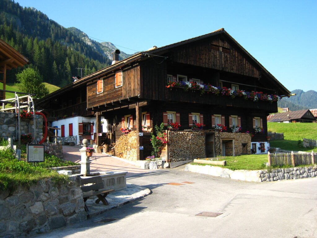
Sappada has no single centre. It is a row of 15 hamlets (“borgate”), one after the other along the road, from Lerpa (1,225 m) to Cima Sappada (1,290 m). The town hall is in Borgata Bach. Many hamlets still have German names: Kratten, Hoffe, Cottern, Mühlbach, Pill.
The upper part of the village, Sappada Vecchia, is listed among “I Borghi più belli d’Italia” (the most beautiful villages in Italy), and Sappada holds the Touring Club Italiano’s “Orange Flag”. Here you see the traditional log houses built in “Blockbau” style: horizontal beams interlocked at the corners and resting on a stone base, with the house on one side and the barn and hayloft on the other. The finest are often in the side lanes rather than on the main road.
Cima Sappada
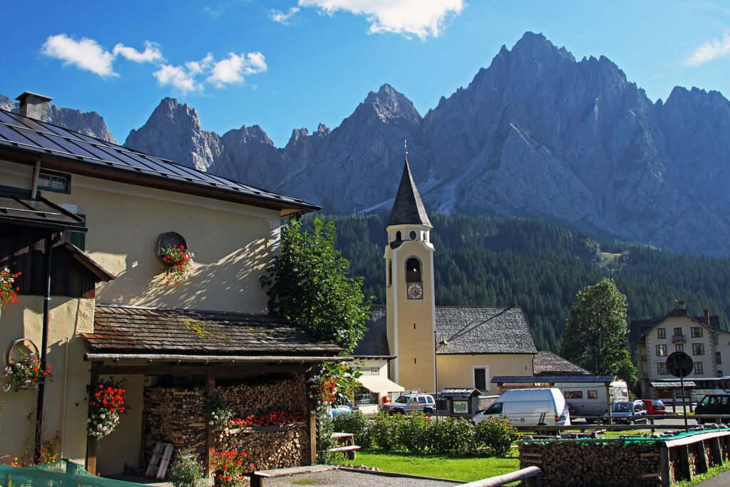
Cima Sappada is the highest and most secluded hamlet, a few kilometres from the town hall towards the Val Sesis. The wooden architecture is best preserved here, with Monte Siera rising behind the rooftops.
The church of Sant’Osvaldo
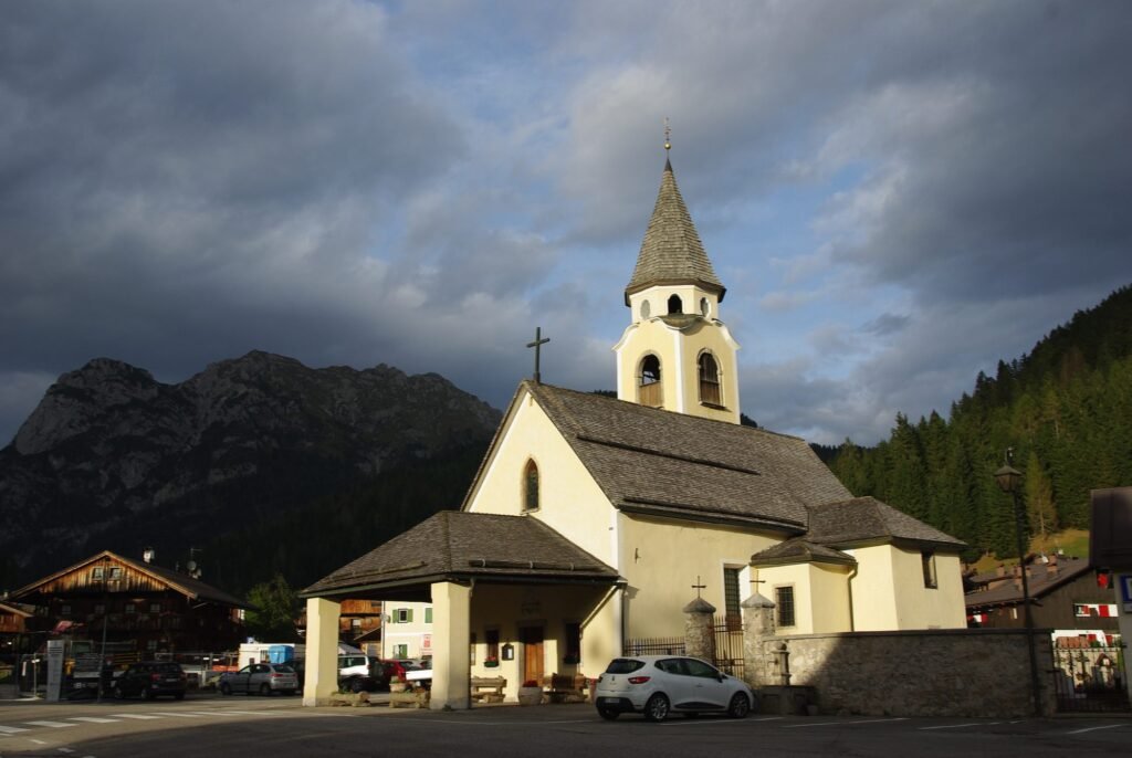
In the middle of Cima Sappada stands the church of Sant’Osvaldo, built in 1732 on the site of an older church and restored several times since. Opposite is the Giuseppe Fontana Ethnographic Museum. The road to the source of the Piave also starts in Cima Sappada.
The source of the Piave and the Val Sesis
The Piave, the river that reaches the Adriatic near Venice, rises above Sappada at about 1,800 m, at the foot of Monte Peralba (2,694 m), the highest peak in the municipality. From Cima Sappada an 8 km paved road climbs the Val Sesis; it is open to cars only in summer. In winter it is closed and the valley becomes snowshoe territory.
On foot, the Piave nature trail links Cima Sappada with the source in about 2 hours 30 minutes, with 520 m of ascent. Along the road there are four mountain huts: Piani del Cristo (1,410 m), Baita Rododendro, Sorgenti del Piave and Pier Fortunato Calvi (2,164 m). A few minutes off the road, the Casera Vecchia dairy farm makes cheese, ricotta and butter.
The Olbe lakes (Laghi d’Olbe)
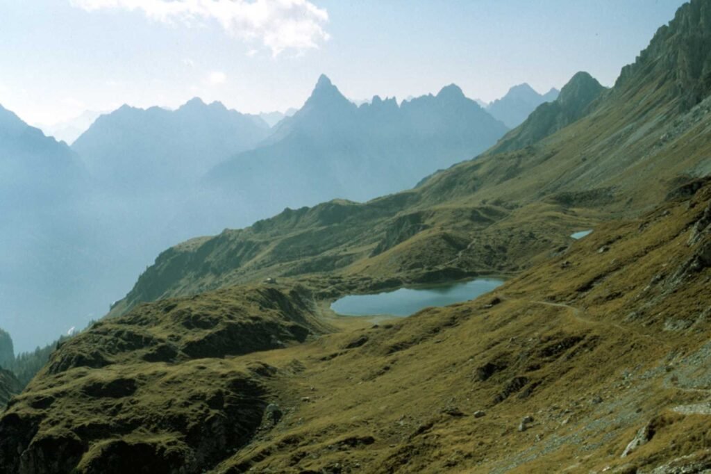
Three small lakes at about 2,150 m below Monte Lastroni, on the north side of the valley. This is Sappada’s most popular hike: clear water, meadows and views of the Peralba. Trail 315 starts in Borgata Mühlbach and climbs the Val d’Olbe: about 3 hours up, graded easy. From the Val Sesis, trail 138 from the Baita Rododendro takes about 2 hours.
There is no hut at the lakes, so bring water and a packed lunch. If you still have energy, Passo del Mulo is an hour further (trail 135), and the summit of Monte Lastroni (2,449 m) is also an hour away (trail 138), with First World War positions. Both are graded intermediate.
The Mühlbach waterfalls
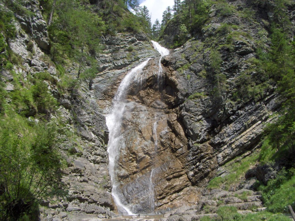
In the Mühlbach hamlet, the stream of the same name tumbles over the rocks in a series of small cascades and pools. It is a short walk, good with children, starting near the wooden bridge. Right next to it, in an old forge and a former municipal slaughterhouse, the small First World War Museum shows objects from both armies that fought on these ridges.
The Farmhouse Museum
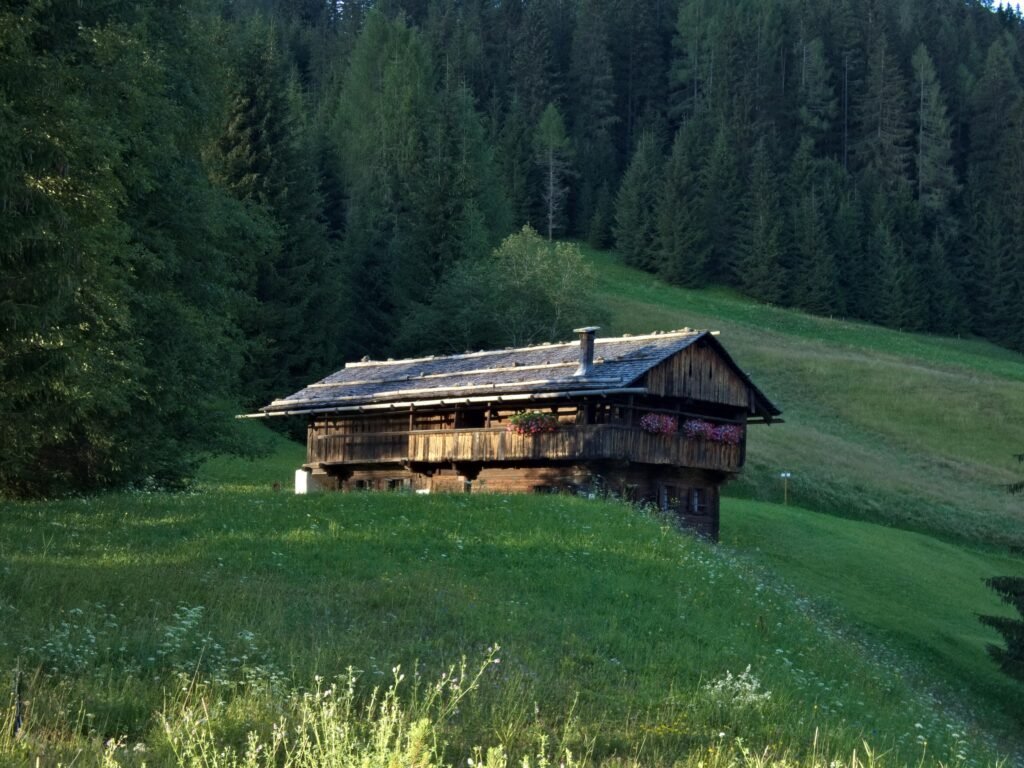
In Borgata Cretta, a 19th-century farmhouse with its barn and hayloft is furnished as it was, with a kitchen garden of mountain crops. You see the kitchen with its open hearth, where meat was smoked, the wood-panelled living room with its big stone stove, and the bedrooms upstairs. Open in summer, usually in the late afternoon.
The Giuseppe Fontana Ethnographic Museum
In Cima Sappada, opposite Sant’Osvaldo: the valley’s natural history, the story of the community and, above all, the carved wooden carnival masks, including the Rollate. Open in summer, in the late afternoon.
Plodn: language and origins
Sappada is a German-speaking linguistic island in Italy. The first settlers arrived around the year 1000 from Tyrol and Carinthia. Legend says they were families from Villgraten in East Tyrol; some scholars think they were colonists drawn by the valley’s iron mines. The dialect, Plodarisch, is close to Bavarian and Tyrolean dialects, and you still hear it in shops and at festivals. Everyone also speaks Italian.
The carnival and the Rollate
Sappada’s carnival, Plodar Vosenòcht, is one of the most distinctive in the Alps. It takes place on the Sundays before Lent (the Sunday of the Poor, of the Farmers and of the Lords), then on the Thursday, Monday and Tuesday before Ash Wednesday. The masks are wooden, carved in the village, and nobody ever shows their face. The symbol is the Rollate: tall, dressed in fur, with “rolln”, heavy and noisy iron balls tied around the waist, and a broom in hand. He leads the parades and protects the other masks.
Skiing in Sappada
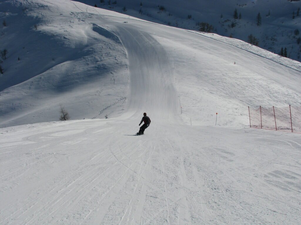
The Sappada ski area is run by PromoTurismoFVG, the regional company that also runs the other Friuli ski areas. The official figures: about 15 km of slopes between 1,245 and 2,024 m, 779 m of vertical, and snowmaking on every run. It is a resort for beginners, families and intermediates, not for skiers who want hundreds of kilometres of linked runs.
The ski sectors
- Campetti: wide nursery slopes in the village centre, with the Campetto 1 drag lift and the ski school, next to Nevelandia.
- Monte Siera and Pian dei Nidi: the main sector, on the south side. The Pian dei Nidi chairlift is the next step for beginners; from there you continue up to Monte Siera. Blue and red runs, including the long Monte Siera Turistica (about 2.5 km).
- Eiben Col dei Mughi: the “Pista Nera” (black run) in the village, served by a chairlift. Sappada’s steepest descent.
- Sappada 2000: the high, sunny sector on the north side, with the Miravalle and Hochbolt runs and the runs back down to the village. A shuttle bus links Pian dei Nidi with Sappada 2000.
Worth knowing: the region has funded a new gondola from the village (Kratten) to the Rifugio Sappada 2000, replacing the two current chairlifts. It is due to open in December 2027. During the works, operations in this sector may change, so check the live lift map on the official website before you travel.
Ski passes 2026/27
The day pass is valid in all ski areas run by PromoTurismoFVG. Prices for visitors not resident in Friuli Venezia Giulia, 2026/27 season:
- High season (19 December 2026 to 14 March 2027): adults €55, seniors (born 1952–1962) €48.50, juniors (born 2008–2019) and over-75s €18.
- Low season (start of season to 18 December, and from 15 March): adults €38.50, seniors €34, juniors €18.
- Children born 2020–2024: free, with ID.
- Sci@ore: 3, 4 or 5-hour passes, valid only at the resort where you buy them; €39 to €48.50 for adults in high season.
That is cheap by Alpine standards. Full prices are on the PromoTurismoFVG ski pass website. The opening date is not official yet: the lifts usually open in early December and close in March.
Cross-country skiing
Sappada is a cross-country village. The Cima Sappada loop, the cross-country stadium and the link between them add up to about 15 km, with a separate trail pass that costs far less than an alpine ski pass. The trails are linked to big names in Italian cross-country skiing such as Silvio Fauner and Pietro Piller Cottrer. Eleven kilometres away, at Piani di Luzza (Forni Avoltri), the Carnia Arena, the national federation’s training centre, has about 10 km of trails.
Snowshoeing, sledging and Nevelandia
In winter, many lanes between the hamlets and through the woods can be walked, snowshoed or sledged. The Val Sesis, closed to cars, is the finest winter walk. With children, head to Nevelandia, the snow play park in the centre: snow tubing, sledge and bob runs, ice rink, bouncy castles, igloos and a little train. Entry is free; you only pay for the activities you use.
Summer in Sappada
Walking times from the local tourist board, one way.
- Rifugio Monte Siera (1,606 m): 1 hour from the bottom of the Monte Siera chairlift, trail 321, easy. In summer 2026 the chairlift ran from 4 July to 6 September, 9am–5pm.
- Passo Siera (1,592 m): 1 hour 30 from Borgata Bach, trail 316. Short and classic, with one exposed section.
- Malga Tuglia (1,597 m): 2 hours from the chairlift, trail 320, through the woods and almost level.
- Olbe lakes: 3 hours from Borgata Mühlbach, trail 315, easy; then on to Passo del Mulo or Monte Lastroni.
- Source of the Piave and Rifugio Calvi: drive to the turn-off, then 1 hour and 350 m of ascent to Rifugio Calvi (2,164 m). From the Calvi, a trail climbs the Peralba, for experienced hikers only.
- Passo dell’Arco (1,907 m) and the Col dei Mughi loop: 2 hours 30 and 4 hours 30, intermediate with exposed sections.
- Monte Chiadin (2,287 m): 3 hours from Rifugio Piani del Cristo, trail 139, intermediate, on an old wartime path.
The Val Sesis huts open roughly from June to September. By bike you can ride up to the source of the Piave on the Val Sesis road or use the valley’s forest tracks. Carry an up-to-date map: above 2,000 m summer storms build quickly.
One tradition: since 1804, on the third weekend of September, the villagers walk on pilgrimage to the sanctuary of Maria Luggau in Austria, via the source of the Piave and Rifugio Calvi, about 9 hours on foot.
Food in Sappada
Mountain cooking with a Tyrolean accent: canederli (bread dumplings), smoked meats, alpine cheeses, butter and ricotta. In the old houses, meat was smoked over the open hearth. In summer you can buy cheese and ricotta straight from the dairy farms, such as Casera Vecchia in the Val Sesis.
Day trips from Sappada
- Forni Avoltri and Piani di Luzza (about 11 km): the neighbouring village in Carnia and its cross-country centre.
- Auronzo di Cadore (about 23 km): Lake Santa Caterina and the cycle path to Misurina.
- Lake Misurina (about 48 km): the lake below the Three Peaks, an easy day out.
- Tre Cime di Lavaredo: via Auronzo and Misurina, using the toll road up to Rifugio Auronzo.
- Sesto (about 41 km) and San Candido (about 48 km): the upper Puster valley, over the Monte Croce Comelico pass.
- Cortina d’Ampezzo (about 58 km): roughly an hour’s drive.
- Tarvisio (about 106 km): Friuli’s other big mountain resort, where Italy meets Austria and Slovenia.
- Lienz (about 90 km): the East Tyrolean town, via San Candido.
Where to stay in Sappada
The village is long, so choose your hamlet to match your plans.
- Central hamlets (Bach, Palù, Granvilla, Pill): best without a car, for families with young children and for skiing at the Campetti, Nevelandia and the Pista Nera. Shops, ski hire and bus stops nearby.
- Kratten, Mühlbach and Sappada Vecchia: wooden houses and peace and quiet, close to the trail to the Olbe lakes and to Sappada 2000.
- Cima Sappada: for cross-country skiers and Val Sesis hikers. The highest and quietest area, with the cross-country loop on the doorstep.
- Lerpa and the lower village: often a little cheaper, a few minutes’ drive from the lifts.
Expect mostly apartments and holiday homes, small family-run hotels, B&Bs, a few chalets and the Val Sesis huts for a night up high. Book early for Christmas, carnival and August.
How to get to Sappada
By car
From Venice: A27 motorway to the last exit, Pian di Vedoia, then towards Pieve di Cadore; before Auronzo turn off towards Santo Stefano di Cadore and climb to Sappada. Allow about 2 hours 15 minutes. From Trieste or Udine: A23 motorway towards Tarvisio, Carnia exit, then Tolmezzo and the Val Degano via Ovaro, Rigolato and Forni Avoltri; about 1 hour 40 minutes from Udine. From Austria: via Lienz and San Candido, then over the Monte Croce Comelico pass to Santo Stefano.
By train
Sappada has no station. The nearest is Calalzo–Pieve di Cadore–Cortina, about 34 km away, with trains from Venice and Padua; from there a direct bus reaches Sappada in under an hour. On the Friuli side, take the train to Carnia station on the Udine–Tarvisio line and continue by bus.
By bus
Dolomiti Bus links Calalzo station with Santo Stefano, Sappada and Cima Sappada (line 33). On the Friuli side, TPL FVG regional buses run from Udine and Tolmezzo. Cortina Express serves Sappada and Cima Sappada from Venice, Mestre and Treviso at certain times of year. Timetables change between summer and winter, so always check the operators’ websites.
By plane
The nearest airports are Trieste (about 133 km), Treviso (about 139 km) and Venice Marco Polo (about 154 km), each about two hours by car. Venice has the most international flights; a hire car is the simplest way on. Klagenfurt (about 174 km), Innsbruck (about 182 km) and Munich (about 306 km) are alternatives from the north.
Parking
In winter there is a car park at Eiben for Nevelandia, the Campetti and the Pista Nera. In summer the Val Sesis has spaces along the road and a large car park at the Baita Rododendro, the starting point for the Olbe lakes.
Frequently asked questions about Sappada
Where is Sappada?
In the upper Piave valley, province of Udine, Friuli Venezia Giulia, on the border with the Cadore (Veneto) and a few kilometres from Austria. About 20 km from Santo Stefano di Cadore and 154 km from Venice airport.
Is Sappada in Veneto or Friuli?
Friuli Venezia Giulia. It was in the province of Belluno until 2017; Law no. 182 of 5 December 2017, in force since 16 December 2017, moved it to the province of Udine after the 2008 referendum.
What is the altitude of Sappada?
The village is at 1,245 m and Cima Sappada at 1,290 m. The slopes reach 2,024 m.
How do you get to the Olbe lakes?
On foot: from Borgata Mühlbach on trail 315 in about 3 hours, or from the Baita Rododendro in the Val Sesis on trail 138 in about 2 hours. Both are easy.
Can you drive to the source of the Piave?
Yes, in summer: 8 km of narrow paved road through the Val Sesis from Cima Sappada. In winter the road is closed to cars.
How many kilometres of slopes does Sappada have?
About 15 km of downhill runs according to PromoTurismoFVG, between 1,245 and 2,024 m, plus about 15 km of cross-country trails.
How much is a Sappada ski pass in 2026/27?
For visitors not resident in Friuli, an adult day pass costs €55 in high season (19 December–14 March) and €38.50 in low season. Juniors €18; children born from 2020 ski free.
Can you reach Sappada without a car?
Yes: train to Calalzo and then Dolomiti Bus, or train to Carnia and then a TPL FVG bus. At certain times Cortina Express also runs from Venice and Treviso.
Do people speak German in Sappada?
They speak Sappadino, or Plodarisch, a dialect of Bavarian and Tyrolean origin: Sappada is a German-speaking island that dates back to around the year 1000. Everyone also speaks Italian.
Photos of Sappada
Photos from Wikimedia Commons: Rollroboter (CC BY-SA 4.0), Tiesse at Italian Wikipedia (Public domain), Vid Pogacnik (CC BY-SA 4.0), Luitold (CC BY-SA 3.0), Sebi1 (Public domain), The original uploader was Sebi1 at Italian Wikipedia..
Later version(s) were up (Public domain), Umberto F. M. Cefala' (CC BY-SA 4.0), nikola_pu (CC BY-SA 3.0).


