


 Français
 Deutsch
 Italiano
ACCOMMODATIONS IN THE AURINA VALLEY
Discover the best Hotels, B&Bs and Apartments in Mountain based on thousands of verified reviews.
AltitudeCampo Tures 864 m · Cadipietra 1,054 m
WhereSouth Tyrol (Italy), north of Brunico
From Brunicoabout 15 km
Slopes86 km · 21 lifts (Klausberg and Speikboden)
Ski passSkiworld Ahrntal (not Dolomiti Superski)
Ski season4 December 2026 – 4 April 2027
Updated October 2026 · Sources: Skiworld Ahrntal, South Tyrol Mining Museum, Südtirol Mobil, suedtirol.info, Wikipedia
Find a place to stay in the Aurina Valley
The Valle Aurina (Ahrntal in German) runs north from Brunico in the Puster Valley to the Austrian border. It is in South Tyrol (Alto Adige), province of Bolzano, not in Trentino. “Valle Aurina” usually means the whole valley, which has three municipalities in a row: Campo Tures at the entrance (864 m), Valle Aurina in the middle (town hall in Cadipietra, 1,054 m) and Predoi at the head, with Casere as the last hamlet. It is the northernmost part of Italy.
Campo Tures is about 15 km from Brunico, 50 km from Bressanone, 90 km from Bolzano and 120 km from Innsbruck. From Campo Tures to Casere, at the end of the road, it is about 26 km. These are not the Dolomites: to the north are the Zillertal Alps, topped by the Picco dei Tre Signori (Dreiherrnspitze, 3,499 m); to the south-east the Rieserferner group. Much of the area is in the Vedrette di Ries-Aurina nature park.
In winter you ski two areas, Klausberg and Speikboden, on one pass: 86 km of slopes and 21 lifts between 950 and 2,510 m. In summer you hike in the park, ride the lifts, tour the old copper mine at Predoi, Taufers Castle and the Riva waterfalls. German is the main language here, spoken by over 95% of residents.
What to see in the Valle Aurina
Everything is along the valley’s single road. By car, Campo Tures to Casere takes about half an hour.
Taufers Castle
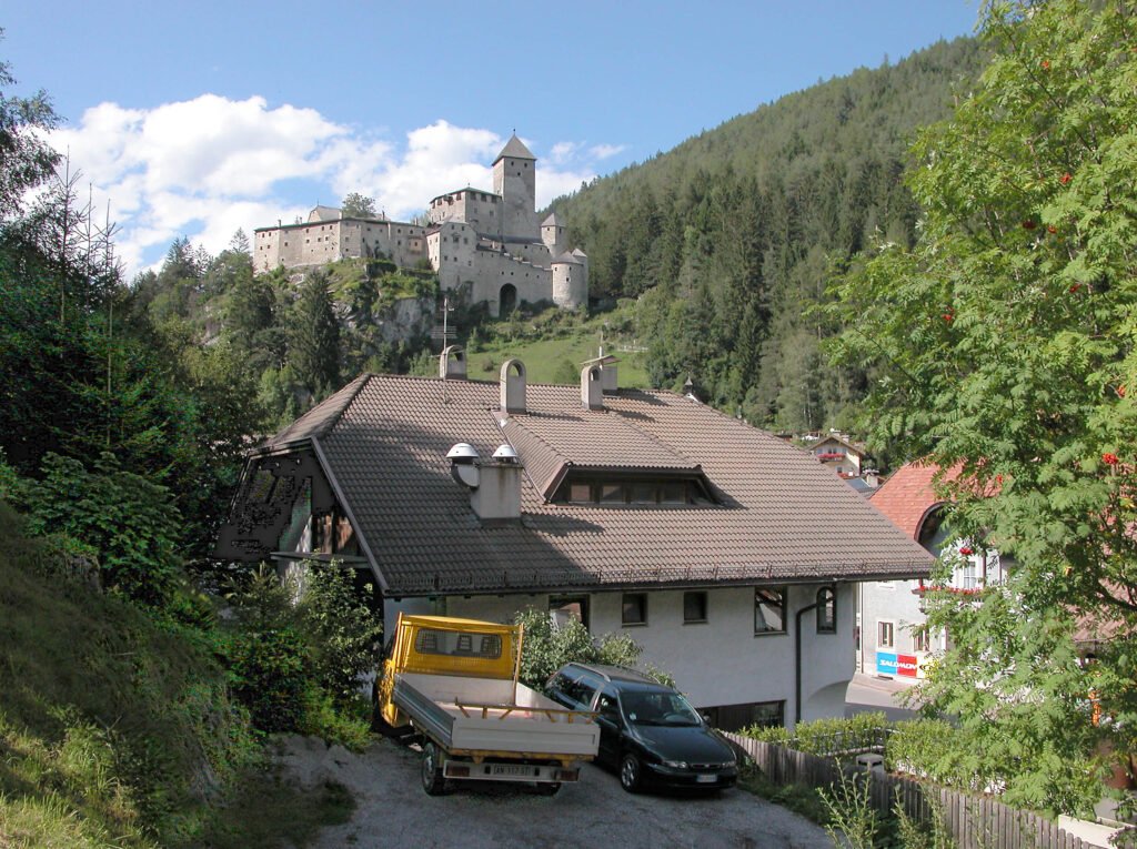
Castel Tures (Burg Taufers) stands on a rocky spur above Campo Tures. It is first recorded around 1225 and was the seat of the lords of Taufers, whose line died out in 1349. Today it belongs to the South Tyrolean Castle Institute. Inside are 64 rooms with almost all their furnishings: a library, a medieval kitchen, an ice cellar, the keep and a painted chapel.
The interior can only be seen on a guided tour, year-round, in Italian or German. From 6 December 2026 to 25 April 2027 there are two tours a day in each language; in summer there are many more. From the village it is about a 10-minute walk on a signed path.
Riva waterfalls
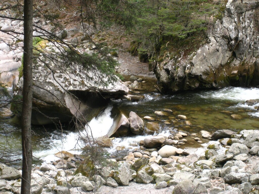
The Riva waterfalls (Reinbachfälle) are three drops of the Riva stream just above Campo Tures. From the village, follow the St Francis trail through the forest: the first fall is about 20 minutes away and fine with small children; allow about an hour of climbing to see all three. It is the busiest walk in the valley, so in August start early.
Campo Tures
Campo Tures (Sand in Taufers) is the largest village and holds the Italian Touring Club’s Orange Flag. Besides the castle there is the Gothic parish church and the Neumelans residence in the centre. A railway linked it to Brunico until 1957; today you arrive by bus.
Nature park visitor centre
On the town hall square, below the castle, the Vedrette di Ries-Aurina visitor centre has a 3D model of peaks, trails and huts, an eagle’s-eye film and a “time pendulum” on how the mountains formed. In summer it runs guided walks and afternoons for children. The park covers more than 310 km² and borders Austria’s Hohe Tauern National Park.
Predoi copper mine
Copper was mined at Predoi from at least the 16th century until 1971. The mine is now part of the South Tyrol Mining Museum. A small train takes you about 1 km into the St Ignatius tunnel, then you walk 360 m on two levels. The tour lasts 1 hour 15 minutes. It is about 8 °C inside: bring a warm jacket and closed shoes; a helmet and cape are provided.
Booking is required (online until the day before). Open April to early November, Tuesday to Sunday, with tours at 10:00, 11:20, 13:20 and 15:00; closed on Mondays. In 2026 a full ticket cost €16, including the exhibition in Cadipietra. Recommended from age 3, not for people with claustrophobia or heart problems. Details: South Tyrol Mining Museum.
Cadipietra granary
In Cadipietra (Steinhaus), seat of the Valle Aurina municipality, the old granary (Kornkasten) is the mining museum’s second site, with a permanent exhibition on the valley’s mining history. The museum also runs a guided walk through the old village centre.
Casere and the head of the valley
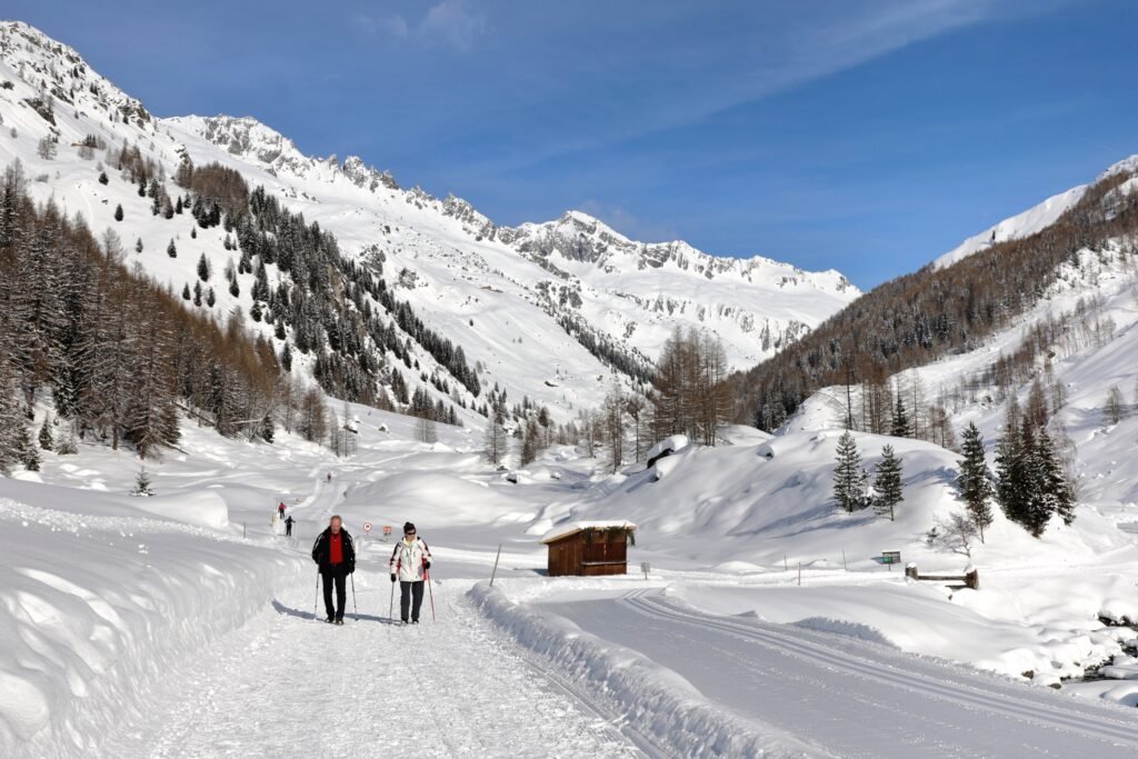
Casere (Kasern) is the last hamlet, in the municipality of Predoi. The road ends here and trails lead towards the Picco dei Tre Signori and the border passes into Austria. Next to the public car park, a nature park information point covers farming and crafts in the upper valley.
Riva di Tures
Riva di Tures (Rein in Taufers) is a hamlet of Campo Tures in a side valley about 11 km away. The road climbs past the waterfalls into a basin ringed by the Rieserferner peaks. It is one of the main starting points for hikes in the park.
The 1947 crossing
In summer 1947 about 5,000 refugees, mostly Jewish Holocaust survivors, crossed the Valle Aurina passes on foot from Austria to reach Mediterranean ports and then Palestine.
Villages of the Valle Aurina
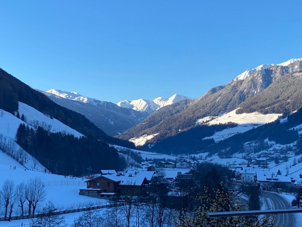
From the valley entrance to its head, in the order you meet them coming from Brunico.
Campo Tures
The main village, at 864 m: shops, bus station, castle and waterfalls on foot. Hamlets: Molini di Tures, Caminata, Acereto and Riva di Tures. Best for: travellers without a car, families, quick access to Speikboden.
Lutago and Riobianco
Lutago (Luttach) is about 5 km beyond Campo Tures on the main road; Riobianco (Weißenbach) sits in a quieter side valley above it. Best for: Speikboden skiers and anyone wanting a smaller village.
San Giovanni and San Martino
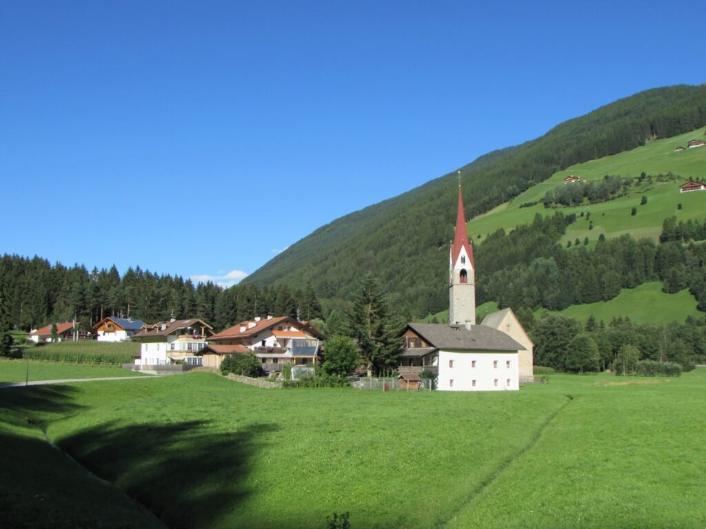
In the middle of the valley, between Lutago and Cadipietra. Best for: staying halfway between the two ski areas, with a car.
Cadipietra
The municipal seat, at 1,054 m and about 13 km from Campo Tures. The K-Express gondola to Klausberg starts here. Best for: Klausberg skiers and families who want the summer coaster.
San Giacomo and San Pietro
The last villages of the municipality, about 16 km from Campo Tures. After San Pietro the valley narrows into the gorge towards Predoi. Best for: lower prices, quiet, close to Klausberg and Casere.
Predoi and Casere
Predoi (Prettau) is the northernmost municipality in the valley and in Italy, home to the mine; Casere is the last hamlet. Best for: hikers and anyone after peace and quiet.
Selva dei Molini
Selva dei Molini (Mühlwald) is in a side valley to the west, about 10 km from Campo Tures. Best for: a small, quiet village if you have a car.
Skiing in the Valle Aurina
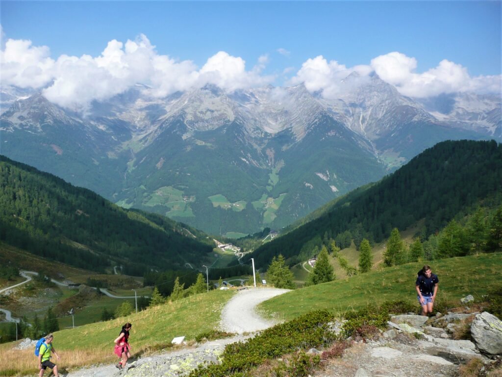
Klausberg and Speikboden make up Skiworld Ahrntal: 86 km of slopes, 21 lifts, from 950 to 2,510 m. The longest run is 9 km with almost 1,500 m of vertical. Snowmaking covers the whole area. The pass is also valid on the small lifts at Riva di Tures and Riobianco.
- Speikboden: above Campo Tures, with the base station between Campo Tures and Lutago.
- Klausberg: from Cadipietra on the K-Express gondola, in the upper valley.
2026/27 season: 4 December 2026 to 4 April 2027 at Klausberg and Speikboden. Lifts run 8:30 to 16:00; last descent 16:30 at Klausberg and 16:45 at Speikboden. Dates for Riva di Tures and Riobianco will be announced later.
Ski pass: prices are only published in the Skiworld Ahrntal online shop; buy at least 48 hours ahead and you save 5%. Note: the Dolomiti Superski pass is not valid in the Valle Aurina. Plan de Corones (Kronplatz), part of Dolomiti Superski with 125 km of slopes and €89 a day in peak season 2026/27, is about 20 km away at Riscone near Brunico.
For ski schools, cross-country trails and snowshoe routes, ask the valley’s tourist offices; the quietest spots are the upper valley towards Casere and the Riva di Tures basin.
Summer in the Valle Aurina
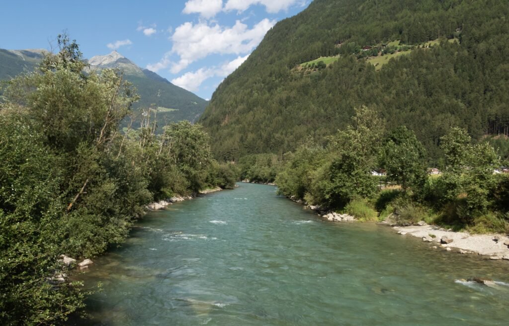
In 2026 the summer lifts ran from 15 May to 1 November at Klausberg and from 30 May to 18 October at Speikboden. The 2027 dates are not out yet; expect late May to October.
- Klausberg: the K-Express gets you up in a few minutes. At the top is the Klausberg Flitzer, an alpine coaster of about 1.8 km, plus panoramic trails facing the Zillertal Alps.
- Speikboden: gondola from the valley, then the Sonnklar chairlift; the start of high trails above Campo Tures.
- Riva waterfalls: the classic short walk, easy to combine with the castle in one morning.
- Vedrette di Ries-Aurina nature park: from Riva di Tures and Casere, trails lead to lakes, pastures and huts. Use the official route sheets for times and ascent; many routes go above 2,000 m and need experience.
- Casere and the Picco dei Tre Signori: the peak (3,499 m) is a glaciated mountaineering ascent, not a hike: go only with experience or a guide.
- Cycling: the valley floor along the Aurino is easy riding between villages; e-bikes help for the climbs to the huts.
On a rainy day, the Predoi mine and Taufers Castle are the two indoor visits.
Day trips from the Valle Aurina
- Brunico (about 15 km): old town, Messner Mountain Museum Ripa, trains along the Puster Valley.
- Plan de Corones (about 20 km to Riscone): gondolas, MMM Corones and LUMEN on the summit.
- Lake Anterselva (about 40 km): alpine lake by the biathlon stadium. See Lake Anterselva.
- Lake Braies (about 43 km): access rules apply in summer. See Lake Braies.
- San Candido (about 46 km) and the Alta Pusteria: cycle path to Lienz, Three Peaks. See San Candido and Alta Pusteria.
- Bressanone (about 50 km): bishops’ town with its cathedral and Novacella Abbey nearby. See Bressanone.
Where to stay in the Valle Aurina
The valley is long, so pick your base by what you plan to do.
- Campo Tures: no car, families, Speikboden, castle and waterfalls on foot; most shops and restaurants.
- Lutago and Riobianco: Speikboden, in smaller villages.
- Cadipietra, San Giacomo and San Pietro: Klausberg and the upper valley.
- Predoi and Casere: hikers and peace and quiet.
- Riva di Tures and Selva dei Molini: quiet side valleys, by car.
Expect mainly family-run hotels, many with a pool and spa, B&Bs (garni), apartments and farm stays. Book early for Christmas, New Year and August.
How to get to the Valle Aurina
By car
Take the Brenner motorway (A22) to the Bressanone/Val Pusteria exit, follow the Puster Valley road (SS49) to Brunico, then turn north to Campo Tures (about 15 km). From Austria you can also come via Lienz. Austrian motorways need a vignette. In South Tyrol, winter tyres or chains on board are required from 15 November to 15 April in snow or ice.
By train
There is no railway in the valley: the Brunico–Campo Tures line closed in 1957. Get off at Brunico or Brunico Nord on the Fortezza–San Candido line, usually changing at Fortezza. From Munich, Zurich or Vienna, travel via Innsbruck and the Brenner. A new link (the Val di Riga loop) is due in 2027 and will remove the change at Fortezza for trains from Bressanone.
By bus
Bus 450 links Brunico, Campo Tures, the Valle Aurina villages and Casere. According to the valley’s lift company, at peak times buses run up to every 15 minutes between Brunico and the valley. Timetables: Südtirol Mobil or its app.
By plane
Distances from Brunico, plus about 15 km to Campo Tures: Bolzano 82 km, Innsbruck 105 km, Treviso about 190 km, Venice 205 km, Verona 223 km, Munich about 300 km, Bergamo 326 km, Milan Malpensa 391 km. Private shuttles serve all of them, and coaches run from Munich and Innsbruck to Bolzano and Bressanone.
Parking
Casere has a public car park by the nature park information point, the start of most valley-floor hikes: arrive early in summer. In Campo Tures, park in the village and walk to the waterfalls and castle. The lift base stations have their own car parks.
Frequently asked questions about the Valle Aurina
Where is the Valle Aurina?
In South Tyrol, province of Bolzano, northern Italy. It runs north from Brunico in the Puster Valley to the Austrian border and is the northernmost part of Italy.
Is the Valle Aurina in Italy or Austria?
Italy. It borders the Austrian Zillertal municipalities of Mayrhofen, Brandberg and Finkenberg.
What is the difference between Valle Aurina and Campo Tures?
Campo Tures is the municipality at the valley entrance (864 m). The Valle Aurina municipality follows, with Lutago, San Giovanni, Cadipietra, San Giacomo and San Pietro. For visitors, “Valle Aurina” means the whole valley including Predoi.
How high is the Valle Aurina?
Campo Tures is at 864 m and Cadipietra at 1,054 m. The slopes reach 2,510 m and the Picco dei Tre Signori 3,499 m.
Is the Valle Aurina in the Dolomites?
No. The mountains are the Zillertal Alps and the Rieserferner group. The nearest Dolomites are around Plan de Corones and Braies.
How many km of slopes are there?
86 km on the Skiworld Ahrntal pass (Klausberg and Speikboden), 2026/27 season from 4 December to 4 April. Dolomiti Superski is not valid.
How do I get to the Riva waterfalls?
On foot from Campo Tures along the St Francis trail: the first fall in about 20 minutes, all three in about an hour of climbing.
When is the Predoi mine open?
April to early November, Tuesday to Sunday, closed Mondays. Booking is required; it is about 8 °C in the tunnel.
Can I reach the Valle Aurina without a car?
Yes: train to Brunico, then bus 450 to Campo Tures and up the valley to Casere.
Where can I find webcams for the Valle Aurina and Casere?
On the Skiworld Ahrntal and valley tourist office websites, with live images of the slopes and villages.
Photos: Valle Aurina
Photos from Wikimedia Commons: Palickap (CC BY-SA 4.0), Jörg Blobelt (CC BY-SA 4.0), Stefano Vigorelli (CC BY-SA 4.0), C.Stadler/Bwag (CC BY-SA 4.0), -wuppertaler (CC BY 4.0), Pmk58 (CC BY-SA 4.0), Rainerhaufe (CC BY-SA 4.0), Michielverbeek (CC BY-SA 4.0).


