


 Français
 Deutsch
 Italiano
ACCOMMODATIONS IN TARVISIO
Discover the best Hotels, B&Bs and Apartments in Mountain based on thousands of verified reviews.
Altitude754 m · runs up to 1,756 m
WhereVal Canale, Friuli Venezia Giulia, Italy
From Udineabout 95 km · A23 or train (about 1 h 15)
Ski runs24 km · Lussari and the Di Prampero
Lift pass€55 adult day, high season 2026/27
Ski season5 Dec 2026 – 29 Mar 2027
Updated October 2026 · Sources: PromoTurismoFVG, Consorzio Tarvisiano, italia.it, RFI, ISTAT
Find a place to stay in Tarvisio
Tarvisio (Tarvis in German, Trbiž in Slovenian) is the north-easternmost town of Friuli Venezia Giulia, in the province of Udine, Italy. It sits at 754 metres in the Val Canale, between the Julian and the Carnic Alps, right on the borders with Austria (Arnoldstein) and Slovenia (Kranjska Gora and Bovec); the three countries meet on Monte Forno. Udine is about 95 km away on the A23 motorway, just over an hour’s drive, and the nearest airport is Trieste, 133 km away.
Around 3,800 people live here, and the town has four official languages: Italian, Friulian, German and Slovenian. For centuries Tarvisio belonged to the bishops of Bamberg and then to Austria; it only became Italian in 1919. You notice it in the place names, the food and the churches.
Why go? In summer for the Fusine Lakes, Monte Lussari, Lake Predil and the Alpe Adria cycle route, which runs all the way to the sea. In winter for the Lussari slopes, 24 km including the Di Prampero run, with a lift pass that costs far less than in the big Alpine resorts. And because in half an hour you can be in Austria or Slovenia.
What to see in Tarvisio
The municipality is large, over 200 km², and the sights are spread between the town and its villages: Camporosso (where the Lussari gondola starts), Fusine in Valromana (towards the lakes and Slovenia), Cave del Predil (towards the lake and the Slovenian border) and Coccau (towards Austria). With a car you can see it all in two or three days; without one, a bike on the cycle path works well.
The town centre and the church of Saints Peter and Paul
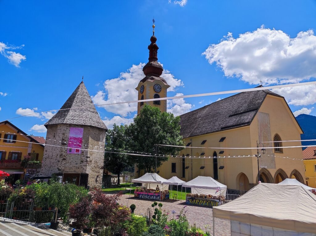
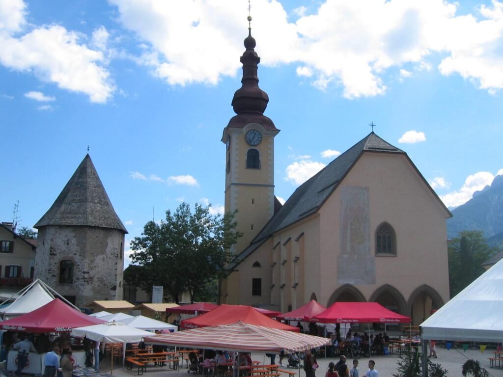
The heart of town is Piazza Unità, with the church of Santi Pietro e Paolo and the medieval tower next to it. The church dates from the 14th century, was completed in the 15th and enlarged in 1959–1962. You can walk round the centre in an hour.
Tarvisio is also a shopping and market town, long popular with Austrians and Slovenians who cross the border to shop. Market days and times change with the season: ask at the Infopoint in the centre.
The Fusine Lakes
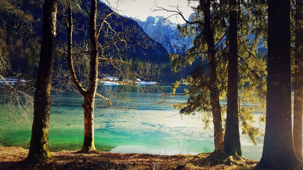
This is the most searched-for sight in the area, and for good reason. Two glacial lakes, the Lower Lake at 924 metres and the Upper Lake five metres higher, at the foot of the Mangart face in the Tarvisio forest. They are about 11 km from the centre: drive through Fusine in Valromana towards the Slovenian border, then turn right at the junction.
The loop around both lakes is 5.4 km long, takes about 2 hours and climbs only 104 metres, so it suits children and older walkers. The main car park is past the houses of Scicchizza and is paid at certain times of year. For a longer walk, climb from the Upper Lake to the Rifugio Zacchi hut at 1,360 metres in about two hours; it is open in summer and winter. Practical tip: arrive early on July and August weekends, when the car parks fill up, or come in autumn, when the larches turn yellow.
Monte Lussari and its village
Lussari (Luschariberg in German, Višarje in Slovenian) is Tarvisio’s signature mountain. At the top, at around 1,800 metres, a small village clusters round a Marian sanctuary: it is the highest village in Friuli Venezia Giulia and for centuries has drawn Italian, Austrian and Slovenian pilgrims. From the top you look out over the Julian and Carnic Alps.
You go up by gondola from Camporosso; the top station is a few metres from the village. In summer 2026 it ran daily from 30 May to 27 September, Monday to Saturday 9:00–17:15, Sundays and holidays 8:30–18:15, with evening runs on Fridays in August. On foot, the Pilgrims’ Path (CAI trail 613) climbs from Camporosso in about 2.5 hours with 950 metres of ascent. In 2023 the forest road from the Val Saisera hosted the Giro d’Italia’s uphill time trial.
Lake Predil
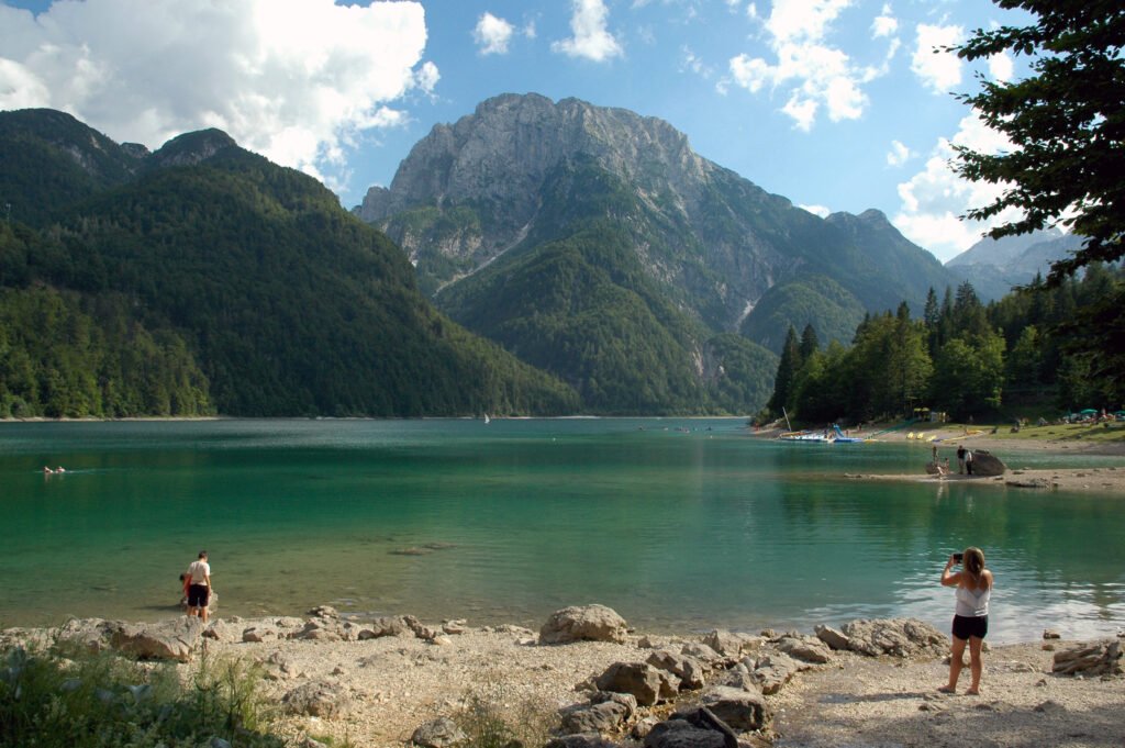
South of town, beyond Cave del Predil, lies Lake Predil, the second-largest natural lake in Friuli Venezia Giulia. It fills a glacial basin near the Slovenian border, below the mountains of the Kanin group. A lakeside path goes all the way round, past the remains of the Raibl fort, an old border fortification.
In summer you can swim here, and there are meadows on the shore to lie on: this is the area’s swimming lake, more than the Fusine Lakes. Carry on up the road and you reach the Predil Pass, then drop into Slovenia towards Bovec and the Soča valley.
Cave del Predil and the Raibl mine
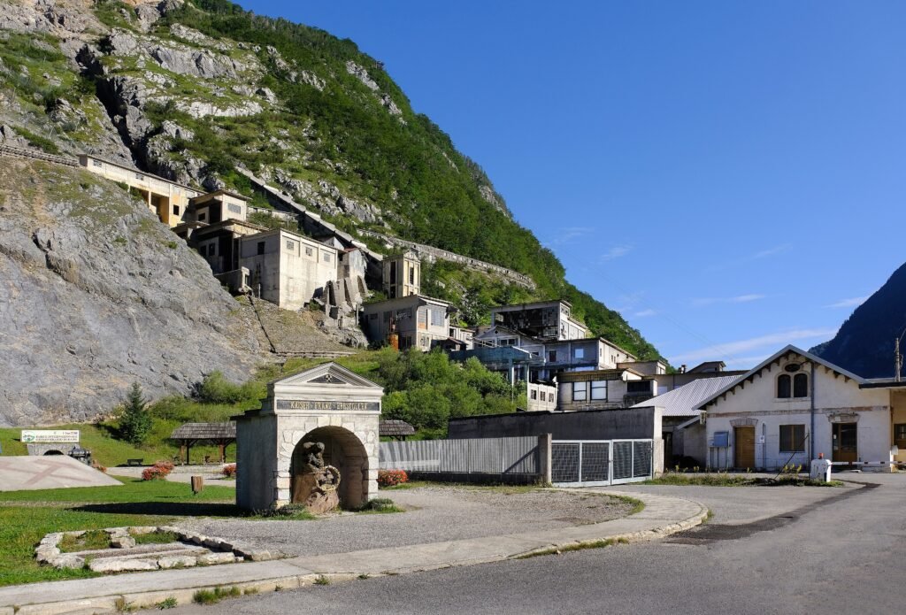
Cave del Predil (Raibl in German), at 900 metres, grew up around a lead and zinc mine that closed in 1991 after centuries of work. Today it is the Raibl International Geomining Park: you ride into the tunnels on a small electric train, often guided by former miners. On the same site are the Museum of Mining Tradition and the “Alpi Giulie” military history museum, in the former school of 1908, which tells the story of the wars fought along this border.
It is the visit for a rainy day. Mine tours must be booked; check current times and prices before you go.
The Slizza Gorge
The Slizza is the stream that runs through Tarvisio towards Austria. Just outside town, in the Boscoverde area (Via Bamberga), it has carved a narrow, deep gorge. A loop of about an hour drops to the stream on steps and switchbacks, follows walkways and tunnels above the water, climbs to the old railway bridge and returns along the cycle path. Wear proper hiking shoes.
Note: in October 2026 the regional tourism website lists the route as temporarily closed. Check with the Tarvisio Infopoint whether it has reopened before you go.
Camporosso and the Val Saisera
Camporosso (Saifnitz) is the village west of town, on the watershed between the Black Sea and the Adriatic: at 816 metres it is the highest point of the Alpe Adria cycle route. The Lussari gondola starts here, and there is a local history museum, the Antiquarium. A little further west, in the neighbouring municipality, the Val Saisera opens under high rock walls; it is the starting point for climbing Lussari on foot or by bike.
Skiing in Tarvisio
The Tarvisio ski area is one of the resorts run by the regional government through PromoTurismoFVG. It has 24 km of downhill runs between 754 and 1,756 metres, a skiable vertical of 1,002 metres, around ten lifts and snowmaking on every run. The 2026/27 season is scheduled from Saturday 5 December 2026 to Easter Monday, 29 March 2027, snow permitting.
The best-known run is the Di Prampero: it drops about 4 km from Monte Lussari to the valley, is meant for experienced skiers and has hosted international races. The gondola and chairlifts serve the Lussari slopes; lower down there are easier slopes and three covered magic carpets for children and beginners. A good long intermediate run is Piste A, 3,250 metres with 542 metres of descent. Ski schools and rental shops are in town.
Lift passes 2026/27. An adult day pass costs €55 in high season (19 December 2026 to 14 March 2027) and €38.50 in low season. Juniors (born 2008–2019) and over-75s pay €18, and children born 2020–2024 ski free with ID. The day pass is valid at every PromoTurismoFVG ski area, including Sella Nevea under Mount Kanin. There are also 3-, 4- and 5-hour passes, valid only at the resort where you buy them. These are the prices for non-residents of Friuli Venezia Giulia; always check the official price list before you travel.
Cross-country skiing. There are dozens of kilometres of cross-country trails in the valleys around Tarvisio, with 7.5 km covered by snowmaking: handy early in the season or in lean snow years.
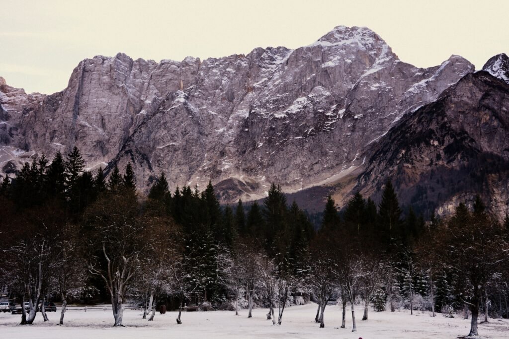
Snowshoeing and winter walks. In winter the Fusine Lakes often freeze, and the basin below Mangart is a classic snowshoe outing. The Rifugio Zacchi stays open in winter. You can also take the gondola up Lussari without skiing, for lunch in the snowy village.
Summer in Tarvisio
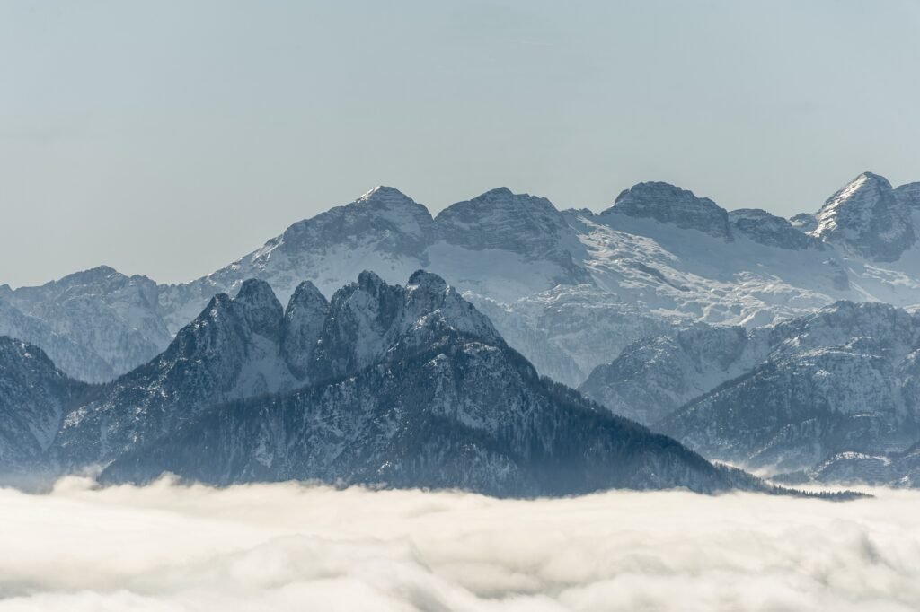
In summer Tarvisio is a base for walking, cycling and lake swimming. Trails range from the flat loop around the lakes to serious Julian Alps climbs such as Mangart, the Cinque Punte and Jôf di Montasio, a little further west.
Hikes
- Fusine Lakes loop: 5.4 km, 2 hours, 104 m of ascent. Easy and family-friendly.
- Fusine Lakes to Rifugio Zacchi (1,360 m): about two hours up from the Upper Lake, on a wide track or steeper paths.
- Pilgrims’ Path to Lussari: from Camporosso, CAI 613, about 2.5 hours and 950 m of ascent. Come down by gondola.
- Val Saisera to Lussari: about 3 hours and 900 m of ascent on the service road.
- Lake Predil loop: a lakeside walk past the Raibl fort.
The Alpe Adria cycle route
Tarvisio lies on the Alpe Adria cycle route, 410 km from Salzburg to Grado. The Italian section (FVG1) starts at Coccau on the Austrian border, or at Fusine on the Slovenian border, and reaches Grado after about 175 km. From Camporosso (816 m) it is almost all downhill, and the first stretch follows the old Pontebbana railway line through tunnels and over bridges. Distances from Coccau: Pontebba km 34, Venzone km 70, Udine km 120, Grado km 175.
The classic day ride is Tarvisio to Venzone, returning by train; there are also bus-and-bike shuttles. Heading north, the route takes you into Austria (Arnoldstein is about 14 km away); heading east from Fusine, it carries on into Slovenia as far as Kranjska Gora.
Road cycling up Lussari
The 2023 Giro climb from the Val Saisera to Lussari is about 7 km long with about 900 metres of ascent and very steep ramps. In summer (in 2026 from 30 May to 27 September) the road is open to bikes uphill only, 9:00–15:00. Riding down is not allowed: you come back by gondola.
Lakes and swimming
For a swim, head to Lake Predil. At the Fusine Lakes people walk, take photos and picnic: the water is cold all year round.
Day trips from Tarvisio
Tarvisio sits where three countries meet: within an hour you have three cuisines, three languages and three mountain ranges.
- Kranjska Gora (Slovenia): Slovenia’s best-known ski resort, just over the border past Fusine. You can also ride there on the cycle path.
- Bovec and the Soča valley (Slovenia): over the Predil Pass, for rafting, canyoning and the emerald-green river.
- Villach (Austria): the nearest Carinthian city, half an hour by train from Tarvisio Boscoverde, passing Arnoldstein on the way.
- Sella Nevea: the ski area under Mount Kanin, on the same regional lift pass.
- Venzone: a medieval walled town rebuilt after the 1976 earthquake, at km 70 of the cycle route.
- Towards the Dolomites: for a longer trip west, Sappada is the closest Friulian mountain resort in our guide; further on are Auronzo di Cadore, Lake Misurina, Cortina d’Ampezzo and, in South Tyrol, San Candido.
Where to stay in Tarvisio
Accommodation is in the town and its villages: hotels, apartments, B&Bs and holiday homes, plus a few mountain huts. The right base depends on your plans.
- Tarvisio town: if you arrive without a car and want shops, restaurants and services within walking distance. Tarvisio Boscoverde station is just outside the centre, on the cycle path.
- Camporosso: for skiers and for Lussari. Close to the gondola and the cycle route, and quieter.
- Fusine in Valromana: for nature, the lakes and trips into Slovenia. Good for families and cyclists.
- Cave del Predil: for peace and quiet, with Lake Predil close by and the road to Bovec. You need a car.
- Lussari village: a handful of rooms at altitude next to the sanctuary, for sunrise over the Julian Alps. Access is by gondola, so check the times.
Book early for December weekends, Christmas, Easter and August: Tarvisio is popular with Austrian and Slovenian visitors too.
How to get to Tarvisio
By car
From Udine, take the A23 Alpe-Adria motorway north: about 95 km, just over an hour. Exit at Tarvisio, the last Italian exit before Austria. From Venice or Trieste, take the A4 to Palmanova and then the A23. From Austria you arrive on the A2 via Villach; from Slovenia, via Kranjska Gora and the Fusine border crossing, or over the Predil Pass from Bovec. In winter you must carry snow tyres or chains.
By train
The station is Tarvisio Boscoverde, on the Pontebbana line. Regional trains run from Udine in about 1 hour 15 minutes, some starting or ending in Trieste or Venice. The cross-border MiCoTra train links Udine, Tarvisio and Villach: from Villach it takes about 30 minutes. Until 12 December 2026 there are engineering works on the line, with earlier departures and some trains replaced by buses: check the notices from RFI and Trenitalia before you travel.
By bus
Intercity buses in the province of Udine are run by TPL FVG; check their website for services to Tarvisio and its villages. During rail works, replacement buses run between Udine, Tarvisio and Villach. In summer there are bus-and-bike shuttles for the cycle route.
By plane
The nearest airport is Trieste (Ronchi dei Legionari), 133 km away. Venice, Klagenfurt in Austria and Ljubljana in Slovenia are also options. From Trieste or Venice, continue by train via Udine or by car on the A23. For skiers, a hire car makes the most sense; there is no scheduled direct airport transfer we could verify.
Parking
In town there are public car parks near the centre. At the Fusine Lakes the car park is past the houses of Scicchizza; it is paid at certain times of year and fills up early on summer weekends. For Lussari, park in Camporosso at the gondola station. For the Slizza Gorge there is a parking area by the cycle path on Via Bamberga.
Up-to-date information on lifts, trails and opening times: PromoTurismoFVG – Tarvisio.
Frequently asked questions about Tarvisio
What is the altitude of Tarvisio?
The town is at 754 metres. The ski runs reach 1,756 metres, and Monte Lussari rises to around 1,800 metres.
Where is Tarvisio?
In the Val Canale in Friuli Venezia Giulia, north-east Italy, in the province of Udine, on the borders with Austria and Slovenia, about 95 km from Udine.
How far is Tarvisio from the Fusine Lakes?
About 11 km, around 20 minutes by car via Fusine in Valromana, or by bike on the cycle path. The loop around both lakes is 5.4 km and takes about 2 hours.
Do you have to pay to park at the Fusine Lakes?
Yes, at certain times of year, mainly in high season. Arrive early on summer weekends.
How do you get up Monte Lussari?
By gondola from Camporosso, or on foot along the Pilgrims’ Path (about 2.5 hours, 950 m of ascent). By bike the road is open uphill only, at set times.
How much is a lift pass in Tarvisio in 2026/27?
An adult day pass costs €55 in high season and €38.50 in low season; juniors and over-75s pay €18. It is valid at all PromoTurismoFVG ski areas.
When is the ski season in Tarvisio?
The 2026/27 season is scheduled from 5 December 2026 to 29 March 2027, snow permitting.
Can you reach Tarvisio by train?
Yes, at Tarvisio Boscoverde station: about 1 hour 15 from Udine and about 30 minutes from Villach on the MiCoTra train.
Can you swim in Lake Predil?
Yes, swimming is allowed in summer and there are meadows on the shore. The Fusine Lakes are mainly for walking.
How long is the Alpe Adria cycle route from Tarvisio?
From Coccau on the Austrian border to Grado it is about 175 km, almost all downhill. The most popular day stage runs as far as Venzone, at km 70.
Photos of Tarvisio
Photos from Wikimedia Commons: Hubertl (CC BY-SA 4.0), No machine-readable author provided. Žiga assumed (based on copyright claims). (Public domain), Ajznponar (CC0), Cecilia Famà (CC BY-SA 4.0), DimiTalen (CC0), Claconvr (CC BY-SA 4.0), Cecilia Famà (CC BY-SA 4.0), Johann Jaritz (CC BY-SA 4.0).


