


 Français
 Deutsch
 Italiano
ACCOMMODATION IN VAL D’AOSTA
Discover the best Hotels, B&Bs and Apartments in the Mountains based on thousands of verified reviews.
Height4,478 m (Italian summit 4,476 m)
WhereSwiss–Italian border: Valais and Aosta Valley
From Geneva233 km to Täsch (Zermatt) · 186 km to Cervinia
Pistes360 km and 52 lifts (Matterhorn Ski Paradise)
Ski passInternational from CHF 104 (Switzerland), €88 (Italy), 2026/27
SeasonSkiing Nov 2026 – early May 2027 · climbing July–September
Updated October 2026 · Sources: Zermatt Bergbahnen (Matterhorn Paradise), Gornergrat Bahn, Cervino SpA, Zermatt Tourism, Aosta Valley Region
Find a place to stay in Monte Cervino
The Matterhorn is 4,478 metres high and stands on the border between Switzerland and Italy, in the Pennine Alps. The border runs along the summit ridge: the north side belongs to Zermatt, in the canton of Valais, Switzerland; the south side belongs to Valtournenche, in Italy’s Aosta Valley. There are two summits: the Swiss one at 4,478 m and the Italian one, with the summit cross, at 4,476 m. In Italian it is Monte Cervino, in French Mont Cervin.
Two resorts sit at its foot: Zermatt (1,608 m) on the Swiss side and Breuil-Cervinia (2,050 m) on the Italian side. Zermatt is car-free: the nearest airports are Geneva and Zurich, about 3 to 4 hours away by train. Cervinia is about 185 km from Milan and 117 km from Turin by road. There is no road between the two resorts, but a cable car crosses the border at 3,480 metres.
Most visitors come to look at the mountain, not to climb it: from the lifts, from the lakes that reflect it and from the trails around it. In winter it towers over 360 km of linked pistes in two countries. In summer people hike, and experienced climbers attempt the summit with a guide between July and September.
What to see at the Matterhorn
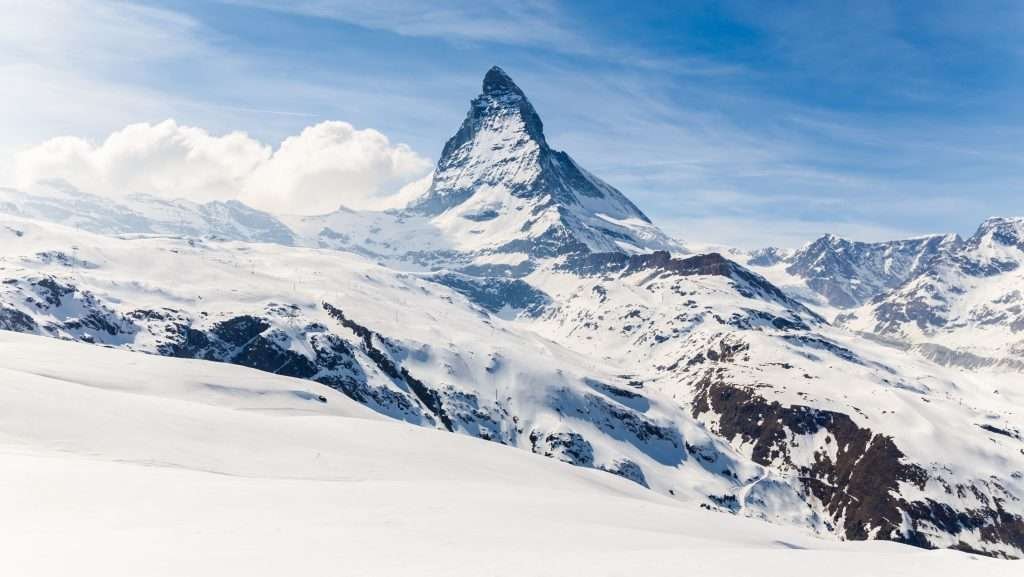
The Matterhorn looks different from each side. These are the places to know before you choose where to base yourself.
Four faces and two summits
The Matterhorn is an almost free-standing pyramid with four faces (north, east, south, west) divided by four ridges: the Lion ridge towards Italy, the Hörnli ridge towards Zermatt, the Zmutt ridge and the Furggen ridge. From Zermatt you see the east face with the Hörnli ridge in profile – the sharp pyramid of the postcards. From Breuil-Cervinia you see the south face, broader and more massive.
Zermatt and the Matterhorn Museum
Zermatt is a car-free village at the head of the Mattertal. From the centre the Matterhorn rises above the rooftops. The Matterhorn Museum – Zermatlantis tells the story of the mountain and its first ascent, and displays the rope that broke in 1865.
Breuil-Cervinia, the Italian side
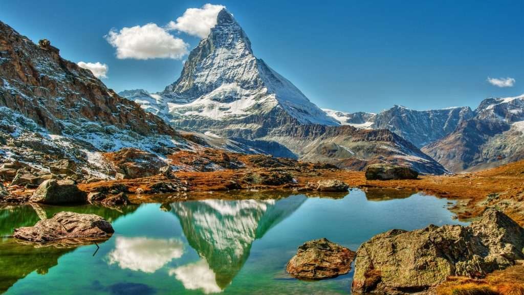
Breuil-Cervinia is part of the municipality of Valtournenche, at 2,050 metres. The Matterhorn faces the village, with the Lion ridge on the left. It is the starting point for the cable cars to Plateau Rosa and for the Italian normal route. See our guide to Cervinia.
Schwarzsee and the Hörnli Hut
Schwarzsee (2,583 m) is a small lake right below the east face, reached by gondola from Zermatt. From here a trail climbs to the Hörnli Hut (3,260 m), the base for the Swiss normal route: 4.3 km, about 2 hours 15 minutes, 693 m of ascent. It is a difficult trail with exposed metal walkways, so you need to be sure-footed.
The Five Lakes Walk and Stellisee
Above Zermatt, between Blauherd and Sunnegga, the Five Lakes Walk passes Stellisee, Grindjisee, Grünsee, Moosjisee and Leisee: 9.8 km, about 2 hours 30 minutes, 165 m up and 454 m down. On a still day the whole Matterhorn is reflected in Stellisee.
Chamois and the Cheneil basin

On the Italian side, further down the Valtournenche valley, Chamois is the only municipality on mainland Italy you cannot reach by car: you go up by cable car from Buisson. From the trails towards Cheneil and the chairlifts up to 2,470 m you see the Matterhorn from a distance, with far fewer people than in Cervinia.
The Tour of the Matterhorn
The Tour of the Matterhorn (Tour Matterhorn) is a multi-day trek around the mountain through Switzerland and Italy. According to Zermatt Tourism it is about 148 km with 13,000 m of ascent, around 60 hours of walking – usually about ten days. Some sections cross glaciers, such as the Theodul Pass, so you need experience or a guide.
Seeing the Matterhorn without climbing it
You can get close to the summit without climbing in two ways: by lift (almost all year, except during maintenance closures) or at the lakes where the mountain is reflected. For Plateau Rosa and for crossing into Switzerland, carry a passport or national ID card.
Plateau Rosa and Testa Grigia (3,480 m)
From Breuil-Cervinia three cable cars take you up: Plan Maison, Cime Bianche Laghi (over 2,800 m) and Plateau Rosa, on the border at 3,480 metres. You are on a glacier, with the Matterhorn to the west and Monte Rosa to the east. In winter 2026/27 the foot passenger ticket (Explore Pass) from Breuil to Plateau Rosa costs €57 return and €36.50 one way; children born after 31 October 2018 travel free with a paying adult.
Matterhorn Glacier Paradise (Klein Matterhorn, 3,883 m)

This is the highest cable car station in Europe, on the Klein Matterhorn (Little Matterhorn), open all year. From Zermatt you get there with a series of lifts via Furi and Trockener Steg; from Cervinia with the Matterhorn Alpine Crossing. At the top there is the Glacier Palace and a viewing platform. In winter 2026/27 the Peak2Peak ticket, which also includes the Gornergrat, costs CHF 165.
The Matterhorn Alpine Crossing
Since 2023 you can travel by cable car between Zermatt and Breuil-Cervinia, via Matterhorn Glacier Paradise and Testa Grigia: 1 hour 30 minutes to 2 hours each way. In winter 2026/27 a one-way ticket costs CHF 127.50 from Zermatt (€127.50 from Cervinia) and a return CHF/€208; children aged 9 to 15 pay half, children aged 3 to 8 travel free with an adult, and children under 3 are not allowed. Luggage costs CHF 20 per piece. It is closed for maintenance from 7 September to 23 October 2026 and from 7 January to 26 February 2027.
Gornergrat (3,089 m)

The Gornergrat cog railway has climbed from Zermatt since 1898; the ride takes 33 minutes. At the top the Matterhorn is straight ahead, with Monte Rosa and the Gorner Glacier on the other side. A return ticket costs CHF 102 in winter 2026/27 and CHF 132 in summer; with a Swiss Travel Pass or Half Fare Card you pay half.
Lago Blu near Cervinia

A small spring-fed lake just below Breuil-Cervinia, among centuries-old larches, just under 2,000 metres. On a clear, windless day the Matterhorn is reflected in the water. It is about a 30-minute walk from the centre, or you can drive up the road from Valtournenche. The three small Layet lakes are nearby, in the pastures.
Riffelsee
Riffelsee lies just below Rotenboden station on the Gornergrat railway, a few minutes’ walk from the train. It is the best-known Matterhorn reflection on the Swiss side: go early in the morning or in the evening, when the air is still. You can walk on to Riffelberg (trail no. 21, 3 km, about one hour).
Climbing the Matterhorn

You can reach the summit, but it is not a hike: it is a serious alpine climb on rock and ice, with climbing above 4,000 metres. According to Zermatt Tourism, 300 to 400 guided clients reach the top each year, while about 3,500 climbers try without a guide and around two in three turn back. From 1865 to the end of the 2011 season, around 500 people died on the Matterhorn.
The Swiss normal route: the Hörnli ridge
This is the route of the first ascent. Climbers sleep at the Hörnli Hut (3,260 m, 150 beds), which must be booked months ahead on the hut’s website, and set off at night. From the hut to the summit there are about 1,200 metres of ascent, with fixed ropes on the steepest sections. The Solvay Hut at 4,003 m is an emergency bivouac, not a place to stay. The descent is the most dangerous part, because of fatigue and rockfall.
The Italian normal route: the Lion ridge
It starts from Breuil-Cervinia or Plan Maison and climbs to the Rifugio Duca degli Abruzzi all’Oriondé (2,802 m), then to the Capanna Carrel at about 3,830 m. It is harder than the Swiss route, with long climbing sections, fixed ropes and ladders. The Capanna Carrel has been rebuilt slightly lower in recent years because of rockfall: check its status and bookings with the Società Guide del Cervino, the Cervinia mountain guides.
Guides, season and preparation
The best period is early or mid-July to mid-September; it is quieter in the first three weeks of July and from late August. In Zermatt a guide takes only one client on the rope, and the climb usually takes two days with a night at the hut. You need excellent stamina, good acclimatisation (climb another 4,000 m peak first) and experience with crampons on mixed ground. The Zmutt and Furggen ridges are harder still and rarely climbed.
The risks today
As temperatures rise, the permafrost thaws and rockfall increases. In summer 2026, after a winter with little snow, the Zermatt guides suspended guided ascents in July; in early August a rockfall on the south side at about 3,900 metres also stopped the Cervinia guides. Always ask the local guides about current conditions before you go.
The first ascent in 1865
On 14 July 1865 Edward Whymper reached the summit via the Hörnli ridge with six companions: Michel Croz, Charles Hudson, Lord Francis Douglas, Douglas Hadow and the guides Peter Taugwalder father and son. On the way down the rope broke and Croz, Hadow, Hudson and Douglas fell to their deaths; Douglas’s body was never found. Jean-Antoine Carrel, the Valtournenche guide who had been trying for years from the Italian side and was on the mountain that day, reached the top three days later, on 17 July, with Jean-Baptiste Bich.
Skiing below the Matterhorn
The Matterhorn Ski Paradise links Zermatt, Breuil-Cervinia and Valtournenche: 360 km of pistes and 52 lifts, from a top point of 3,899 m down to 1,620 m. You ski from one country to the other via Plateau Rosa and the Theodul Pass. The Swiss side alone has up to 200 km of pistes.
- Season 2026/27: Zermatt 1 November 2026 to 3 May 2027, Breuil-Cervinia 24 October 2026 to 2 May 2027, Valtournenche 28 November 2026 to 25 April 2027.
- Ski pass bought in Switzerland: one day in Zermatt from CHF 89, International (including Cervinia) from CHF 104, with prices varying by date. Children up to 8 ski free.
- Ski pass bought in Italy: one day Cervinia-Valtournenche €64, International €88; six days €338 and €464.50. Children born after 31 October 2018 ski free with a paying adult.
- Who it suits: skiers who like long runs and high-altitude snow; for off-piste, hire a guide.
Summer skiing takes place on the Theodul Glacier, between Klein Matterhorn and Plateau Rosa, on around twenty kilometres of pistes. In 2026 it was planned from May to early September, but it was suspended at the end of July because of poor snow and glacier conditions. Check dates on the Matterhorn Paradise website or the Cervino SpA website.
Cervinia or Zermatt?
Two very different resorts below the same mountain.
- View: Zermatt has the classic, pointed pyramid; from Cervinia the Matterhorn looks broader and more massive, but it is right outside your door.
- Altitude: Cervinia is at 2,050 m, with ski-in/ski-out in many areas and early snow; Zermatt is at 1,608 m and you reach the high slopes by lift.
- Getting there: Zermatt is easy by train from Geneva or Zurich airport; Cervinia is easiest by car or transfer from Turin or Milan.
- Cost: Cervinia is in euros and the ski pass is cheaper (€64 against CHF 89 or more); in Zermatt accommodation, food and lifts cost more.
- Atmosphere: Zermatt has an old wooden village centre, shops, museums and scenic railways; Cervinia is a purpose-built ski resort, more practical.
In short: for the classic view, the Gornergrat railway and a car-free village, choose Zermatt. To ski for less with an easy drive from Italian airports, choose Cervinia. With the Alpine Crossing or the International ski pass you can see the other side in a day.
Where to stay near the Matterhorn
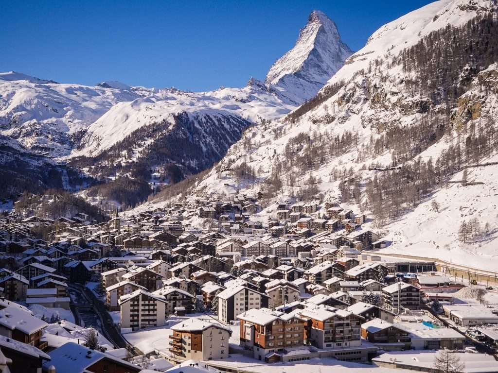
There are four bases, two on each side.
- Zermatt: for train travellers, for the Gornergrat and the classic view, and for families who want a village without traffic. Plenty of hotels, chalets and apartments, at high prices.
- Täsch: 12 minutes from Zermatt by shuttle train, with the covered car park. Cheaper, and handy if you arrive by car for a short stay.
- Breuil-Cervinia: for skiers (ski-in/ski-out in many areas) and for Plateau Rosa and Lago Blu. Hotels and many apartments, priced in euros.
- Valtournenche: further down the valley, linked by lift to the Cervinia ski area. Often cheaper, a village that lives all year round. Quieter still: Chamois, with no cars.
You will find available accommodation below.
How to get to the Matterhorn
Choose your side first: there is no road between Zermatt and Breuil-Cervinia. By car it is about 226 km and over 3 hours 30 minutes around the Alps; with the Matterhorn Alpine Crossing it takes about 2 hours.
By car
Swiss side: you drive as far as Täsch (Matterhorn Terminal) and continue by shuttle train. From Geneva about 233 km (3 hours), from Zurich about 225 km (3 hours 30), from Milan about 230 km (3 hours 20).
Italian side: A5 motorway Turin–Aosta, exit Châtillon–Saint-Vincent, then the regional road up the Valtournenche valley to Breuil-Cervinia (27 km). From Milan about 185 km (2 hours 30), from Turin about 117 km (1 hour 45), from Geneva about 186 km through the Mont Blanc tunnel.
By train
Swiss side: the Matterhorn Gotthard Bahn runs right into Zermatt. From Visp about 1 hour, from Brig 1 hour 20 to 1 hour 30, from Zurich main station about 3 hours 15, from Geneva about 3 hours 45, changing at Visp. The Glacier Express connects Zermatt with St. Moritz in about 8 hours (seat reservation required).
Italian side: the nearest station is Châtillon–Saint-Vincent. Until 13 December 2026 replacement buses run between Ivrea and Aosta during electrification works, so check the timetable.
By bus
Buses run from Châtillon to Breuil-Cervinia, about ten a day, stopping at Valtournenche and at Buisson for Chamois.
By plane
For Zermatt: Geneva (about 3 hours by car to Täsch, about 4 hours by train) and Zurich (about 3 hours 35 by train). For Cervinia: Turin Caselle (about 121 km) and Milan Malpensa (about 180 km), usually with a hire car or a private transfer.
Parking
In Täsch the Matterhorn Terminal has 2,100 covered spaces at about CHF 16–17 a day, slightly less from the eighth day; the shuttle train to Zermatt takes 12 minutes and runs every 20 minutes (return CHF 17.20). In Breuil-Cervinia you park in the village car parks and near the lift stations, some of them paid: on winter weekends, arrive early.
Frequently asked questions about the Matterhorn
How high is the Matterhorn?
4,478 metres. The Italian summit, with the cross, is at 4,476 m, about a metre lower than the Swiss summit.
Where is the Matterhorn located?
In the Pennine Alps, on the border between Switzerland and Italy, between Zermatt (canton of Valais) and Breuil-Cervinia (Aosta Valley).
What country is the Matterhorn in?
Both Switzerland and Italy: the border runs over the summit. It is most often associated with Switzerland because the classic view is from Zermatt.
Can you climb the Matterhorn?
Yes, but it is a difficult alpine climb: you need rock and ice experience, excellent fitness and, in practice, a guide. The normal routes are the Hörnli ridge (Switzerland) and the Lion ridge (Italy), from July to mid-September.
Can you get close without climbing?
Yes. Cable cars take you to 3,883 m at Matterhorn Glacier Paradise and to 3,480 m at Plateau Rosa, right next to the mountain.
Where is the best view of the Matterhorn?
The classic pyramid is seen from the Swiss side: Gornergrat, Riffelsee, Stellisee and Zermatt itself. On the Italian side: Lago Blu, Breuil-Cervinia and Plateau Rosa.
Cervinia or Zermatt?
Zermatt for the classic view, train access and a car-free village; Cervinia for cheaper skiing and an easy drive from Turin or Milan.
Can you travel from Zermatt to Cervinia?
Yes, with the Matterhorn Alpine Crossing (1 hour 30 to 2 hours, from CHF 127.50 one way) or on skis with the International ski pass. By car it is about 226 km.
Who first climbed the Matterhorn?
Edward Whymper and six companions, on 14 July 1865, from the Swiss side; four of them died on the descent. From the Italian side, Jean-Antoine Carrel and Jean-Baptiste Bich, on 17 July 1865.
When is the best time to visit?
For skiing, November to April (Cervinia opens in late October). For hiking and reflections in the lakes, late June to September.
Weather in Monte Cervino
Photos of Monte Cervino


