


 Français
 Deutsch
 Italiano
ALLOGGI NEL TRENTINO-ALTO ADIGE
Scopri i migliori Hotel, B&B e Appartamenti in Montagna in base a migliaia di recensioni verificate.
Altitude1,642 m
WhereAnterselva (Antholz) Valley, South Tyrol
From Brunicoapprox. 29 km · 35 min
Lake loop3.4 km · 1 h 30, easy
Parking€10 per day (June – October 2026)
Staller Pass2,052 m · closed in winter
Updated October 2026 · Sources: Antholz Valley tourist board, IDM South Tyrol, Land Tirol
Find a place to stay in Lago di Anterselva
Lake Anterselva (Antholzer See in German) is in South Tyrol, northern Italy, at 1,642 metres above sea level, at the head of the Anterselva (Antholz) Valley, a side valley of the Puster Valley. It belongs to the municipality of Rasun-Anterselva (province of Bolzano), lies inside the Vedrette di Ries-Aurina Nature Park and sits a few kilometres below the Austrian border at the Staller Pass. Brunico is about 29 km away, Dobbiaco about 35 km and Bolzano about 100 km.
With a surface of 44 hectares and a depth of 38 metres, it is the third-largest mountain lake in South Tyrol. It formed when landslides dammed the valley’s stream. At the valley end of the lake stands the Südtirol Arena, the biathlon stadium that hosted the biathlon events of the Milano Cortina Winter Olympics in February 2026.
In summer you come for the lake loop (3.4 km, easy, pushchair-friendly), the hike up to the Staller Pass and the mountain huts, or the drive over the pass into Austria on its timed one-way road. In winter the lake freezes: you cross-country ski on the biathlon centre’s trails and, once the ice has been checked and opened, walk across the lake. Below you’ll find what to see, hikes with times and elevation gain, the rules for the pass and the car park, and where to stay in the valley.
In this guide
What to see at Lake Anterselva
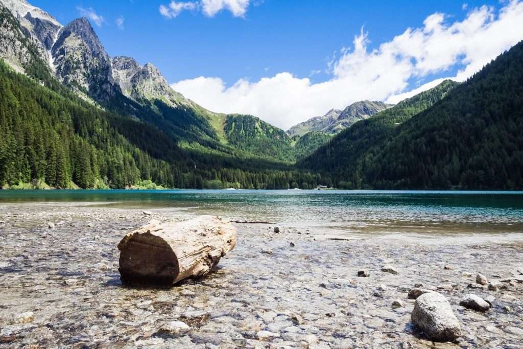
The lake is long and narrow, ringed by spruce and larch forest, below the peaks of the Rieserferner (Vedrette di Ries) group. Everything worth seeing is on its shores or a few hours’ walk away. Allow half a day for the loop and a full day if you add the Staller Pass.
The lake and its nature trail
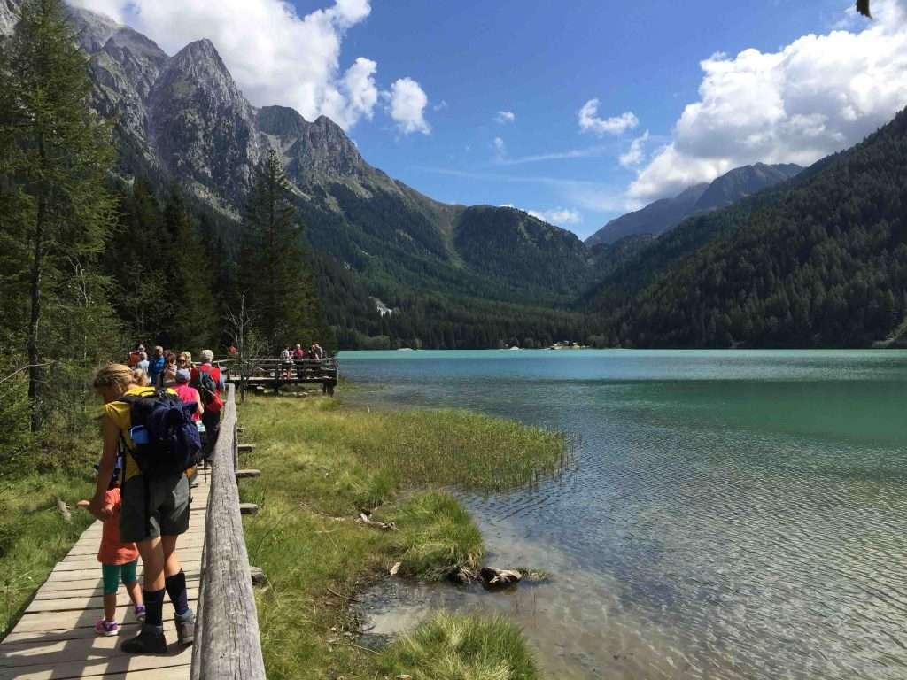
The best way to see the lake is the nature trail that runs all the way round it. Information boards cover plants, wildlife, rocks and how the lake formed, plus a few play stations for children. On the north shore the path crosses wetland on wooden boardwalks. The colours change a lot through the year: dark green in summer, golden larches in October, white in winter.
Südtirol Arena
The biathlon stadium stands at the entrance to the lake, at around 1,600 metres. It has been open since 1971 and is a regular stop on the Biathlon World Cup every winter. Outside race days you can see the shooting range, the stands and the trail loop, which is open to cross-country skiers in winter. This is also where you’ll find the lake’s only car park.
Staller Pass
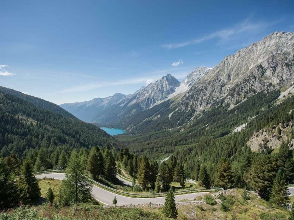
The Staller Pass (Staller Sattel, Passo Stalle, 2,052 m) links the Anterselva Valley with East Tyrol in Austria. You can walk up from the lake in under two hours, or drive the narrow hairpin road controlled by traffic lights. From the top you look back over the head of the valley and, on the Austrian side, down into the Defereggen Valley.
Obersee
The Obersee (2,016 m) is the small lake just over the border, about 200 metres past the pass, already in Austria. An easy, pushchair-friendly path runs round it and there’s an inn on the shore. Many people drive up just for this: two lakes in two countries in one outing.
Steinzger Alm
The Steinzger Alm (1,894 m) is a staffed mountain hut on the slope above the lake, reached by a forest path. Higher up are the unstaffed Upper Steinzger Alm (2,076 m) and a viewpoint over both Lake Anterselva and the Obersee. Check opening times before you go: the huts only open in season.
Vedrette di Ries-Aurina Nature Park
The lake lies inside the nature park covering the Rieserferner group and the mountains towards the Aurina Valley. The peaks rise above 3,000 metres. Protected-area rules apply: stay on the paths and follow the signs at the park entrances.
Anterselva di Mezzo and the valley farms
Heading back down towards the Puster Valley you pass Anterselva di Sopra, Anterselva di Mezzo and Anterselva di Sotto: small German-speaking villages with mountain churches, farmsteads scattered over the slopes and hay meadows. Anterselva di Mezzo is the main village, with shops and most services.
Walking around Lake Anterselva
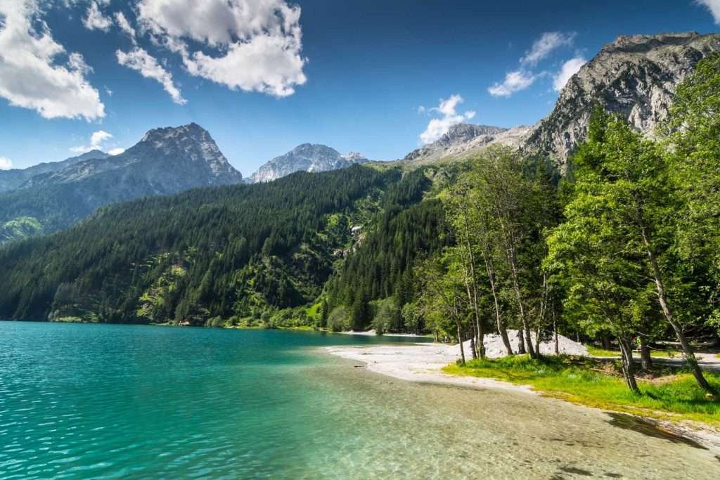
The lake loop is 3.4 km long with 79 metres of ascent and descent: about an hour and a half at an easy pace, an hour if you walk briskly. It’s easy and signed as pushchair-friendly. The highest point is 1,681 metres.
- Start: the biathlon centre car park or the “Lago di Anterselva” bus stop, about 200 metres from the trailhead.
- Surface: wide, well-kept paths, a few gravel sections and wooden boardwalks on the north shore. Fine with a pushchair; with a wheelchair, check the gravel sections with the tourist office first.
- Food and drink: a few cafés and restaurants with terraces and a playground around the lake. They may be closed out of season.
- Swimming: some people take a dip in midsummer, but the water stays cold even in August.
You can walk the loop in either direction. If you came by bus, you can extend the walk down to Anterselva di Mezzo and ride bus 431 back up. Summer weekends are busy: go early in the morning or after 4 pm.
Biathlon in Anterselva
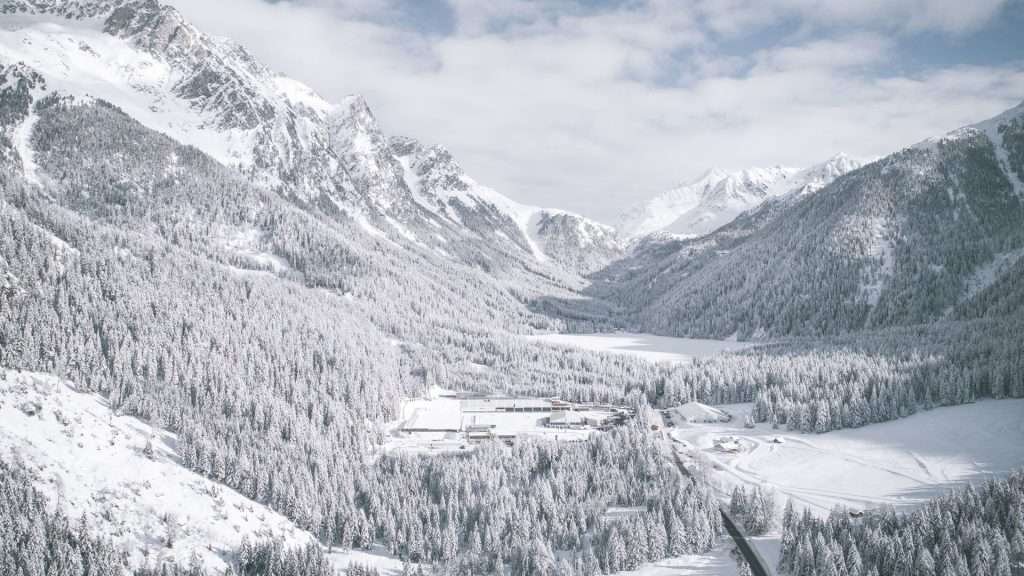
Anterselva is one of the great names in biathlon. The Südtirol Arena opened in 1971 and has hosted six World Championships: 1975, 1976, 1983, 1995, 2007 and 2020. The World Cup returns every January.
Milano Cortina 2026 Winter Olympics
At the Milano Cortina 2026 Winter Olympics every biathlon race was held here, under the name Anterselva Biathlon Arena: 11 races from 8 to 21 February 2026.
- 8 February: mixed relay 4×6 km. Gold for France, silver for Italy (Tommaso Giacomel, Lukas Hofer, Dorothea Wierer, Lisa Vittozzi).
- 10 and 11 February: individual races, men’s 20 km and women’s 15 km.
- 13 and 14 February: sprints, men’s 10 km and women’s 7.5 km.
- 15 February: pursuits. Sweden’s Martin Ponsiluoma won the men’s race; Italy’s Lisa Vittozzi won the women’s 10 km with 20 hits out of 20, Italy’s first ever Olympic biathlon gold.
- 17 and 18 February: men’s 4×7.5 km and women’s 4×6 km relays.
- 20 and 21 February: mass starts, men’s 15 km and women’s 12.5 km.
Watching a race
The next World Cup stage in Anterselva is scheduled for mid-January 2027. Dates, programme and tickets are on the IBU website. On race days the valley fills up: book accommodation months ahead and check parking and shuttle arrangements, which change on those days.
Hiking from Lake Anterselva
Trails for every level start at the lake. The times and elevation gains below come from the valley’s tourist board. The hiking season usually runs from June to October, depending on snow.
Lake Anterselva – Staller Pass
5.1 km, 1 hour 50 minutes, 451 metres of ascent, moderate. Start at the biathlon centre, follow the left-hand shore and at the far end take trail no. 11, which climbs steadily through forest to the pass. The Obersee is 200 metres further on, in Austria. Return the same way or, on days when it runs, on the 2 Lakes Shuttle.
Steinzger Alm loop
11.6 km, about 4.5 hours, 695 metres of ascent, for fit hikers. Climb on trail 7B to the Steinzger Alm (1,894 m), continue on 7A to the viewpoint over both lakes, descend to the Staller Pass and return to the lake on trail no. 11.
Cycling
The valley road climbs about 600 metres from Rasun to the lake on gentle gradients: easy on an e-bike, a good workout on a regular bike. Traffic is light outside peak hours, but set off early on summer weekends.
Lake Anterselva in winter
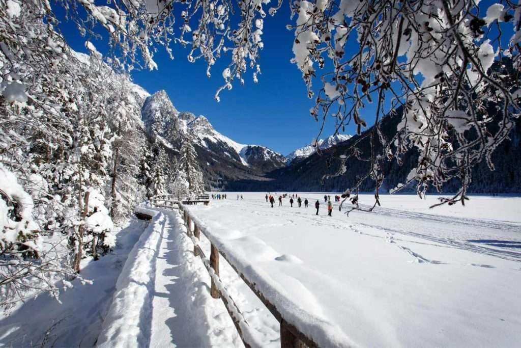
In winter the lake freezes and the landscape changes completely. The Staller Pass road is closed and becomes a winter walking and sledging route towards the lake and the Obersee.
Walking on the frozen lake
You may only walk on the ice when the lake is officially open. The ice thickness is checked regularly and the route across is only opened when the ice is thick enough. The current status (open or closed) is shown on the Antholz Valley tourist board website and at the tourist office. In mild weather the crossing can be closed mid-season, as happened in March 2025; the shoreline path then stays open. The marked winter route is about 2 km long: never leave the groomed track.
Cross-country skiing
The biathlon centre’s trails are the heart of cross-country skiing in the valley: the main loop is 17.4 km, intermediate, topping out at 1,674 metres, plus short loops of 1.5 to 4.6 km. One trail links the centre with Anterselva di Sopra. Rental and lessons are available in the valley.
Downhill skiing
There are no lifts at the lake. The nearest ski area is Plan de Corones (Kronplatz), with a lift base at Valdaora, about 20 km away. The slopes of the Alta Pusteria are also within a day trip.
When to visit Lake Anterselva
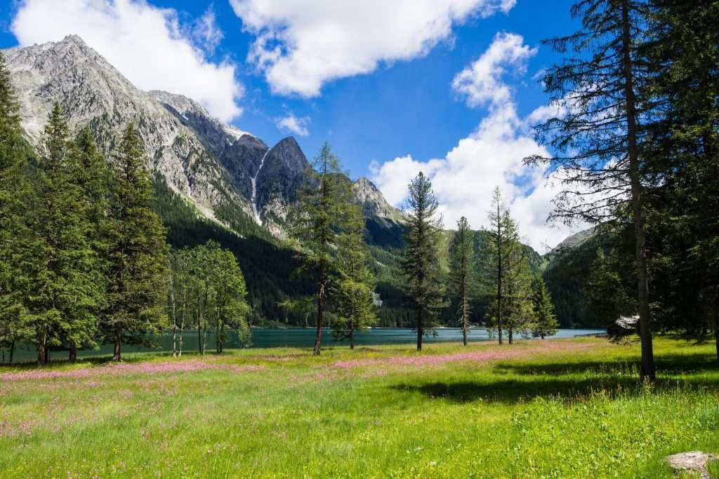
- June and July: meadows in flower, huts open, Staller Pass open. July weekends are busy.
- August: the busiest month. Arrive before 9 am or take the bus.
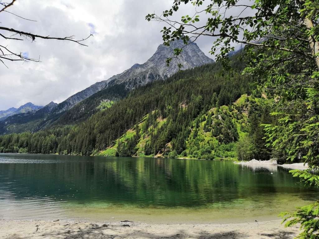
- September and October: the best time for hiking. The larches turn gold in October; the 2 Lakes Shuttle runs until mid-October.
- December to March: frozen lake, cross-country skiing, Biathlon World Cup in January.
- April, May and November: shoulder season. Unsafe ice, snow on higher trails, Staller Pass closed until late May.
Day trips from Lake Anterselva
- Brunico (about 29 km): the Puster Valley’s main town, with an old centre and a castle.
- Lake Braies (about 35 km): the most famous lake in the Dolomites; car access is regulated in summer.
- Dobbiaco (about 35 km): gateway to the Sesto Dolomites and the cross-country trails of the Alta Pusteria.
- San Vigilio di Marebbe (about 38 km): the Ladin village below Plan de Corones, a base for the Fanes-Senes-Braies Nature Park.
- San Candido (about 41 km): a Romanesque collegiate church and the cycle path to Lienz.
- Tre Cime di Lavaredo (about 60 km to the Auronzo hut): the classic Dolomites outing.
- Defereggen Valley and Lienz: in summer, cross the Staller Pass into East Tyrol. Lienz is about 60 km away.
Where to stay at Lake Anterselva
There’s very little accommodation on the lakeshore itself: you stay in the valley villages or in the Puster Valley. The valley is narrow and about 17 km long; bus 431 runs the full length every half hour.
- Anterselva di Sopra (above 1,300 m, about 4 km from the lake): closest to the lake and the stadium. For cross-country skiers, biathlon fans and anyone who wants to hike from the door. Hotels, guesthouses and apartments.
- Anterselva di Mezzo (around 1,250 m, about 6 km): the main village, with shops and services. For families and week-long stays.
- Anterselva di Sotto (around 1,120 m, about 9 km): quieter, with farm stays. For couples and smaller budgets.
- Rasun (around 1,000–1,100 m, at the valley entrance): handy if you’re mixing the lake with Plan de Corones.
- Valdaora (about 20 km): the railway station and a Plan de Corones lift base. For train travellers and keen skiers.
- Brunico (about 29 km): more choice of hotels and restaurants. For seeing the rest of the Puster Valley too.
For a family week, an apartment or farm stay in the valley works best; for one or two nights, a hotel in Anterselva di Sopra or di Mezzo. For the Biathlon World Cup in January, book very early.
How to get to Lake Anterselva
By car
Take the SS 49 Puster Valley road and, between Rasun and Valdaora, turn off into the Anterselva Valley. From there it’s about 17 km to the lake, through Anterselva di Sotto, di Mezzo and di Sopra. Allow about 35 minutes from Brunico, 1 hour 40 from Bolzano and 2 hours from Innsbruck via the Brenner Pass.
From Austria: the Staller Pass
From the Defereggen Valley (East Tyrol) you reach the lake directly over the Staller Pass. On the Italian side the road is narrow and runs one way at a time, controlled by traffic lights:
- Italy to Austria: uphill from minute 30 to minute 45 of every hour;
- Austria to Italy: downhill from minute 0 to minute 15 of every hour.
No buses or lorries; motorhomes only up to 10 metres long and 3 metres high. The road is closed in winter: in 2025/26 the closure began on 19 November 2025 and the pass reopened on 22 May 2026. It usually closes in November and reopens in late May, depending on snow; the date for winter 2026/27 hasn’t been announced yet. Check with Land Tirol or the tourist board before you set off.
By train
The station for the lake is Valdaora-Anterselva (Olang-Antholz), on the Puster Valley line Fortezza – San Candido. From Innsbruck or Bolzano, change at Fortezza; from Brunico it’s only a few minutes. At the station, take bus 431. Timetables on Südtirolmobil.
By bus
Bus 431 links Valdaora station with Rasun, the three Anterselva villages and the lake every 30 minutes. From late May to mid-October the 2 Lakes Shuttle also runs from the lake (Südtirol Arena) to the Staller Pass and the Obersee. In 2026 it ran Wednesday to Sunday from 23 May to 14 June and from 9 September to 18 October, and daily from 17 June to 6 September. Südtirol Pass fares apply and seats are limited.
By plane
The nearest airports are Bolzano (about 110 km) and Innsbruck (about 135 km). Venice and Treviso (about 200–220 km) and Munich (about 240 km) have more international flights. Without a car, take the train from Innsbruck or Bolzano to Fortezza, then the Puster Valley line to Valdaora.
Parking
The only car park at the lake is at the biathlon centre. From 1 June to 1 November 2026 it costs €10 a day for a car, €5 after 2 pm; €8 for a motorbike and €15 for a motorhome. Before 8.30 am you can buy the ticket online (€10.60 including fee); after 8.30 am you pay the attendant. Overnight parking is not allowed. On peak days it fills up: arrive early or leave the car down the valley and take the bus.
Frequently asked questions about Lake Anterselva
Where is Lake Anterselva?
In South Tyrol, northern Italy, at the head of the Anterselva Valley, a side valley of the Puster Valley, in the municipality of Rasun-Anterselva (Bolzano). It lies at 1,642 m, about 29 km from Brunico, 35 km from Dobbiaco and 100 km from Bolzano, below the Staller Pass on the Austrian border.
How high is Lake Anterselva?
1,642 metres. Anterselva di Sopra is above 1,300 metres, Anterselva di Mezzo around 1,250 and Anterselva di Sotto around 1,120.
How long is the walk around Lake Anterselva?
3.4 km with 79 metres of ascent: about an hour and a half at an easy pace. It’s easy and pushchair-friendly.
How much is parking at Lake Anterselva?
From 1 June to 1 November 2026: €10 a day for a car, €5 after 2 pm. It’s the only car park at the lake, at the biathlon centre. No overnight parking.
How do I get to Lake Anterselva without a car?
By train to Valdaora-Anterselva on the Puster Valley line, then bus 431, which runs every 30 minutes to the lake.
When can you drive over the Staller Pass?
In summer it’s open 24 hours a day with alternating one-way traffic: from Italy you go up between minute 30 and 45 of each hour, from Austria you come down between minute 0 and 15. It’s closed in winter, usually from November to late May.
Can you walk on frozen Lake Anterselva?
Yes, but only when the crossing is officially open after the ice thickness has been checked. Check the status with the tourist office or on the valley’s website and stay on the marked route.
Was the 2026 Olympic biathlon held in Anterselva?
Yes, all 11 biathlon races of Milano Cortina 2026, from 8 to 21 February, at the Südtirol Arena. Lisa Vittozzi won gold in the pursuit and Italy took silver in the mixed relay.
Can you swim in Lake Anterselva?
Some people do in summer, but the water is very cold even in August. The lake is in a nature park: follow the signs on site.
How much time do I need at Lake Anterselva?
Half a day for the loop and a break. A full day if you go up to the Staller Pass and the Obersee or do the Steinzger Alm loop.
Photos of Lago di Anterselva


