


 Français
 Deutsch
 Italiano
ACCOMMODATIONS IN THE DOLOMITES
Discover the best Hotels, B&Bs and Apartments in the Mountains based on thousands of verified reviews.
AltitudeSan Pietro 1,125 m · Santa Maddalena 1,339 m
WhereIsarco Valley, South Tyrol, Italy
From Bressanonebus 330 · about 35 min to Santa Maddalena
Highest peakSass Rigais, 3,025 m (Odle)
Wintertobogganing, 18 km cross-country · no big ski area
Driving to Santa Maddalenabarrier May – Nov: residents and guests only
Updated October 2026 · Sources: Odles Dolomites tourist board, Südtirolmobil, ISTAT, Euronews
Find a place to stay in Val di Funes
Val di Funes (Villnößtal in German, sometimes called the Funes Valley) is a side valley of the Isarco Valley in South Tyrol, in Italy’s Dolomites. It is about 24 km long. It branches off north of Chiusa (Klausen) and climbs east to the foot of the Odle (Geisler) peaks, the jagged Dolomite skyline behind almost every photo of the valley. The whole valley is one municipality, Funes, with about 2,560 residents spread over several villages: Tiso (963 m) at the entrance, the main village San Pietro (1,125 m) halfway up, and Santa Maddalena (1,339 m) at the end.
You get there by car from the Chiusa/Val Gardena exit of the A22 Brenner motorway, or by bus from Bressanone (Brixen): line 330 reaches Santa Maddalena in about 35 minutes. Bolzano is under an hour’s drive away, Innsbruck about an hour and a half. The upper valley is part of the Puez-Odle Nature Park, within the Dolomites UNESCO World Heritage Site.
Come in summer and autumn to hike between mountain huts and meadows below the Odle, and to photograph the two most famous little churches in the Dolomites. In winter it is a quiet valley for tobogganing, snowshoeing and cross-country skiing; for downhill skiing you go to the Plose or Val Gardena. One thing to know before you go: since 2026, from May to November, you can no longer drive up to the church in Santa Maddalena.
What to see in Val di Funes
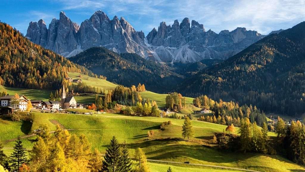
One day is enough for a first look, but stay longer if you hike. The valley road (SP 27) leaves Chiusa through a narrow gorge, passes below Tiso, runs through San Pietro and ends at Santa Maddalena and Ranui. Beyond that there is only the road to the Zans car park and, in summer, the road over the Passo delle Erbe.
Santa Maddalena and its church

Santa Maddalena (St. Magdalena) is the last village in the valley, at 1,339 m, right in front of the Odle. The church is first recorded in 1394; today’s late Gothic building dates from 1492, with a Baroque interior and a choir vault painted in 1928. Its pointed spire against the Odle is the valley’s signature view.
The classic viewpoint is above the village: walk about 1.5 km up the paved Magdalenaweg lane to the benches at the top. Since 2026 the road to the church has been closed to cars from May to November (see “Photographing Val di Funes”).
St. Johann in Ranui church
About a kilometre east of Santa Maddalena and a little higher up, the chapel of San Giovanni in Ranui (St. Johann in Ranui) stands alone in a meadow below the Odle. It is Baroque, with an onion dome, and dedicated to St. John of Nepomuk (not John the Baptist, as you often read). The façade says “built by Michael Jenner 1744”; according to the owners of the Ranuihof farm, though, Michael Jenner had died in 1723, and the real patron was a relative, Joseph Anton Jenner.
The chapel and the meadow are private, part of the farm next door. To get close you go through a paid turnstile, installed in 2022; the photo from the road at the edge of the meadow is free. Stay off the meadows: they are mown for hay.
San Pietro, the main village
San Pietro (St. Peter) is the largest village and where the services are: town hall, shops, pharmacy, bus stops. The Baroque parish church of Saints Peter and Paul, from 1795, is nicknamed the “cathedral of the valley”. Reinhold Messner grew up here: he was born in Bressanone in 1944 but spent his childhood in San Pietro, where his father was the village teacher. At five he climbed the Sass Rigais, the highest Odle peak, with his father. He is an honorary citizen of Funes.
San Valentino
On the sunny slope above San Pietro, the chapel of San Valentino is the oldest in the valley: Romanesque, from 1303, with 15th- and 16th-century frescoes.
Tiso and the mineral museum
Tiso (Teis), at 963 m, is the first village you reach from Chiusa. It is known for its geodes, the “Teiser Kugeln”: rock spheres up to about 20 cm across, lined with amethyst, quartz and agate crystals. You can see them at the Tiso Mineral Museum, open from late March to early November, closed on Mondays. Check opening times and guided tours before you go.
The Odle group
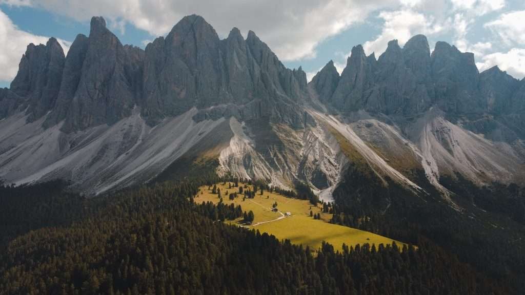
The Odle (Geisler) close off the valley to the south-east and separate it from Val Gardena. The highest summits are the Sass Rigais and the Furchetta, both 3,025 m; the other spires are lower. The summits are for people with via ferrata or climbing experience. Everyone else can walk the trail along their base, the Adolf Munkel Trail.
Puez-Odle Nature Park and visitor centre
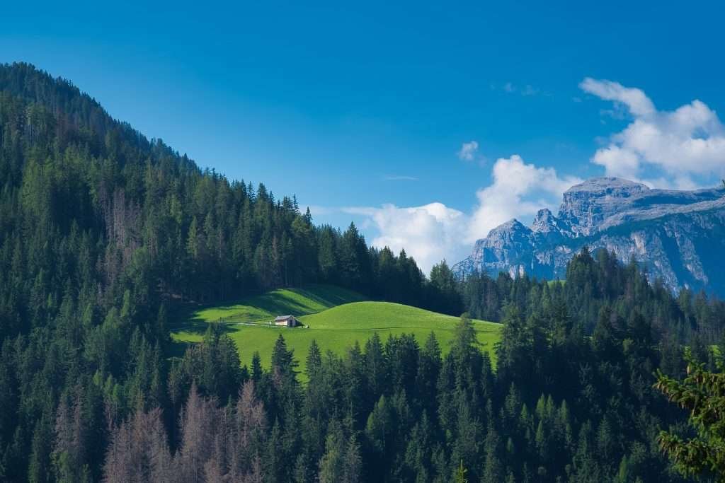
The park protects more than 10,000 hectares between Val di Funes, Val Gardena and Val Badia. In Santa Maddalena, the park visitor centre (open since 2009) covers Dolomite geology, wildlife and plants, and mountaineering history. In summer it opens Tuesday to Saturday, and on Sundays too in July and August. At Malga Zannes there is also a Dolomites UNESCO info point.
Passo delle Erbe and Sass de Putia
From the end of the valley a narrow road climbs to the Passo delle Erbe (Würzjoch, about 2,000 m), open from spring to autumn, and continues into Val Badia. Above the pass rises the Sass de Putia (Peitlerkofel, 2,875 m). The loop around the mountain is about 13 km and 4.5 hours; the summit is a separate climb with a short protected section at the top.
Hiking in Val di Funes
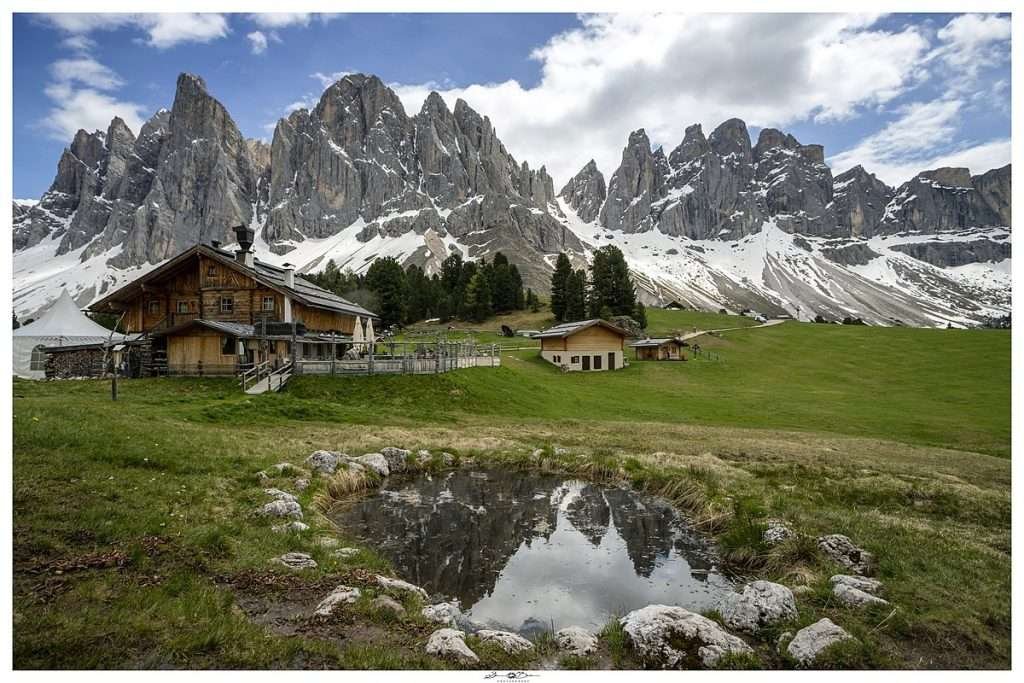
Almost all the classic hikes start at the Zans car park, next to Malga Zannes, at about 1,680 m and 5.5 km above Santa Maddalena. The huts (malghe) usually open from late May or June to late October. The times below come from local hiking guides, so treat them as estimates.
Adolf Munkel Trail
The valley’s best-known trail: no. 35 runs through forest and across scree at the foot of the Odle. The classic loop starts at Zans, climbs to the Glatschalm, follows the Munkel trail to the Gschnagenhardt hut (2,006 m) and returns via the Geisleralm and Dusleralm. About 9 km, 3.5 hours and around 400 m of ascent. It is an easy mountain trail, but you need hiking boots.
Malga Zannes and Malga Gampen
Malga Zannes is right by the car park, the easiest stop if you don’t want to walk far. From there, Malga Gampen (Gampenalm, 2,062 m) is about 1.5 hours and 400 m of climbing along the stream and through meadows: not a flat walk. Keen hikers continue to the Rifugio Genova (Schlüterhütte, 2,306 m) at Passo Poma, about 2 hours from Zans.
Geisleralm (Rifugio delle Odle)
The Geisleralm (1,996 m) is about 1.5 hours from Zans. The loop down via the Dusleralm is about 7.5 km with 360 m of ascent; with a lunch stop, plan half a day. It has a playground, which makes it the classic family hike.
Easy walks
From Zans, the Zannes nature trail is a loop of about 1 hour 15 minutes, suitable for people with limited mobility. The Sunnseitnweg links San Pietro and Santa Maddalena along the sunny side of the valley. To see the whole valley, walk from Tiso to Santa Maddalena and take the bus back.
Photographing Val di Funes
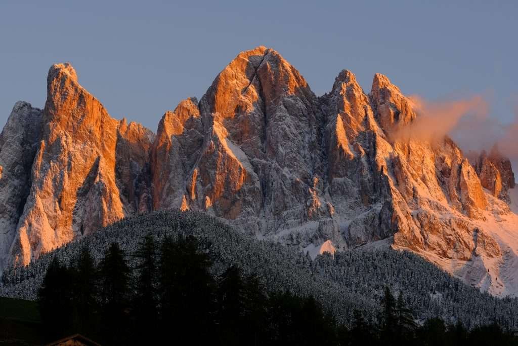
The two classic shots: Santa Maddalena church from the viewpoint above the village, and the Ranui chapel with the Odle behind it. In the late afternoon and at sunset the peaks glow pink (the “enrosadira”). Several rules changed in 2026:
- Santa Maddalena: since 1 May 2026, from May to November, a barrier in the village centre in front of the church only lets through residents and guests staying at least one night beyond it. Day visitors park in the paid car parks lower down and walk up: 15 to 30 minutes. The municipality acted because up to 600 people a day came for the photo at peak times.
- Ranui: the photo from the edge of the meadow is free; to get closer you pay at the owner’s turnstile. The meadow is private farmland.
- Zans: a traffic light at Ranui controls access to the trailhead car park. When it is red the car park is full and only drivers with an online booking can go up. Otherwise park in Santa Maddalena and take bus 330, which runs to Zans every hour.
- Drones: not allowed in the Puez-Odle Nature Park without a permit. Don’t fly over meadows, farms or people.
Parking fees are under review, so check on site or on the tourist board website, where you can also book Zans.
Val di Funes in winter
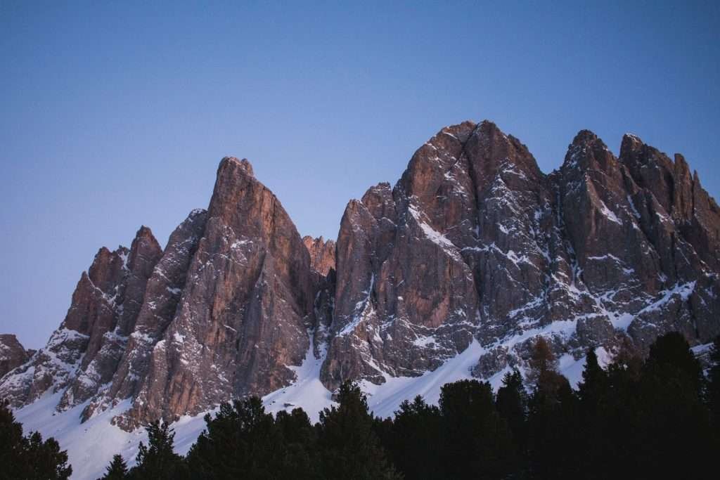
To be clear: Val di Funes is not a ski resort. The only lift in the valley is the Filler drag lift in Santa Maddalena, for children and beginners, with a long magic carpet. For real skiing, head to the Plose above Bressanone, part of Dolomiti Superski, or to Val Gardena and the Sella Ronda.
What the valley does well in winter:
- Tobogganing: six natural toboggan runs. The longest runs from the Geisleralm down to Ranui, about 6 km; you can hire sledges at the hut. From the Gampenalm you come down a groomed run, with a separate winter path for the climb. Helmets are compulsory and you may only sledge on marked runs.
- Cross-country skiing: 18 km of trails, from the Zannes loop up to the high trail at the Passo delle Erbe.
- Snowshoeing and winter walks: groomed paths from Zans to the huts that open in winter; the tourist board runs guided outings.
The huts usually open from late December, with rest days midweek: always check before heading up.
When to visit Val di Funes
- June – July: meadows in flower, huts open, long days. Snow can linger on higher trails until early June.
- August: the busiest month, especially at Santa Maddalena and Zans. Start early in the morning.
- September – October: the best time to hike and photograph, with golden larches and fewer people.
- November: many huts and hotels close; the Santa Maddalena barrier stays in place until November.
- December – March: tobogganing, snowshoeing, cross-country skiing and snowy Odle. For skiing you need to drive.
Day trips from Val di Funes
- Chiusa (Klausen): the small town at the mouth of the valley, with Säben (Sabiona) monastery on its rock.
- Bressanone (Brixen): cathedral, cloister, bishop’s palace and old town; above it, the Plose ski area.
- Ortisei: the main village of Val Gardena, reached via Chiusa.
- Seceda: take the cable car up from Ortisei and see the Odle from the other side.
- Santa Cristina: in the heart of Val Gardena, the base for Col Raiser and the Puez-Odle trails.
- Passo Gardena: the pass between Val Gardena and Val Badia. Since 2026 car access is regulated here too: check before you go.
- Passo delle Erbe and Val Badia: in summer, drive up from the valley and down to San Martino in Badia.
Where to stay in Val di Funes
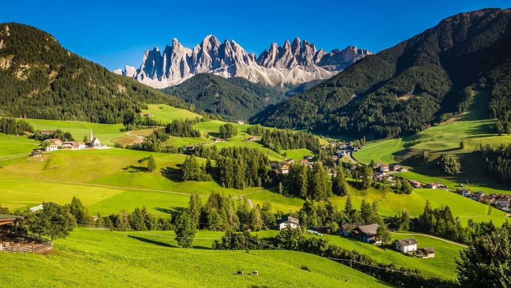
Where you stay matters more here than elsewhere, because of the car access rules. Expect mostly family-run hotels, guesthouses, apartments and farm stays (the Red Rooster / Roter Hahn network).
- Santa Maddalena: the best base for hiking and photography, minutes from the churches, the viewpoint and the road to Zans. If your accommodation is beyond the barrier you can drive up even from May to November: ask before booking.
- San Pietro: the main village, with shops, a pharmacy and an hourly bus. Handy for families and travellers without a car; Santa Maddalena is a few minutes away.
- Tiso: quieter and close to Chiusa, useful if you also want to explore Val Gardena. Prices are often a little lower.
- Ranui: a few places to stay on isolated farms below the Odle, for peace and quiet and trailheads on your doorstep.
If the valley is full, look nearby: Chiusa, at the mouth of the valley, with a train station and a bus to Tiso, and Bressanone, the nearest town, with plenty of choice, trains and the direct line 330. From July to September, book well ahead.
How to get to Val di Funes
By car
Take the A22 Brenner motorway and exit at Chiusa/Val Gardena. Follow the main road to Chiusa, then the SP 27 to Funes: first a narrow gorge, then the valley opens out after San Pietro. Allow under an hour from Bolzano, about an hour and a half from Innsbruck and over two hours from Verona. In summer you can also arrive from Val Badia over the Passo delle Erbe. Hire cars are easy to pick up at Verona, Innsbruck or Munich airports.
By train
The nearest stations are Chiusa, served by regional trains on the Brenner line, and Bressanone, where Eurocity trains between Munich and Verona also stop. From Bressanone, take bus 330. Timetables on Trenitalia.
By bus
Line 330 leaves from Bressanone station, runs via San Pietro and reaches Santa Maddalena in about 35 minutes, hourly all year. In summer and winter it continues to Zans. From Chiusa, line 331 goes up to Tiso. Timetables on Südtirolmobil.
By plane
The closest airport is Bolzano, with few flights. The main alternatives are Innsbruck (about 1.5 hours’ drive), Verona (over 2 hours) and Munich (about 3 hours). Without a car, take the train to Bressanone and then the bus.
Parking
In Santa Maddalena, from May to November, day visitors park in the paid car parks in the village (Ranui, Putzen, Filler) and walk on. The Zans trailhead car park has spaces you can book online and is controlled by the traffic light at Ranui; coaches must book. In San Pietro there is parking in the centre. Bookings on the tourist board website.
Frequently asked questions about Val di Funes
Where is Val di Funes?
In South Tyrol, northern Italy, in the Isarco Valley between Chiusa and Bressanone. It runs about 24 km east to the Odle peaks, on the border with Val Gardena.
What is the altitude of Val di Funes?
Tiso is at 963 m, San Pietro at 1,125 m and Santa Maddalena at 1,339 m. The Zans car park is at about 1,680 m; the Odle reach 3,025 m.
Can you drive to Santa Maddalena?
From May to November the road to the church is closed by a barrier: only residents and guests staying beyond it may pass. Everyone else parks in the village and walks 15 to 30 minutes.
Do you have to pay to see the Ranui church?
To get close, yes: you enter through the meadow owner’s paid turnstile. The photo from the road is free.
How long is the Adolf Munkel Trail?
The loop from Zans via Gschnagenhardt and the Geisleralm is about 9 km, 3.5 hours, with around 400 m of ascent.
Can you ski in Val di Funes?
Barely: there is only a small children’s lift in Santa Maddalena. For skiing, go to the Plose or Val Gardena; in the valley you can toboggan, cross-country ski and snowshoe.
Was Reinhold Messner born in Val di Funes?
He was born in Bressanone in 1944 but grew up in San Pietro, where his father was a teacher. He is an honorary citizen of Funes.
How do you get to Val di Funes without a car?
By train to Bressanone, then bus 330 to San Pietro and Santa Maddalena, every hour. From Chiusa, line 331 goes to Tiso.
When is the best time to visit Val di Funes?
June to October for hiking; September and October for autumn colours and fewer crowds. Winter for tobogganing and quiet, not for downhill skiing.
Photos of Val di Funes


